MyTopo
Pescado New Mexico US Topo Map
Couldn't load pickup availability
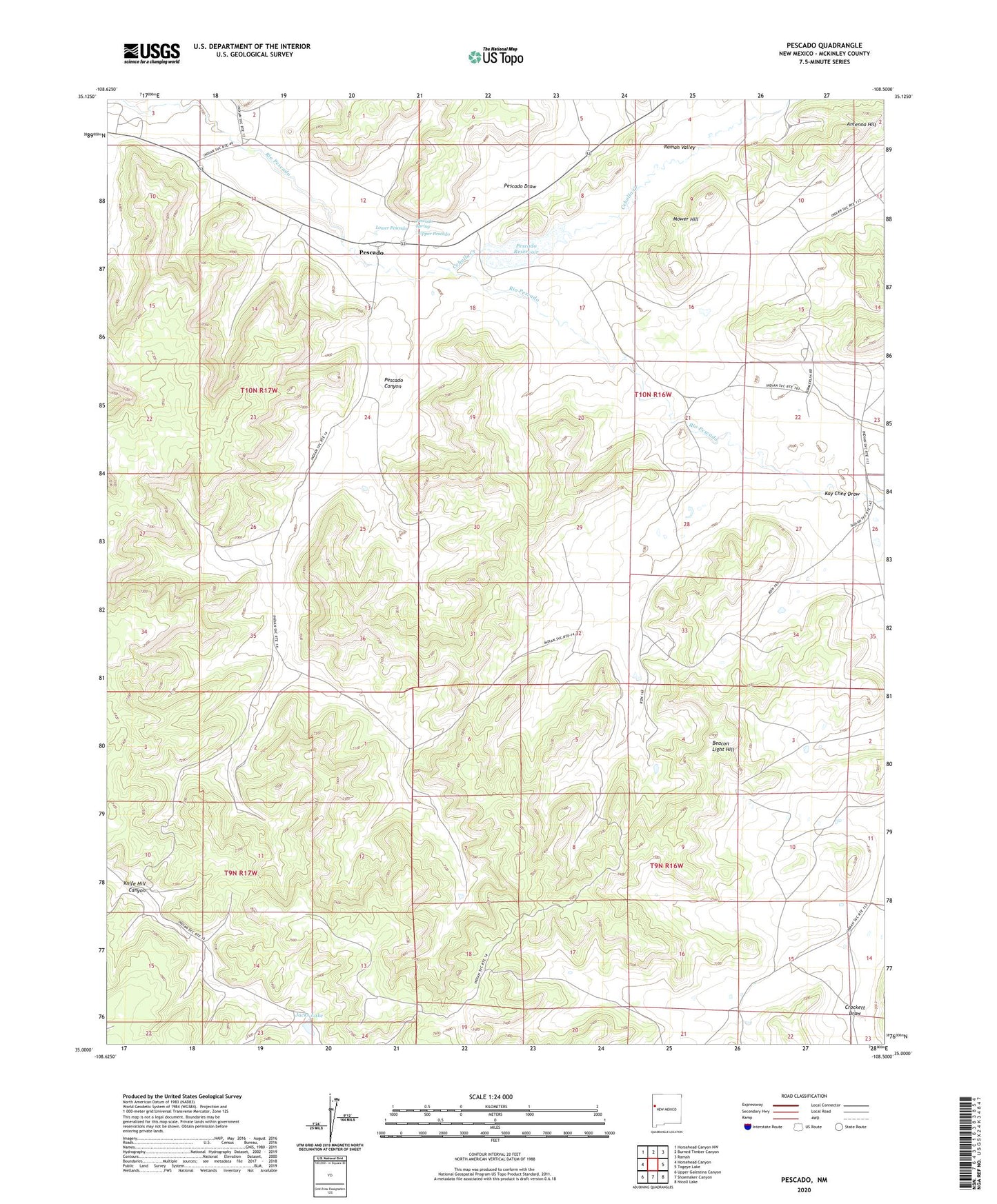
2023 topographic map quadrangle Pescado in the state of New Mexico. Scale: 1:24000. Based on the newly updated USGS 7.5' US Topo map series, this map is in the following counties: McKinley. The map contains contour data, water features, and other items you are used to seeing on USGS maps, but also has updated roads and other features. This is the next generation of topographic maps. Printed on high-quality waterproof paper with UV fade-resistant inks.
Quads adjacent to this one:
West: Horsehead Canyon
Northwest: Horsehead Canyon NW
North: Burned Timber Canyon
Northeast: Ramah
East: Togeye Lake
Southeast: Nicoll Lake
South: Shoemaker Canyon
Southwest: Upper Galestina Canyon
This map covers the same area as the classic USGS quad with code o35108a5.
Contains the following named places: Antenna Hill, Beacon Light Hill, Cebolla Creek, Jacks Lake, Kay Chee Draw, Lower Pescado, Mower Hill, Pescado, Pescado Canyon, Pescado Draw, Pescado Reservoir, Pescado Reservoir Dam, Pescado Spring, Ramah Valley, Upper Pescado