MyTopo
Rock Tank Draw New Mexico US Topo Map
Couldn't load pickup availability
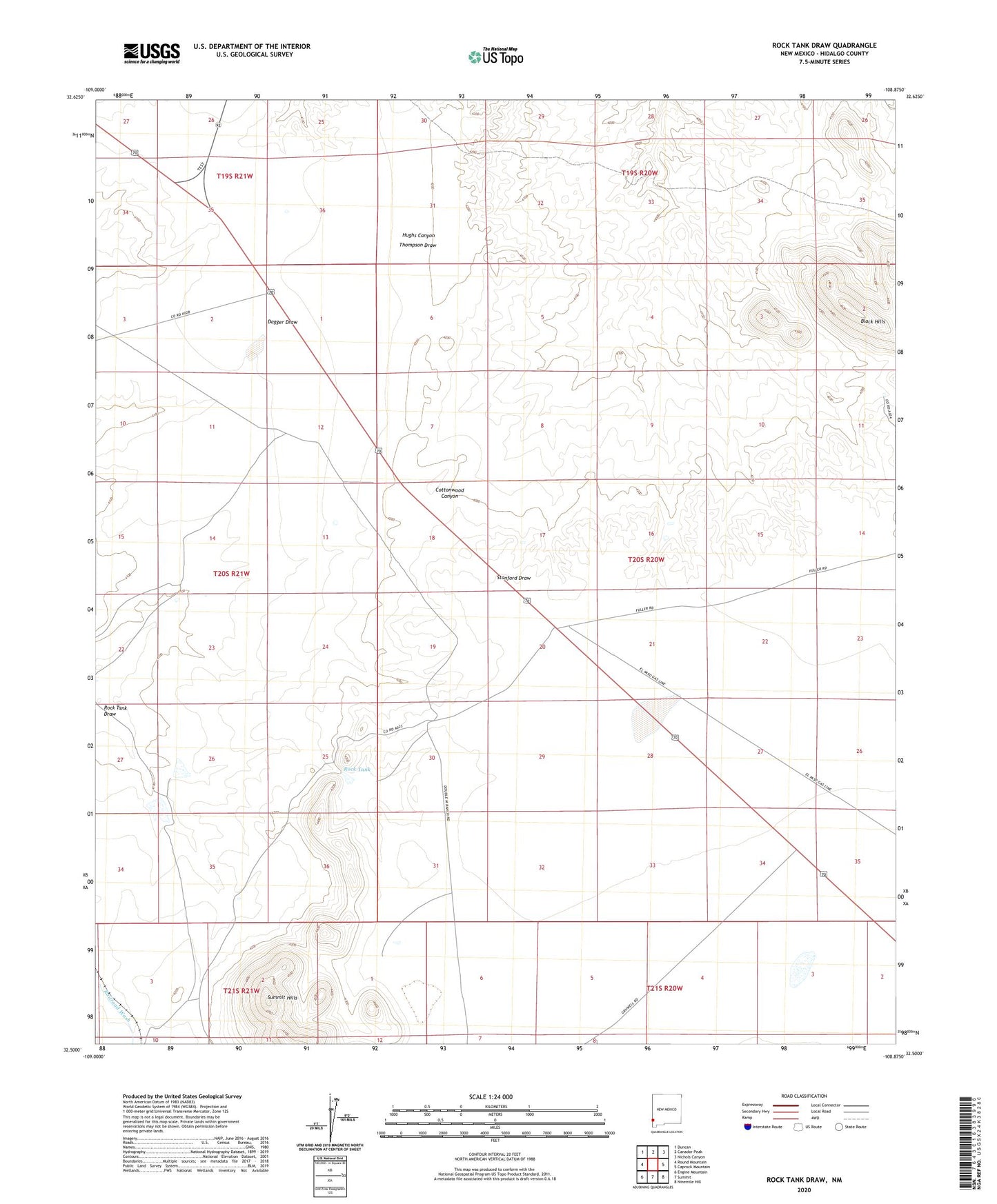
2023 topographic map quadrangle Rock Tank Draw in the state of New Mexico. Scale: 1:24000. Based on the newly updated USGS 7.5' US Topo map series, this map is in the following counties: Hidalgo. The map contains contour data, water features, and other items you are used to seeing on USGS maps, but also has updated roads and other features. This is the next generation of topographic maps. Printed on high-quality waterproof paper with UV fade-resistant inks.
Quads adjacent to this one:
West: Round Mountain
Northwest: Duncan
North: Canador Peak
Northeast: Nichols Canyon
East: Caprock Mountain
Southeast: Ninemile Hill
South: Summit
Southwest: Engine Mountain
This map covers the same area as the classic USGS quad with code o32108e8.
Contains the following named places: Backer Ranch, Black Hills, Burtch Windmill, Cottonwood Windmill, Gila Bend, Raymond Fuller Ranch, Rock Tank, Rock Tank Draw, Secho Detention Dam, Stanford Detention Dam Number Three, Stanford Detention Dam Number Two, Summit Hills