MyTopo
Ocate New Mexico US Topo Map
Couldn't load pickup availability
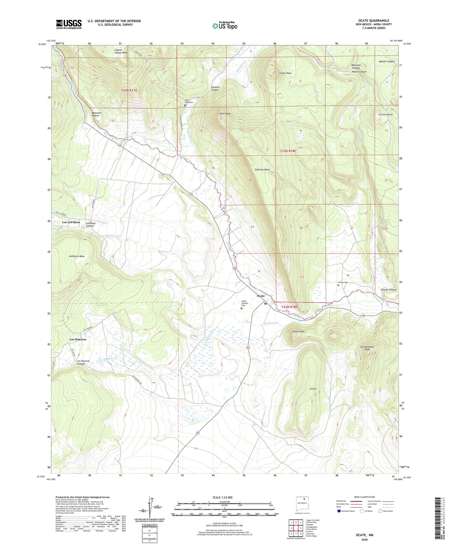
2020 topographic map quadrangle Ocate in the state of New Mexico. Scale: 1:24000. Based on the newly updated USGS 7.5' US Topo map series, this map is in the following counties: Mora. The map contains contour data, water features, and other items you are used to seeing on USGS maps, but also has updated roads and other features. This is the next generation of topographic maps. Printed on high-quality waterproof paper with UV fade-resistant inks.
Quads adjacent to this one:
West: Guadalupita
Northwest: Agua Fria Peak
North: White Peak
Northeast: Rayado
East: Mora Ranch
Southeast: Cerro Negro
South: Ojo Feliz
Southwest: Lucero
Contains the following named places: Banderitas Creek, Borrego Windmill, Calverts, Cejita, Cejita Windmill, Cerrito Pelon, Chavez Canyon, Cooks Peak, Duran, Franklin Canyon, Gallinas Mesa, Guadalupe Church, Halls Peak, Halls Peak Cemetery, J P Strong Store, La Canada, La Canada Windmill, Laizy Daisy, LeFebres Canyon, LeFebres Creek, Los Huerros, Los Huerros Canyon, Los Huerros Creek, Los LeFebres, Los Naranjos Peak, Manueles Canyon, Manueles Creek, Mares, Mares Canyon, Martinez Canyon, Ocate, Ocate - Ojo Feliz Volunteer Fire Department, Ocate Catholic Cemetery, Ocate Mission, Ocate Peak, Octate Post Office, San Juan Church, Strong Cemetery, Wheaten Creek, William Atkens, ZIP Code: 87734