MyTopo
Ojito Spring New Mexico US Topo Map
Couldn't load pickup availability
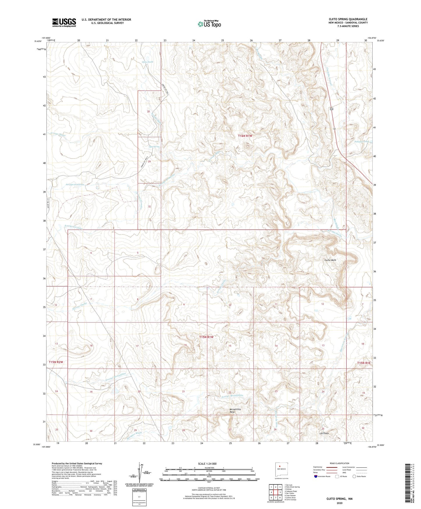
2020 topographic map quadrangle Ojito Spring in the state of New Mexico. Scale: 1:24000. Based on the newly updated USGS 7.5' US Topo map series, this map is in the following counties: Sandoval. The map contains contour data, water features, and other items you are used to seeing on USGS maps, but also has updated roads and other features. This is the next generation of topographic maps. Printed on high-quality waterproof paper with UV fade-resistant inks.
Quads adjacent to this one:
West: Cabezon Peak
Northwest: San Luis
North: Holy Ghost Spring
Northeast: Gilman
East: San Ysidro
Southeast: Cerro Conejo
South: Collier Draw
Southwest: Casa Salazar
Contains the following named places: Arroyo Alamito, Arroyo Alamo, Arroyo Armiento, Arroyo Bernalillito, Arroyo Corrales, Arroyo Cucho, Arroyo la Jara, Arroyo Ojito, Arroyo Ojitos, Bernalillito Mesa, Cuchilla Arroyo, Cucho Mesa, Lone Wolf Group, Los Posos, Marquez Ranch, Marquez Wash, Ojito Spring, Ojito Tank, Ojito Wilderness, Ojito Wilderness Study Area, Penasco Tank, Polka Dot Uranium Group, Rattlesnake Group, Rio Salado Detention Dam Number 18, Rio Salado North Detention Dam Number Seven, Tenorio Tank, Yellow Cliffs Group