MyTopo
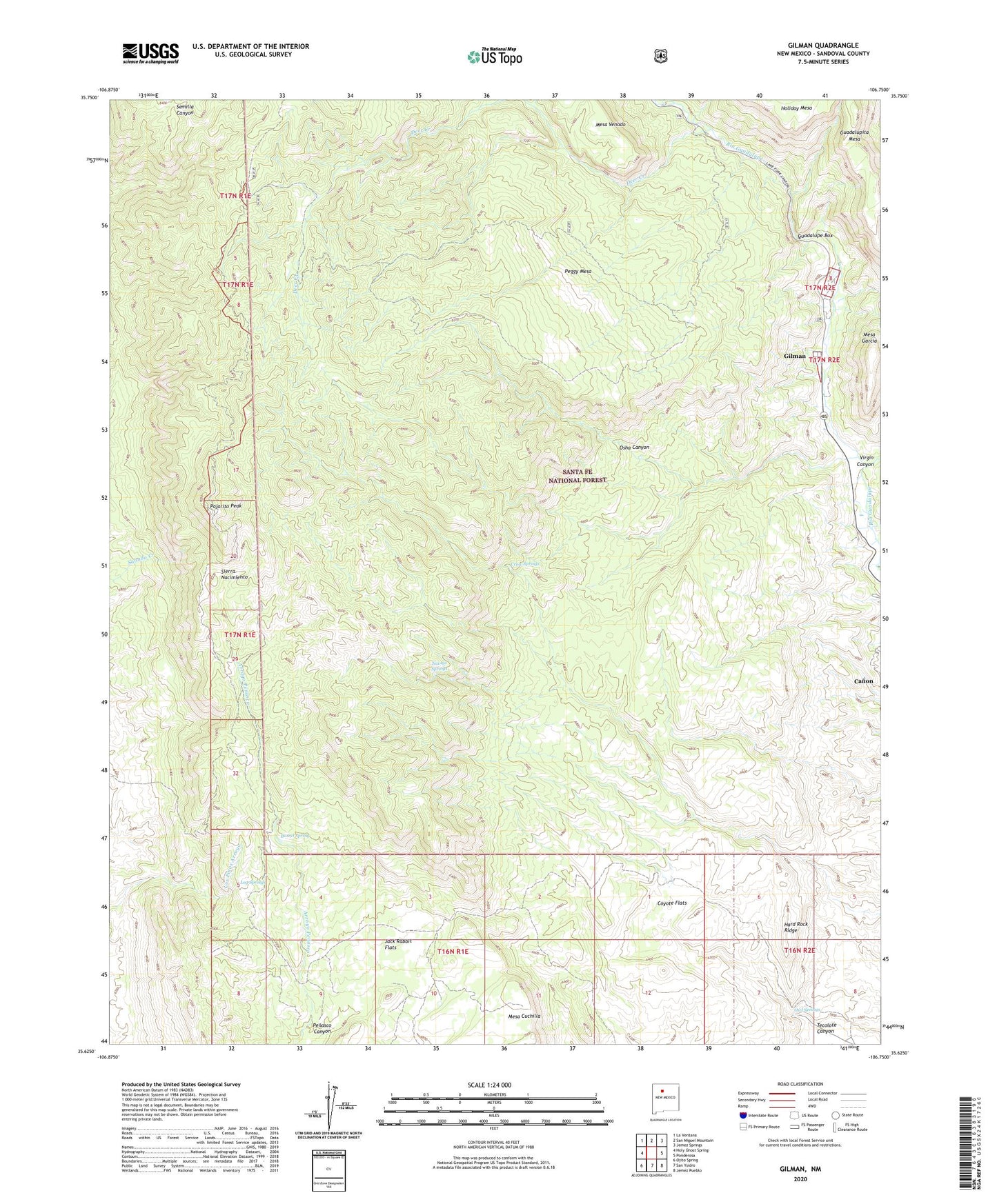
Gilman New Mexico US Topo Map
Couldn't load pickup availability
Also explore the Gilman Forest Service Topo of this same quad for updated USFS data
2023 topographic map quadrangle Gilman in the state of New Mexico. Scale: 1:24000. Based on the newly updated USGS 7.5' US Topo map series, this map is in the following counties: Sandoval. The map contains contour data, water features, and other items you are used to seeing on USGS maps, but also has updated roads and other features. This is the next generation of topographic maps. Printed on high-quality waterproof paper with UV fade-resistant inks.
Quads adjacent to this one:
West: Holy Ghost Spring
Northwest: La Ventana
North: San Miguel Mountain
Northeast: Jemez Springs
East: Ponderosa
Southeast: Jemez Pueblo
South: San Ysidro
Southwest: Ojito Spring
This map covers the same area as the classic USGS quad with code o35106f7.
Contains the following named places: Barrel Spring, Canon Census Designated Place, Coyote Flats, Crow Springs, Deer Creek, Deer Creek Landing, Deer Creek Prospect, Gilman, Guadalupe 3 in Water Well, Guadalupe Box, Hard Rock Ridge, Jack Rabbit Flats, Log Springs, Mesa Garcia, Navajo Springs, Osha Canyon, Owl Springs, Pajarito Peak, Peggy Mesa, Penasco Canyon, Porter Landing, Sandoval County, Tecolote Canyon, Virgin Canyon