MyTopo
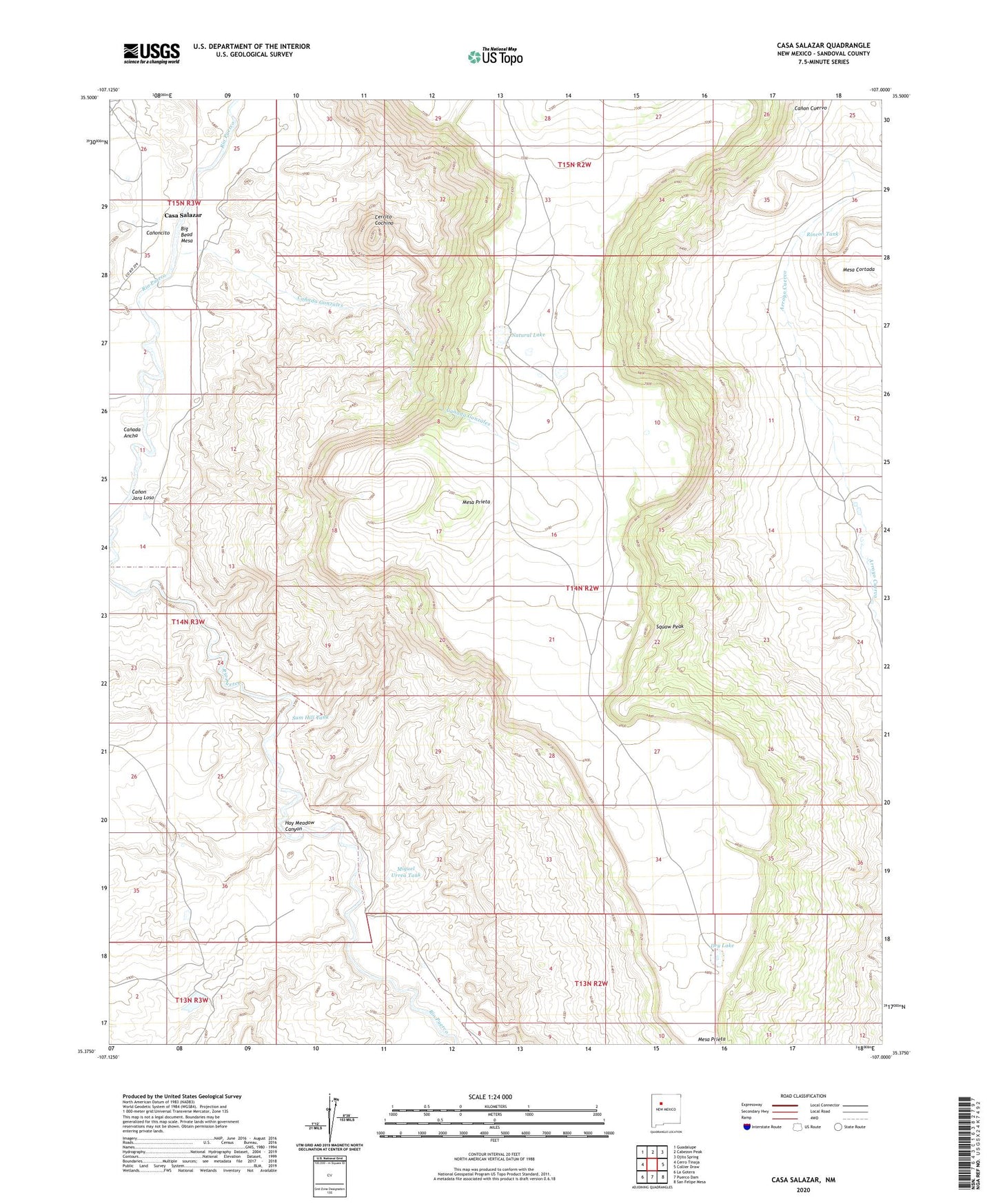
Casa Salazar New Mexico US Topo Map
Couldn't load pickup availability
2023 topographic map quadrangle Casa Salazar in the state of New Mexico. Scale: 1:24000. Based on the newly updated USGS 7.5' US Topo map series, this map is in the following counties: Sandoval. The map contains contour data, water features, and other items you are used to seeing on USGS maps, but also has updated roads and other features. This is the next generation of topographic maps. Printed on high-quality waterproof paper with UV fade-resistant inks.
Quads adjacent to this one:
West: Cerro Tinaja
Northwest: Guadalupe
North: Cabezon Peak
Northeast: Ojito Spring
East: Collier Draw
Southeast: San Felipe Mesa
South: Puerco Dam
Southwest: La Gotera
This map covers the same area as the classic USGS quad with code o35107d1.
Contains the following named places: Big Bead Mesa, Canada Ancha, Canada Gonzales, Canon Jara Loso, Canoncito, Casa Salazar, Casa Salazar Post Office, Cerrito Cochino, Dry Lake, Hay Meadow Canyon, Mesa Cortada, Miguel Urrea Tank, Natural Lake, Rincon De Cochino, Rincon Entranoso, Rincon Tank, Sam Hill Tank, Squaw Peak