MyTopo
Collier Draw New Mexico US Topo Map
Couldn't load pickup availability
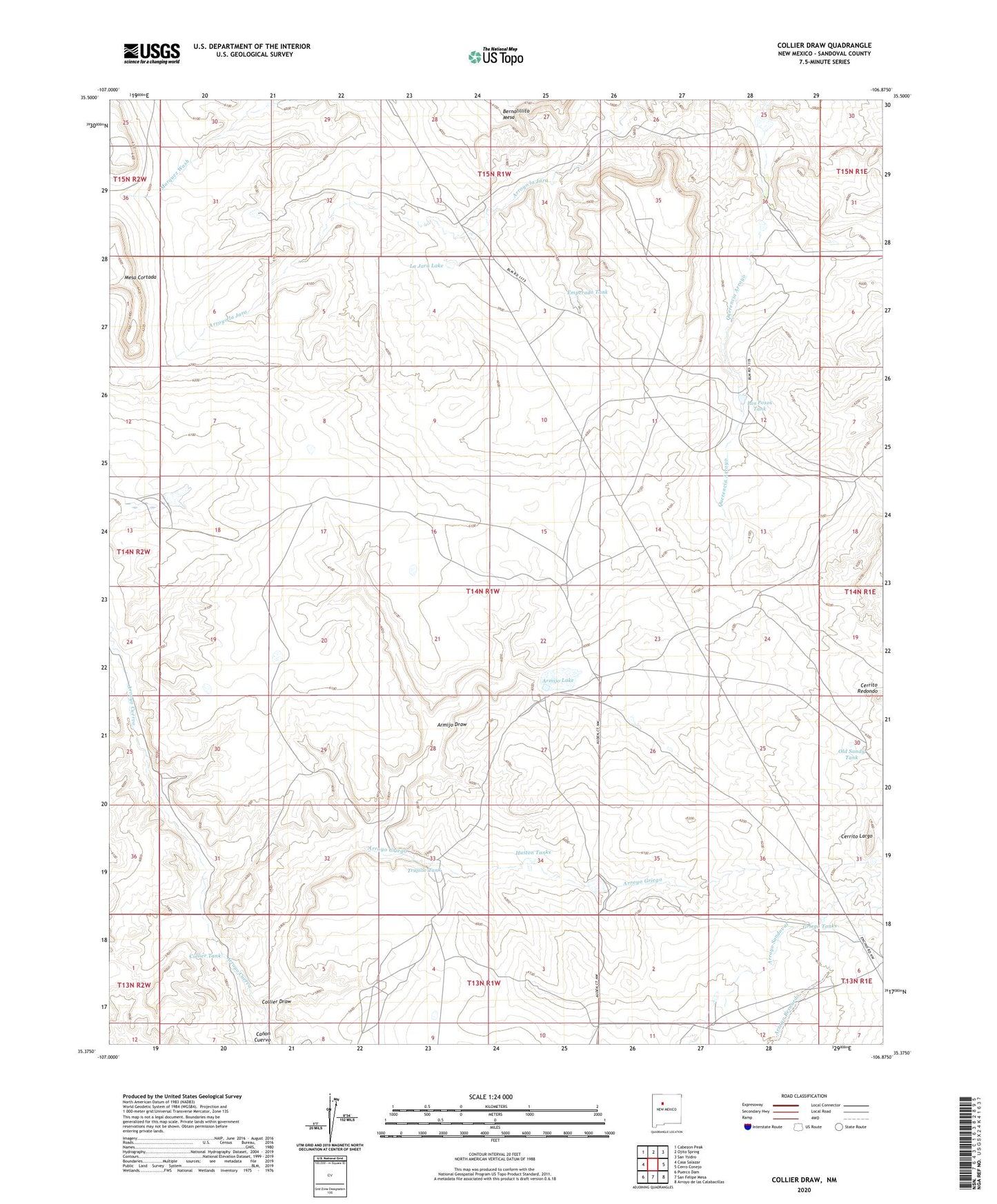
2023 topographic map quadrangle Collier Draw in the state of New Mexico. Scale: 1:24000. Based on the newly updated USGS 7.5' US Topo map series, this map is in the following counties: Sandoval. The map contains contour data, water features, and other items you are used to seeing on USGS maps, but also has updated roads and other features. This is the next generation of topographic maps. Printed on high-quality waterproof paper with UV fade-resistant inks.
Quads adjacent to this one:
West: Casa Salazar
Northwest: Cabezon Peak
North: Ojito Spring
Northeast: San Ysidro
East: Cerro Conejo
Southeast: Arroyo de las Calabacillas
South: San Felipe Mesa
Southwest: Puerco Dam
This map covers the same area as the classic USGS quad with code o35106d8.
Contains the following named places: Armijo Draw, Armijo Lake, Arroyo Griego, Cerrito Largo, Cerrito Redondo, Collier Draw, Collier Tank, Emperado Tank, Griego Tanks, Huston Tanks, La Jara Lake, Los Posos Tank, Old Sandy Tank, Red Gate Dam, Redgate Dam, Rio Salado North Detention Dam Number Five, Trujillo Tank