MyTopo
Oscura New Mexico US Topo Map
Couldn't load pickup availability
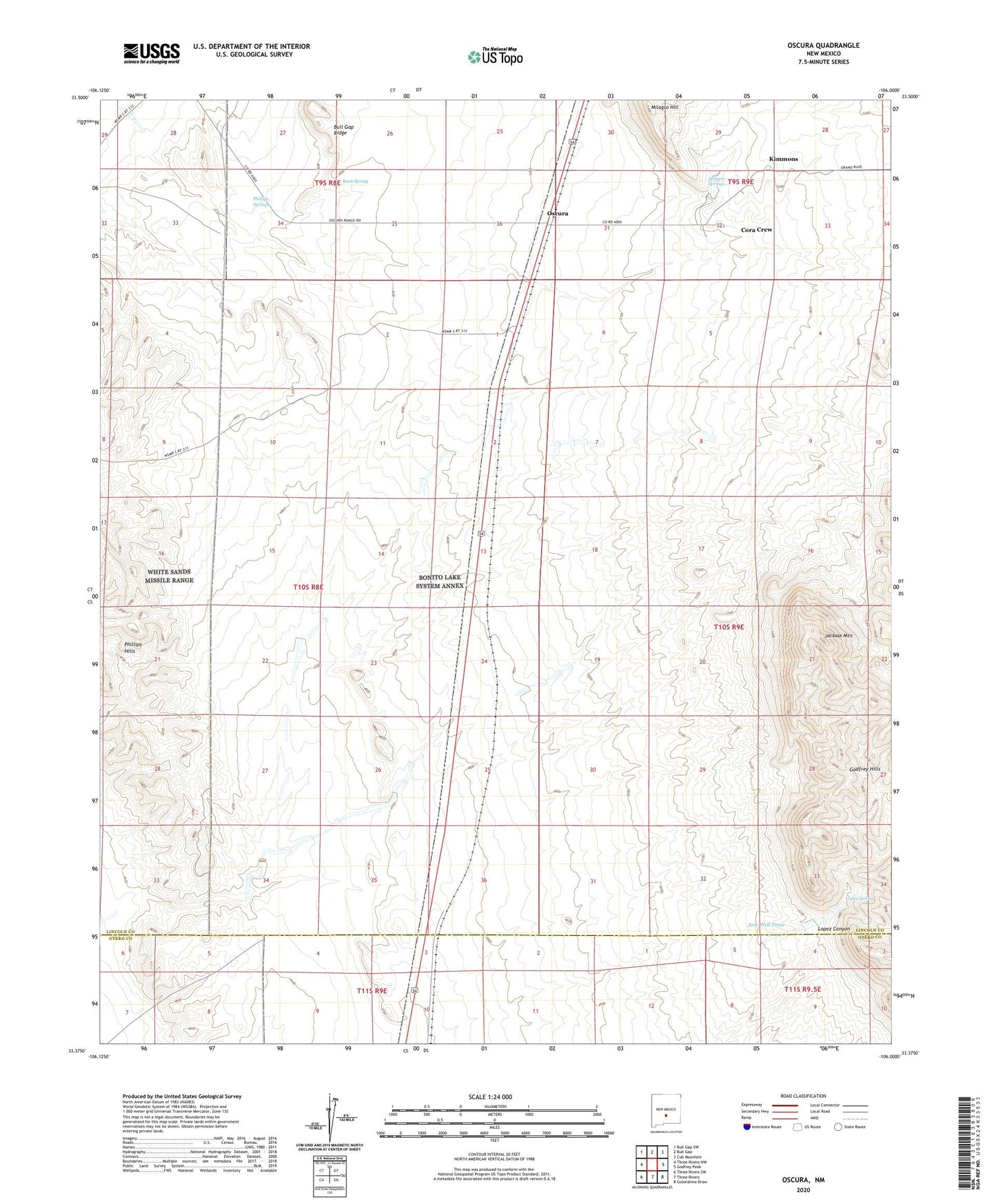
2023 topographic map quadrangle Oscura in the state of New Mexico. Scale: 1:24000. Based on the newly updated USGS 7.5' US Topo map series, this map is in the following counties: Lincoln, Otero. The map contains contour data, water features, and other items you are used to seeing on USGS maps, but also has updated roads and other features. This is the next generation of topographic maps. Printed on high-quality waterproof paper with UV fade-resistant inks.
Quads adjacent to this one:
West: Three Rivers NW
Northwest: Bull Gap SW
North: Bull Gap
Northeast: Cub Mountain
East: Godfrey Peak
Southeast: Golondrina Draw
South: Three Rivers
Southwest: Three Rivers SW
This map covers the same area as the classic USGS quad with code o33106d1.
Contains the following named places: Brownstein Windmill, Bull Gap Ridge, Cora Crew, Harrold Water Well, Husk Windmill, Jackass Mountain, Jackson Well, Keen Spring, Kimmons, Lopez Canyon, Lopez Spring, McKim Water Well, Milagro Hill, Milagro Springs, New Water Well, North Siding, Norton Well, Oscura, Oscura Post Office, Phillips Springs, Rey Mine, Stiles, Taylor Windmill