MyTopo
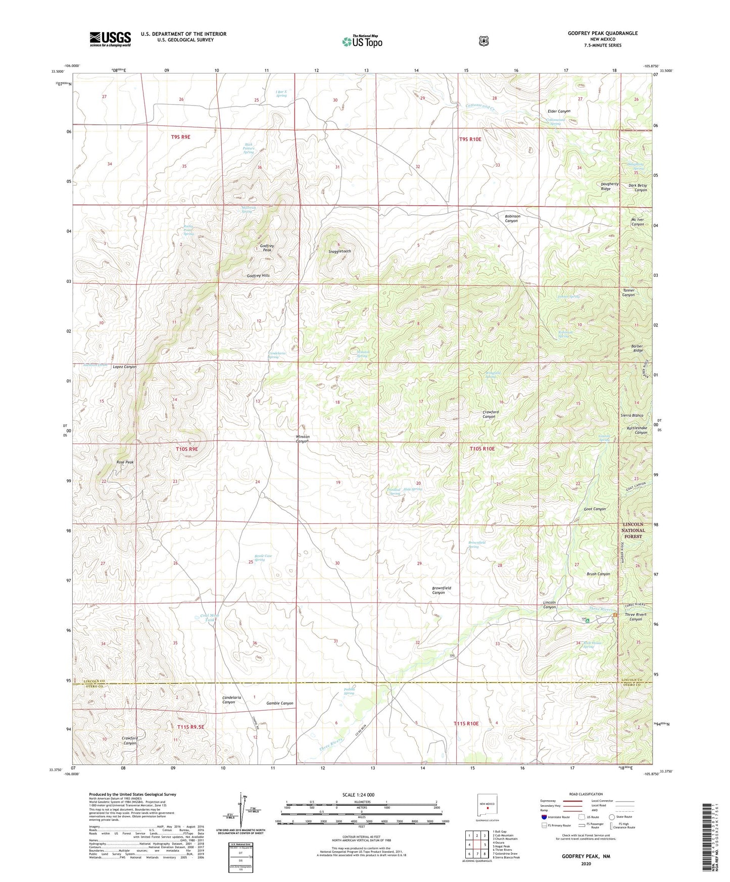
Godfrey Peak New Mexico US Topo Map
Couldn't load pickup availability
Also explore the Godfrey Peak Forest Service Topo of this same quad for updated USFS data
2023 topographic map quadrangle Godfrey Peak in the state of New Mexico. Scale: 1:24000. Based on the newly updated USGS 7.5' US Topo map series, this map is in the following counties: Lincoln, Otero. The map contains contour data, water features, and other items you are used to seeing on USGS maps, but also has updated roads and other features. This is the next generation of topographic maps. Printed on high-quality waterproof paper with UV fade-resistant inks.
Quads adjacent to this one:
West: Oscura
Northwest: Bull Gap
North: Cub Mountain
Northeast: Church Mountain
East: Nogal Peak
Southeast: Sierra Blanca Peak
South: Golondrina Draw
Southwest: Three Rivers
This map covers the same area as the classic USGS quad with code o33105d8.
Contains the following named places: Barber Ridge, Bataan Lodge, Bessie Case Spring, Brownfield Canyon, Brownfield Spring, Brownfield Windmill, Brush Canyon, Buck Pasture Spring, Candelaria Canyon, Candelaria Spring, Coal Mine Tank, Cottonwood Spring, Crawford Canyon, Crawford Well, Daugherty Ridge, Daugherty Spring, Elder Canyon, Gamble Canyon, Gamble Windmill, Goat Canyon, Godfrey Hills, Godfrey Peak, Halfway Windmill, Hall Windmill, Hide Spring, I Bar X Spring, I-X Ranch, Lincoln Canyon, Lincoln Spring, Maverick Spring, Mc Iver Canyon, New Brownfield Well, North Windmill, Padilla Spring, Rattlesnake Canyon, Robinson Canyon, Robinson Spring, Rock House Spring, Rocky Point Spring, Rose Peak, Snaggletooth, Snaggletooth Well, Spring Canyon, Tanner Spring, Three Rivers Campground, Three Rivers Canyon, Three Rivers Ranch, Tramble Windmill, Trinidad Spring, Twin Wells Windmill, Walker Windmill, Wingfield Spring, Winston Canyon, Winston Spring