MyTopo
Pajaro Canyon New Mexico US Topo Map
Couldn't load pickup availability
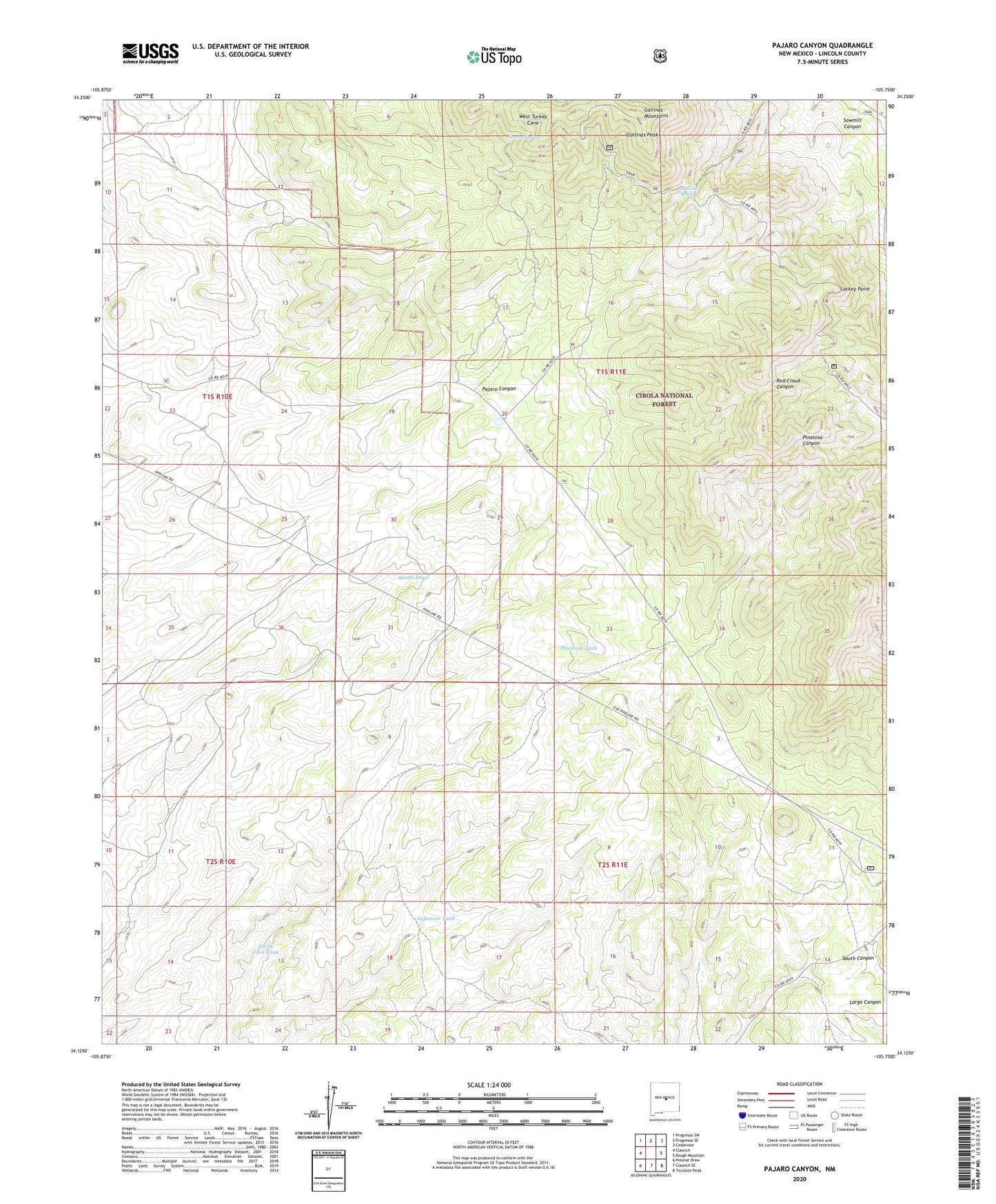
2020 topographic map quadrangle Pajaro Canyon in the state of New Mexico. Scale: 1:24000. Based on the newly updated USGS 7.5' US Topo map series, this map is in the following counties: Lincoln. The map contains contour data, water features, and other items you are used to seeing on USGS maps, but also has updated roads and other features. This is the next generation of topographic maps. Printed on high-quality waterproof paper with UV fade-resistant inks.
Quads adjacent to this one:
West: Claunch
Northwest: Progresso SW
North: Progresso SE
Northeast: Cedarvale
East: Rough Mountain
Southeast: Tecolote Peak
South: Claunch SE
Southwest: Polecat Draw
Contains the following named places: American Contact Mine, American Mine - Gallinas District, Antelope Tank, Antelope Trick Tank, Antelope Windmill, Cement Spring, Federation Trick Tank, Gallinas Lookout, Gallinas Mountains, Gallinas Peak, Gallinas Spring, Iron Box Mine, Iron Lamp, Iron Mask Mine, Iron Mine Trick Tank, Iron State Mine, Japanese Tank, Juan Well, Lackey Point, Lackey Point Trick Tank, Little Marie, M and E Number 13, Middle Antelope Windmill, North Corn Tank, North Well, Pajaro Canyon, Picnic Tank, Pinatosa Tank, Pinatosa Trick Tank, Pride Number Two, Ranger Tank, Rare Metals, Red Cloud Campground, Round Mountain Trick Tank, Sawmill Canyon, School Section Windmill, Sky High, Surrat Ranch, Turkey Cone Trick Tank, Twin Tanks, West Tank, West Turkey Cone, Youngblood Well