MyTopo
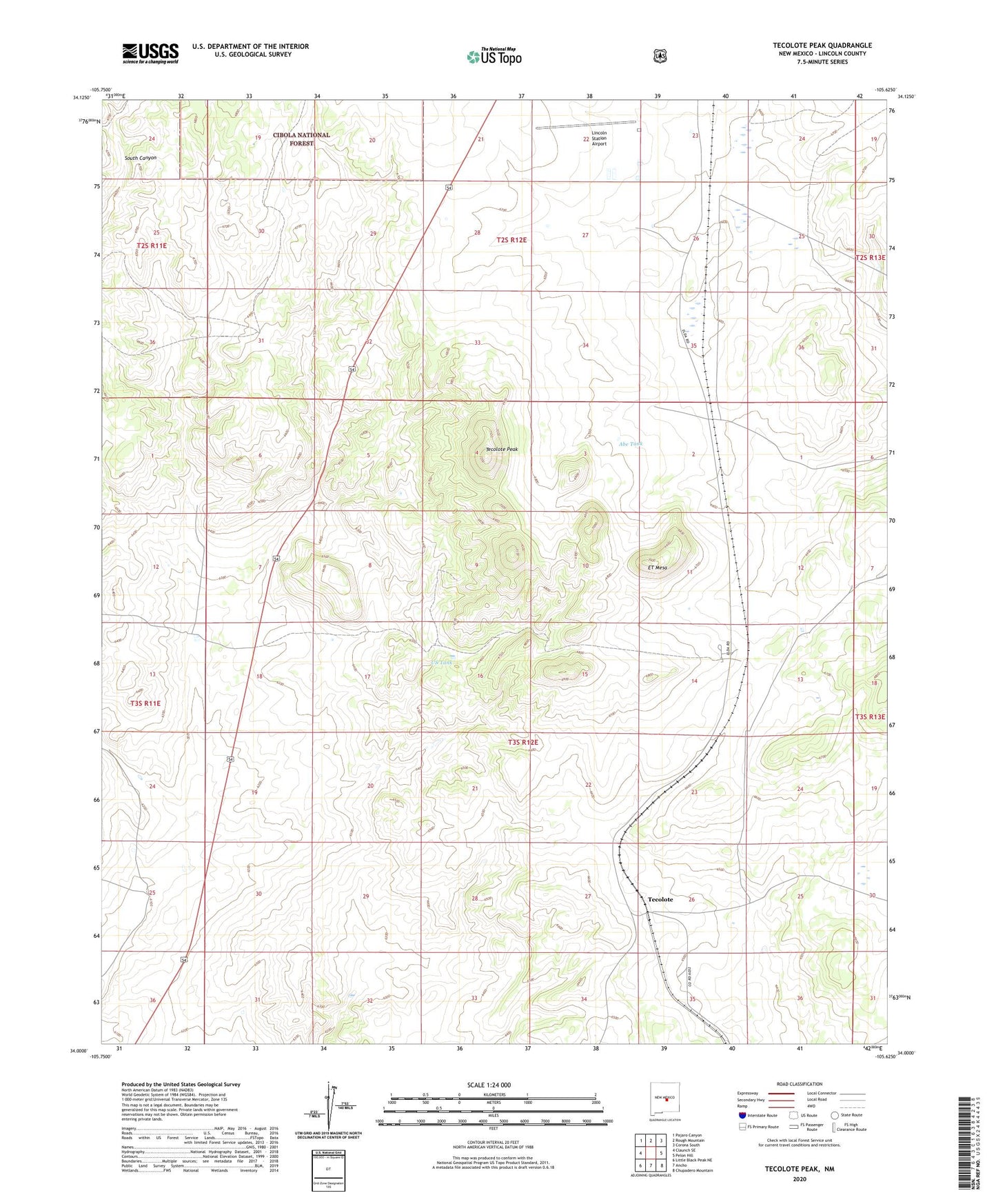
Tecolote Peak New Mexico US Topo Map
Couldn't load pickup availability
Also explore the Tecolote Peak Forest Service Topo of this same quad for updated USFS data
2023 topographic map quadrangle Tecolote Peak in the state of New Mexico. Scale: 1:24000. Based on the newly updated USGS 7.5' US Topo map series, this map is in the following counties: Lincoln. The map contains contour data, water features, and other items you are used to seeing on USGS maps, but also has updated roads and other features. This is the next generation of topographic maps. Printed on high-quality waterproof paper with UV fade-resistant inks.
Quads adjacent to this one:
West: Claunch SE
Northwest: Pajaro Canyon
North: Rough Mountain
Northeast: Corona South
East: Pelon Hill
Southeast: Chupadero Mountain
South: Ancho
Southwest: Little Black Peak NE
This map covers the same area as the classic USGS quad with code o34105a6.
Contains the following named places: Abe Tank, Bessemer Mine, Betty Prospect, Bond Mine, Bond Number Two Mine, Consolidated Mine, Consolidated Number Three, Contact, Elda, Elda Mine, ET Mesa, ET Well, Homestead Well, Iron Age Mine, Iron City Mine, Iron Contact Mine, Iron Edge Mine, Iron Handle Mine, Iron Monument Lode, Iron Pan Mine, Iron Rail Mine, Lincoln Pumping Station, Lincoln Station Airport, Martin Tank, May Tank, North Well, Red Cloud Canyon, Roosevelt Tank, South Well, Tecolote, Tecolote Peak, Tecolote Peaks Iron Claim, US Tank, Vaughn Ranch, Victoriana Tank