MyTopo
Paraje Well New Mexico US Topo Map
Couldn't load pickup availability
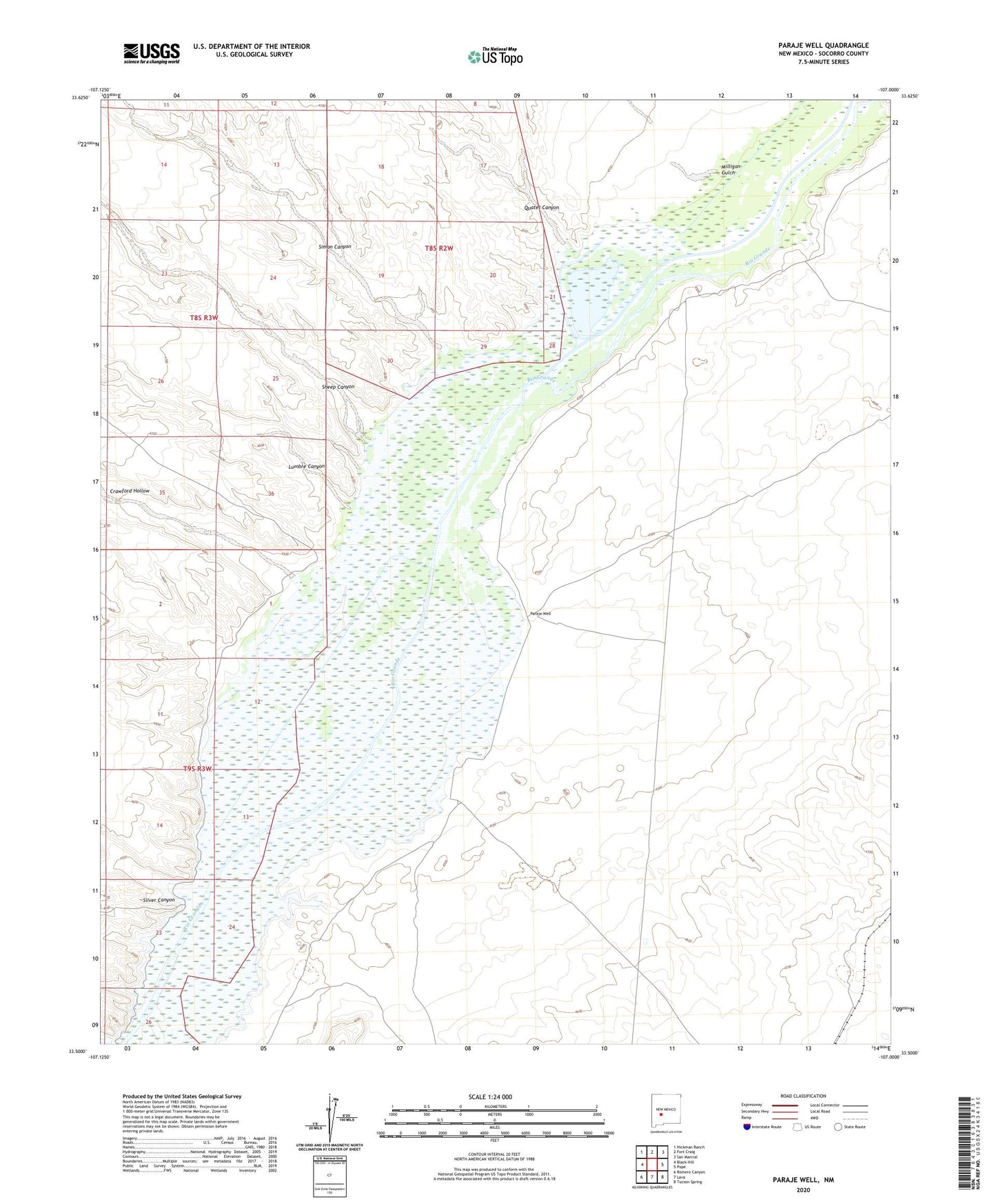
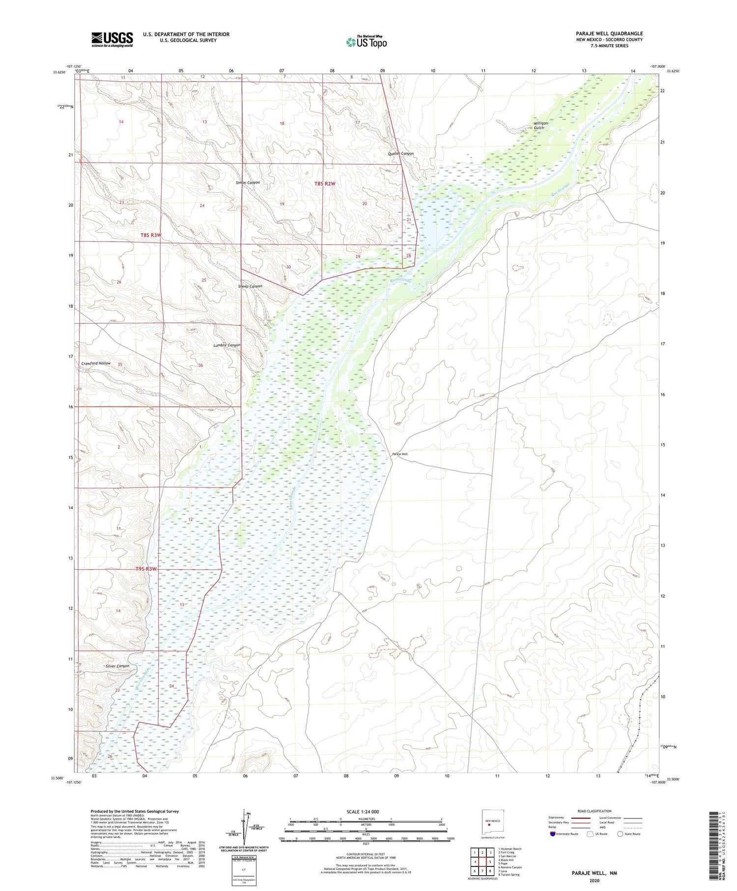
2023 topographic map quadrangle Paraje Well in the state of New Mexico. Scale: 1:24000. Based on the newly updated USGS 7.5' US Topo map series, this map is in the following counties: Socorro. The map contains contour data, water features, and other items you are used to seeing on USGS maps, but also has updated roads and other features. This is the next generation of topographic maps. Printed on high-quality waterproof paper with UV fade-resistant inks.
Quads adjacent to this one:
West: Black Hill
Northwest: Hickman Ranch
North: Fort Craig
Northeast: San Marcial
East: Pope
Southeast: Tucson Spring
South: Lava
Southwest: Romero Canyon
This map covers the same area as the classic USGS quad with code o33107e1.
Contains the following named places: Bosque Well, Crawford Hollow, Lumbre Canyon, Milligan Gulch, Paraje, Paraje Post Office, Paraje Well, Quates Canyon, Rock Creek, Sheep Canyon, Silver Canyon, Simon Canyon