MyTopo
Pecos Falls New Mexico US Topo Map
Couldn't load pickup availability
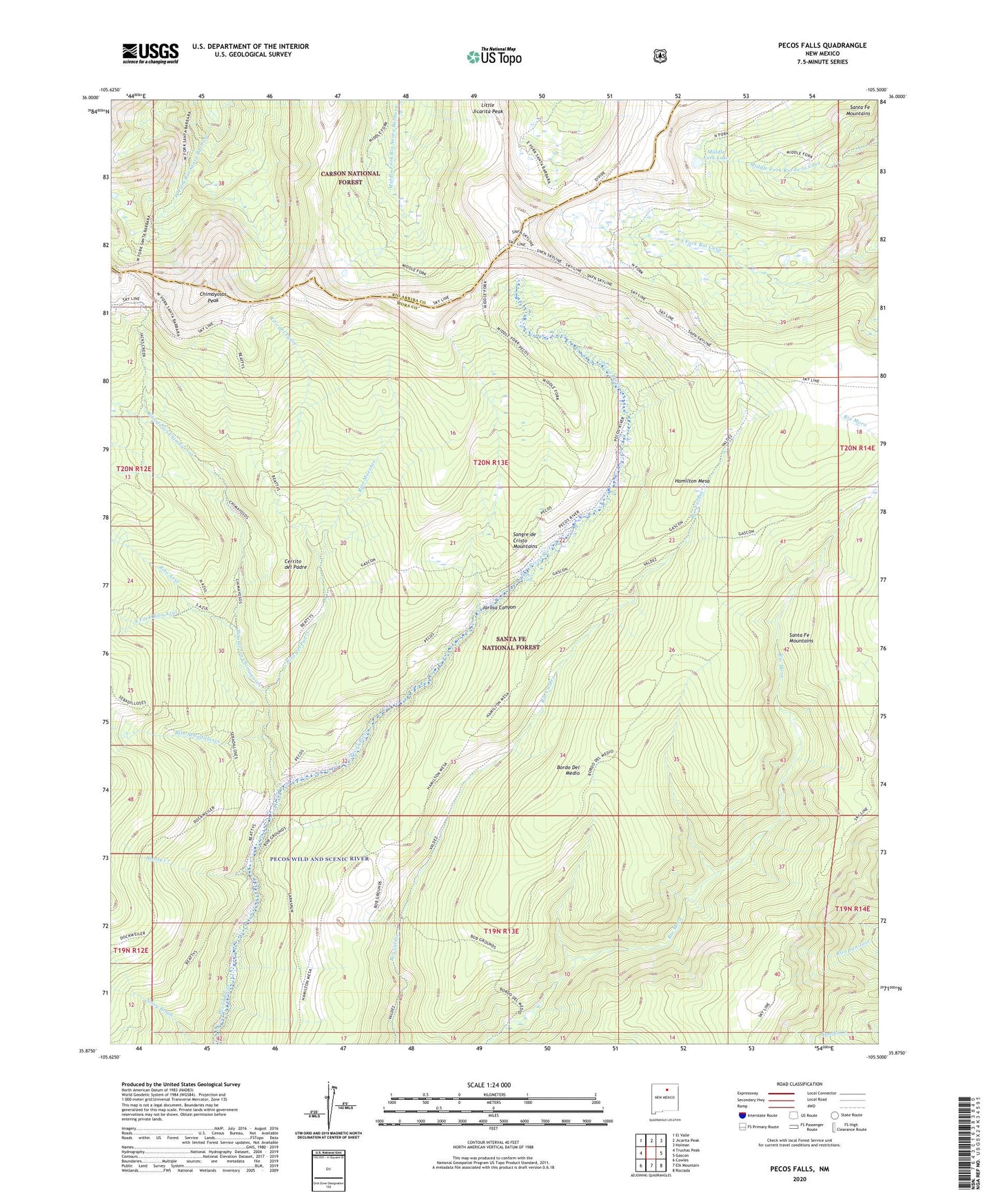
2020 topographic map quadrangle Pecos Falls in the state of New Mexico. Scale: 1:24000. Based on the newly updated USGS 7.5' US Topo map series, this map is in the following counties: Mora, Rio Arriba. The map contains contour data, water features, and other items you are used to seeing on USGS maps, but also has updated roads and other features. This is the next generation of topographic maps. Printed on high-quality waterproof paper with UV fade-resistant inks.
Quads adjacent to this one:
West: Truchas Peak
Northwest: El Valle
North: Jicarita Peak
Northeast: Holman
East: Gascon
Southeast: Rociada
South: Elk Mountain
Southwest: Cowles
Contains the following named places: Beatty Cabin, Beatty Creek, Bordo Del Medio, Cerrito del Padre, Chimayosos Peak, Hamilton Mesa, Jarosa Canyon, Kennedy Point, Little Jicarita Peak, Lost Bear Lake, Middle Fork Lake, Pecos Falls, Rincon Bonito, Rito Azul, Rito de los Chimayosos, Rito del Padre, Rito Maestas, Rito Sebadilloses, Santa Fe Mountains, Smith Cabin, South Fork Rito Azul, ZIP Code: 87742