MyTopo
Picacho Mountain New Mexico US Topo Map
Couldn't load pickup availability
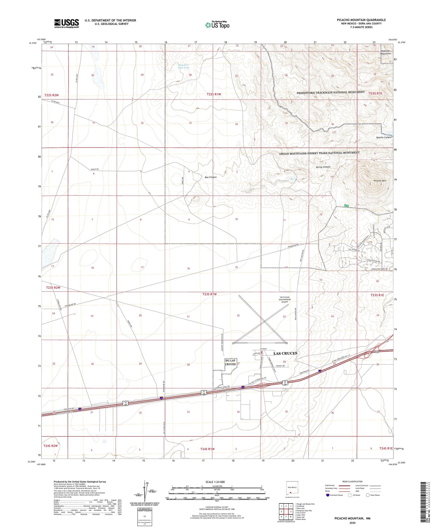
2020 topographic map quadrangle Picacho Mountain in the state of New Mexico. Scale: 1:24000. Based on the newly updated USGS 7.5' US Topo map series, this map is in the following counties: Doña Ana. The map contains contour data, water features, and other items you are used to seeing on USGS maps, but also has updated roads and other features. This is the next generation of topographic maps. Printed on high-quality waterproof paper with UV fade-resistant inks.
Quads adjacent to this one:
West: Sleeping Lady Hills
Northwest: Rough and Ready Hills
North: Leasburg
Northeast: Dona Ana
East: Las Cruces
Southeast: Black Mesa
South: Afton NW
Southwest: Aden Hills
Contains the following named places: Box Canyon Dam, Hawkins East Tank, KRWG-FM (Las Cruces), KRWG-TV (Las Cruces), Las Cruces Air Force Station, Las Cruces Fire Department Station 7, Las Cruces International Airport, Lauer Claims, Mesilla Civil Colony Tract Number 2, Picacho Hills Census Designated Place, Picacho Mountain, Picacho North Dam, Picacho South Dam, Prehistoric Trackways National Monument, Sertoma International Raceway, Spring Canyon