MyTopo
Leasburg New Mexico US Topo Map
Couldn't load pickup availability
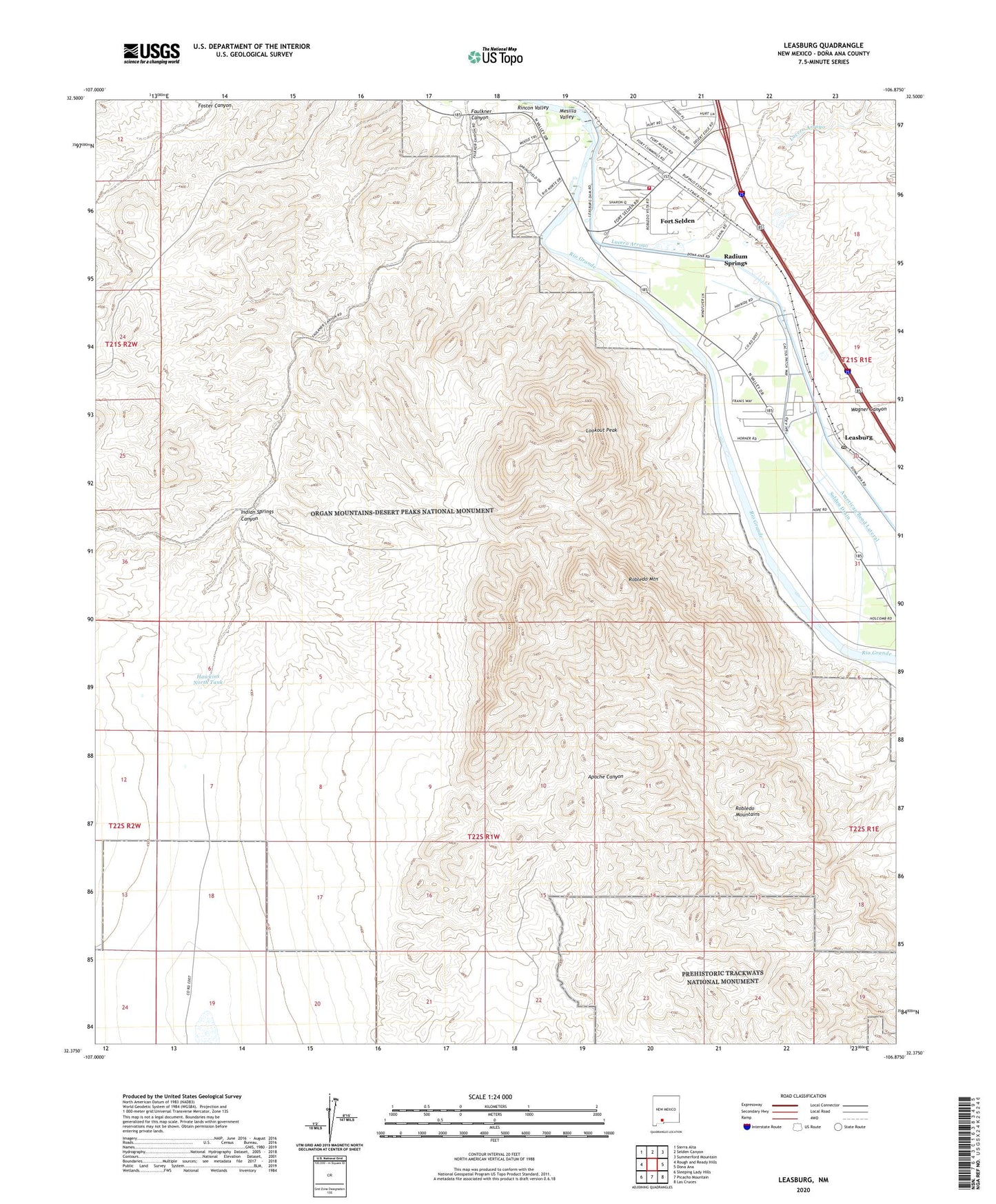
2023 topographic map quadrangle Leasburg in the state of New Mexico. Scale: 1:24000. Based on the newly updated USGS 7.5' US Topo map series, this map is in the following counties: Doña Ana. The map contains contour data, water features, and other items you are used to seeing on USGS maps, but also has updated roads and other features. This is the next generation of topographic maps. Printed on high-quality waterproof paper with UV fade-resistant inks.
Quads adjacent to this one:
West: Rough and Ready Hills
Northwest: Sierra Alta
North: Selden Canyon
Northeast: Summerford Mountain
East: Dona Ana
Southeast: Las Cruces
South: Picacho Mountain
Southwest: Sleeping Lady Hills
This map covers the same area as the classic USGS quad with code o32106d8.
Contains the following named places: American Bend Lateral, Bartlett-Garcia Conde Initial Survey Point Historical Marker, Dona Ana County Fire and Emergency Services District 8 Station - Radium Springs, Faulkner Canyon, Fort Selden, Fort Selden Post Office, Fort Selden State Monument, Fort Selden State Monument Historical Marker, Gilliland, Gilliland Claim, Hatch Valley, Hawkins North Tank, Indian Springs Canyon, Iron Hill District, Leasburg, Leasburg Dam, Leasburg Dam State Park, Leasburg Diversion Dam, Leasburg Post Office, Lookout Peak, Lucero Arroyo, Lucero Detention Dike, Radium Springs Census Designated Place, Radium Springs Post Office, Roblado Mountains Wilderness Study Area, Robledo Mountain, Robledo Mountains, Selden Drain, United States Bureau of Reclamation 41 Water Well, United States Bureau of Reclamation 42 Water Well, United States Bureau of Reclamation 43 Water Well, Wagner Canyon, Willis Groups, ZIP Code: 88007