MyTopo
Post Office Flat New Mexico US Topo Map
Couldn't load pickup availability
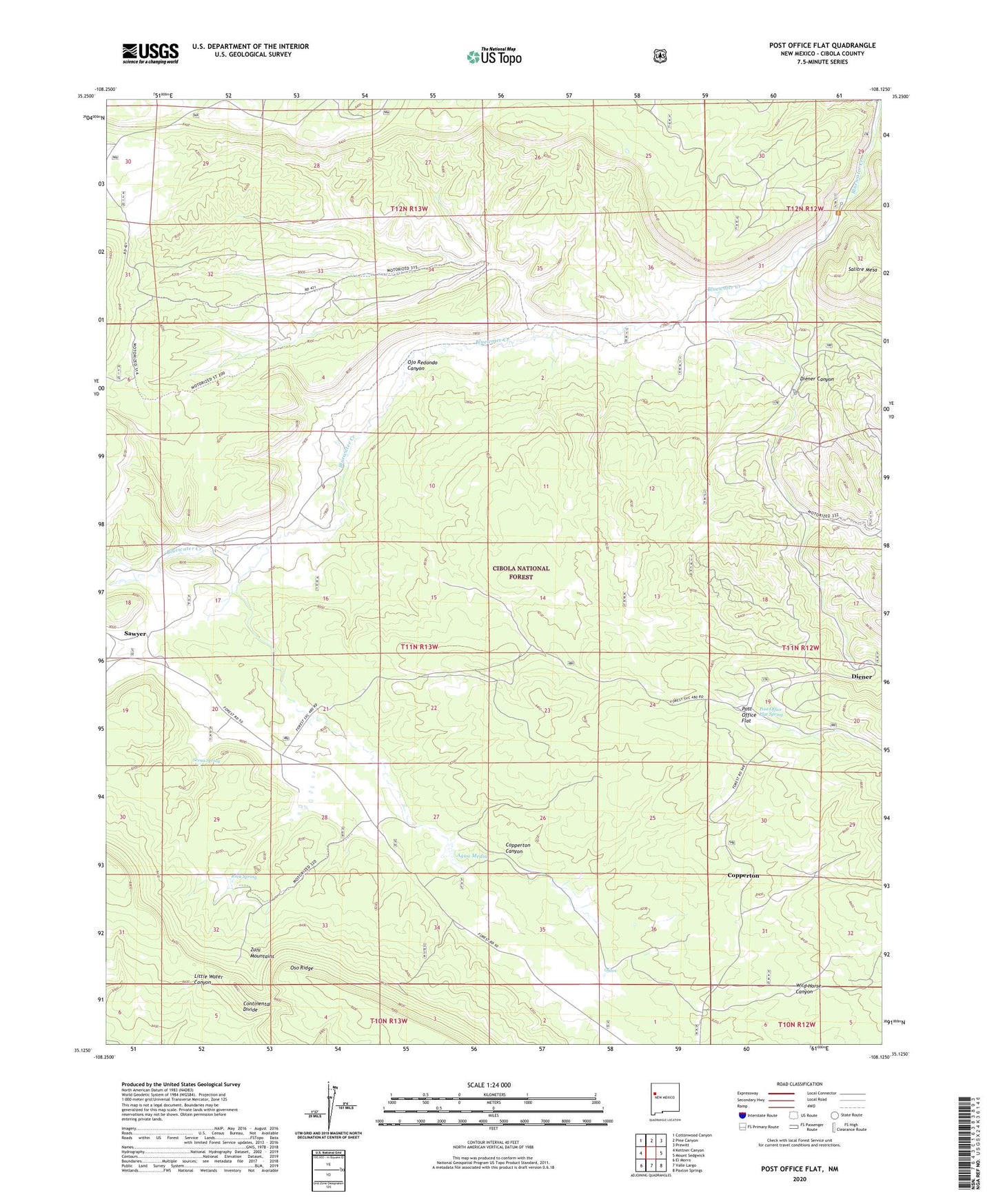
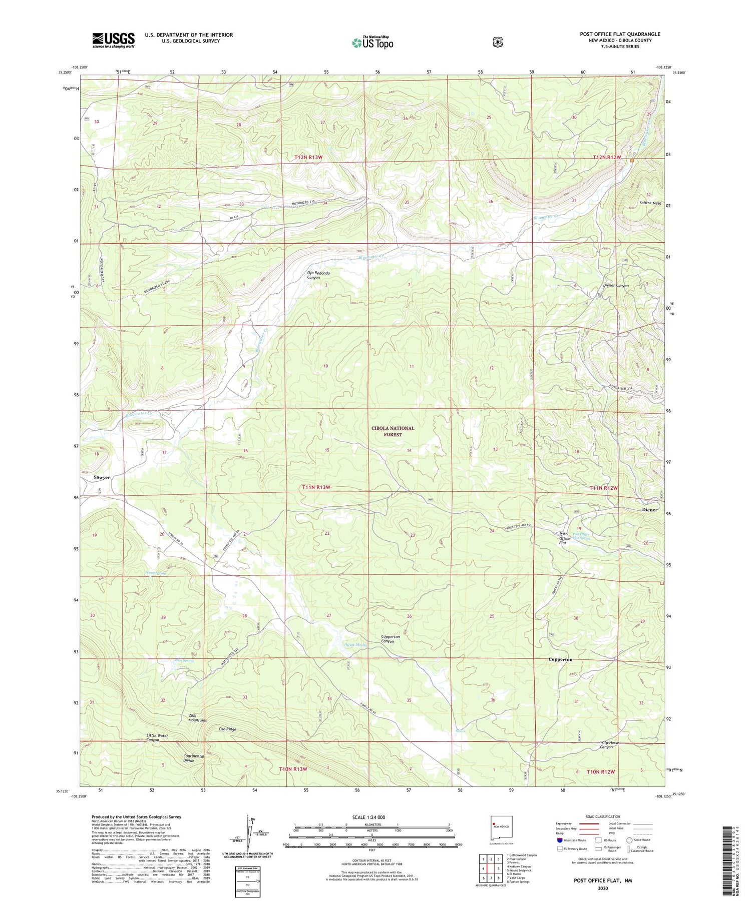
2020 topographic map quadrangle Post Office Flat in the state of New Mexico. Scale: 1:24000. Based on the newly updated USGS 7.5' US Topo map series, this map is in the following counties: Cibola. The map contains contour data, water features, and other items you are used to seeing on USGS maps, but also has updated roads and other features. This is the next generation of topographic maps. Printed on high-quality waterproof paper with UV fade-resistant inks.
Quads adjacent to this one:
West: Kettner Canyon
Northwest: Cottonwood Canyon
North: Pine Canyon
Northeast: Prewitt
East: Mount Sedgwick
Southeast: Paxton Springs
South: Valle Largo
Southwest: El Morro
Contains the following named places: Agua Media, Bluewater Creek Picnic Area, Copperton, Copperton Canyon, Coppertown Post Office, Diener, Diener Canyon, Diener Post Office, Mirabal Mine, Ojitos, Ojo Redondo Canyon, Post Office Flat, Post Office Flat Spring, Rock Spring, Sawyer, Sawyer Post Office, Serna Homestead, Serna Spring, Wilcoxson Ranch