MyTopo
Kettner Canyon New Mexico US Topo Map
Couldn't load pickup availability
Also explore the Kettner Canyon Forest Service Topo of this same quad for updated USFS data
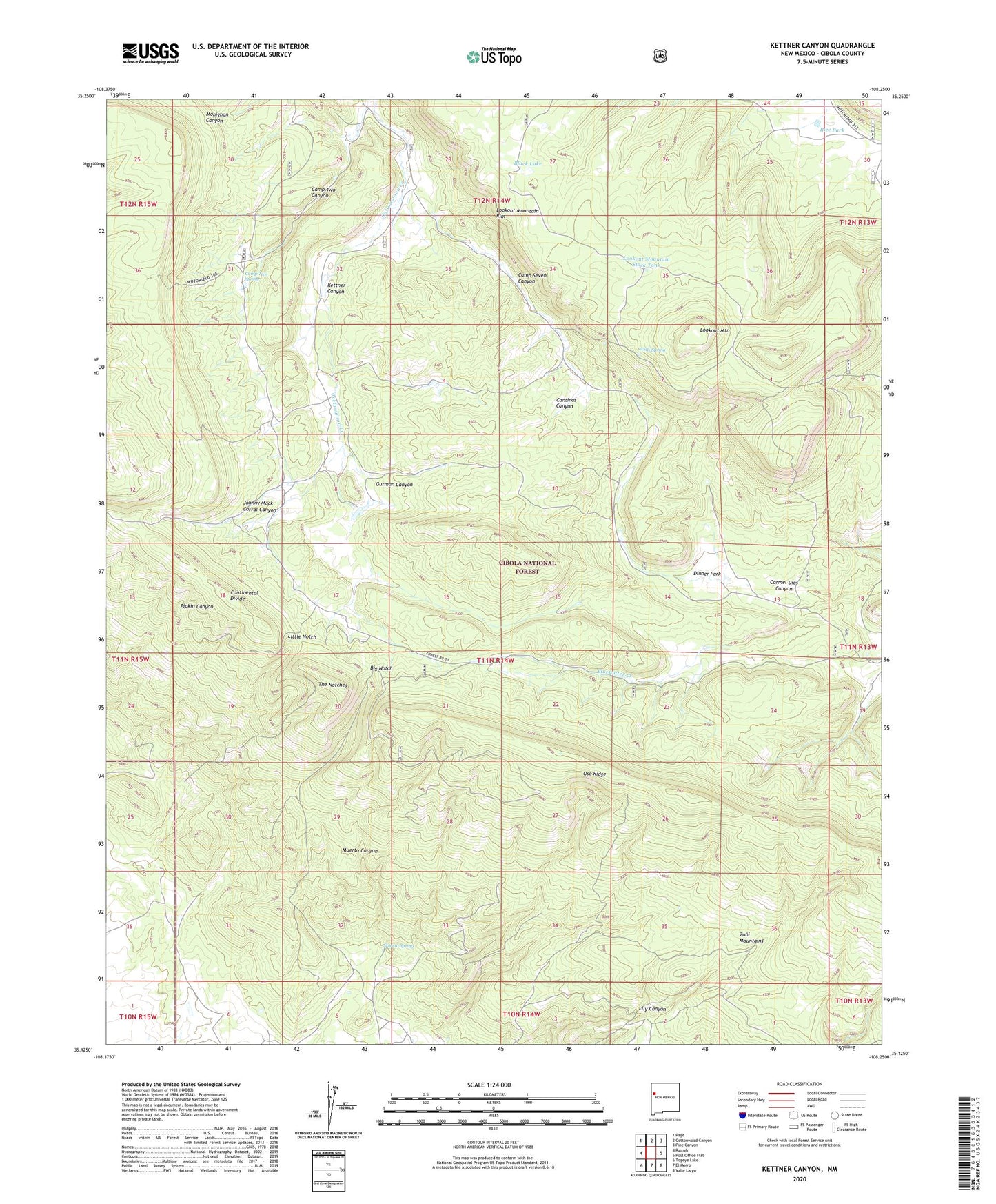
2023 topographic map quadrangle Kettner Canyon in the state of New Mexico. Scale: 1:24000. Based on the newly updated USGS 7.5' US Topo map series, this map is in the following counties: Cibola. The map contains contour data, water features, and other items you are used to seeing on USGS maps, but also has updated roads and other features. This is the next generation of topographic maps. Printed on high-quality waterproof paper with UV fade-resistant inks.
Quads adjacent to this one:
West: Ramah
Northwest: Page
North: Cottonwood Canyon
Northeast: Pine Canyon
East: Post Office Flat
Southeast: Valle Largo
South: El Morro
Southwest: Togeye Lake
This map covers the same area as the classic USGS quad with code o35108b3.
Contains the following named places: Big Notch, Black Lake, Camp Seven Canyon, Camp Two, Camp Two Canyon, Camp Two Spring, Cantinas Canyon, Carmel Dias Canyon, Dinner Park, Gurman Canyon, Johnny Mack Corral Canyon, Kettner Canyon, Little Notch, Lookout Mountain, Lookout Mountain Rim, Lookout Mountain Stock Tank, Muerto Spring, Muerto Well, Rice Park, The Notches, Wells Spring, Zuni Mountains