MyTopo
Cottonwood Canyon New Mexico US Topo Map
Couldn't load pickup availability
Also explore the Cottonwood Canyon Forest Service Topo of this same quad for updated USFS data
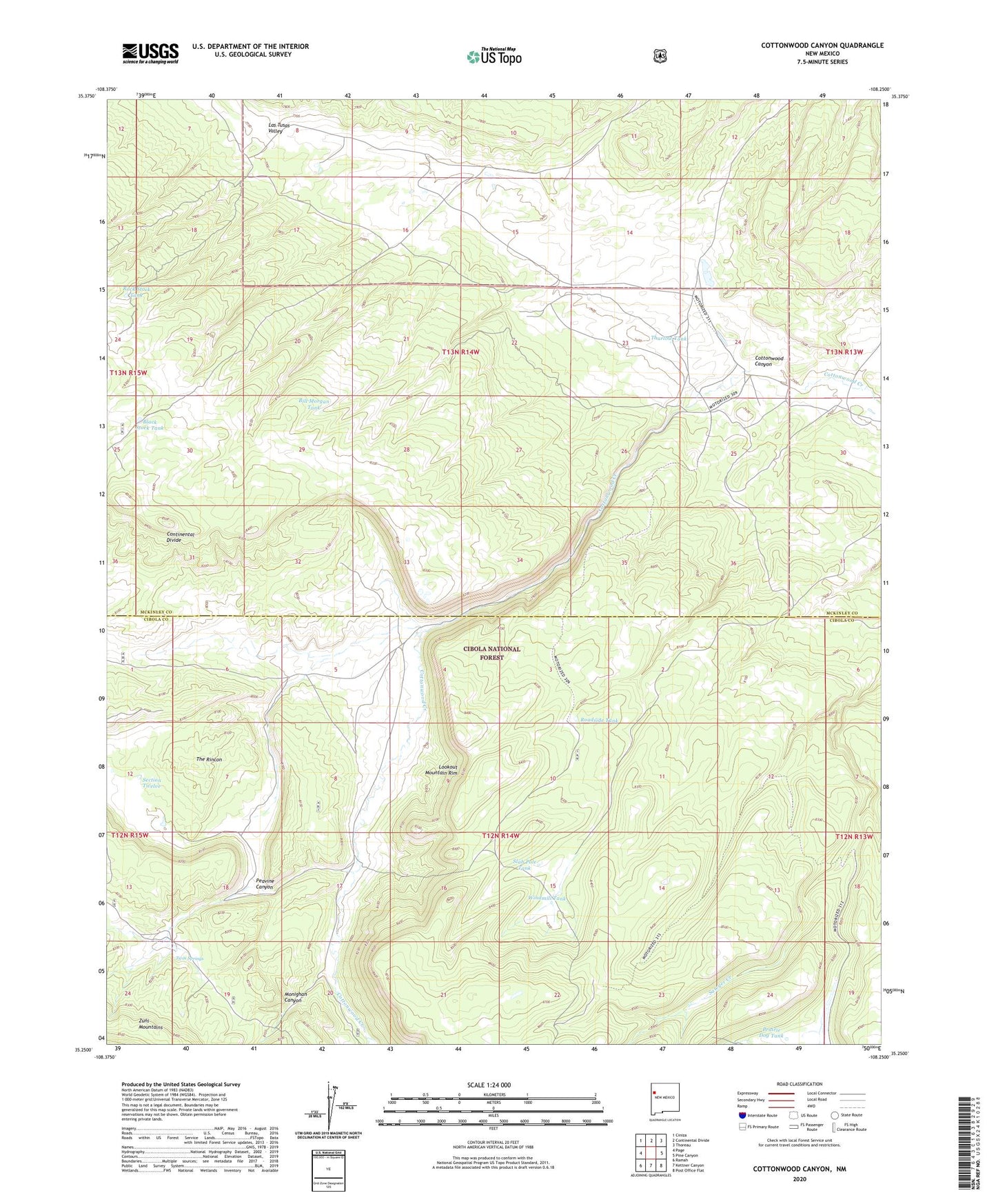
2023 topographic map quadrangle Cottonwood Canyon in the state of New Mexico. Scale: 1:24000. Based on the newly updated USGS 7.5' US Topo map series, this map is in the following counties: Cibola, McKinley. The map contains contour data, water features, and other items you are used to seeing on USGS maps, but also has updated roads and other features. This is the next generation of topographic maps. Printed on high-quality waterproof paper with UV fade-resistant inks.
Quads adjacent to this one:
West: Page
Northwest: Ciniza
North: Continental Divide
Northeast: Thoreau
East: Pine Canyon
Southeast: Post Office Flat
South: Kettner Canyon
Southwest: Ramah
This map covers the same area as the classic USGS quad with code o35108c3.
Contains the following named places: 10006 Water Well, Bass Ranch, Bill Morgan Tank, Black Stock Tank, Coddington Ranch, Corral Tanks One and Two, Cottonwood Canyon, Irvin Ranch, Long Park, Monighan Canyon, Peavine Canyon, Prairie Dog Tank, Rice Park Dam, Roadside Tank, Rock Dam, Rock Stock Tank, Section Twelve, Slab Pole Tank, The Rincon, Thurlow Tank, Twin Springs, Windmill Tank