MyTopo
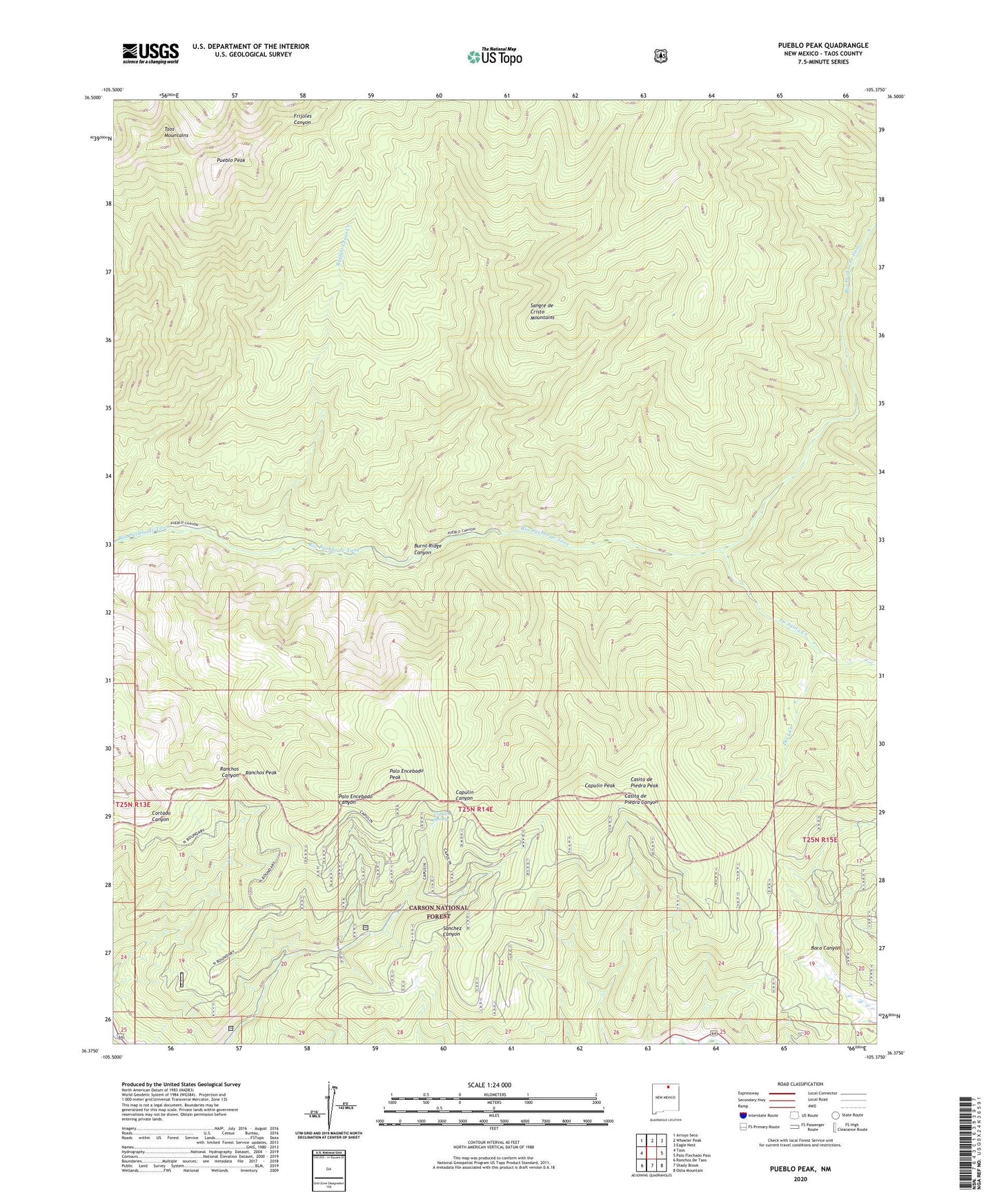
Pueblo Peak New Mexico US Topo Map
Couldn't load pickup availability
Also explore the Pueblo Peak Forest Service Topo of this same quad for updated USFS data
2023 topographic map quadrangle Pueblo Peak in the state of New Mexico. Scale: 1:24000. Based on the newly updated USGS 7.5' US Topo map series, this map is in the following counties: Taos. The map contains contour data, water features, and other items you are used to seeing on USGS maps, but also has updated roads and other features. This is the next generation of topographic maps. Printed on high-quality waterproof paper with UV fade-resistant inks.
Quads adjacent to this one:
West: Taos
Northwest: Arroyo Seco
North: Wheeler Peak
Northeast: Eagle Nest
East: Palo Flechado Pass
Southeast: Osha Mountain
South: Shady Brook
Southwest: Ranchos De Taos
This map covers the same area as the classic USGS quad with code o36105d4.
Contains the following named places: Buffalo Grass Creek, Burnt Ridge Canyon, Burnt Ridge Trail, Capulin Peak, Capulin Spring, Casita de Piedra Peak, Deer Creek, Kit Carson Trail, La Junta Creek, Palo Encebado Peak, Pueblo Peak, Ranchos Peak, Simpson Memorial Trail, Taos Pueblo Division, ZIP Code: 87571