MyTopo
Redmesa Colorado US Topo Map
Couldn't load pickup availability
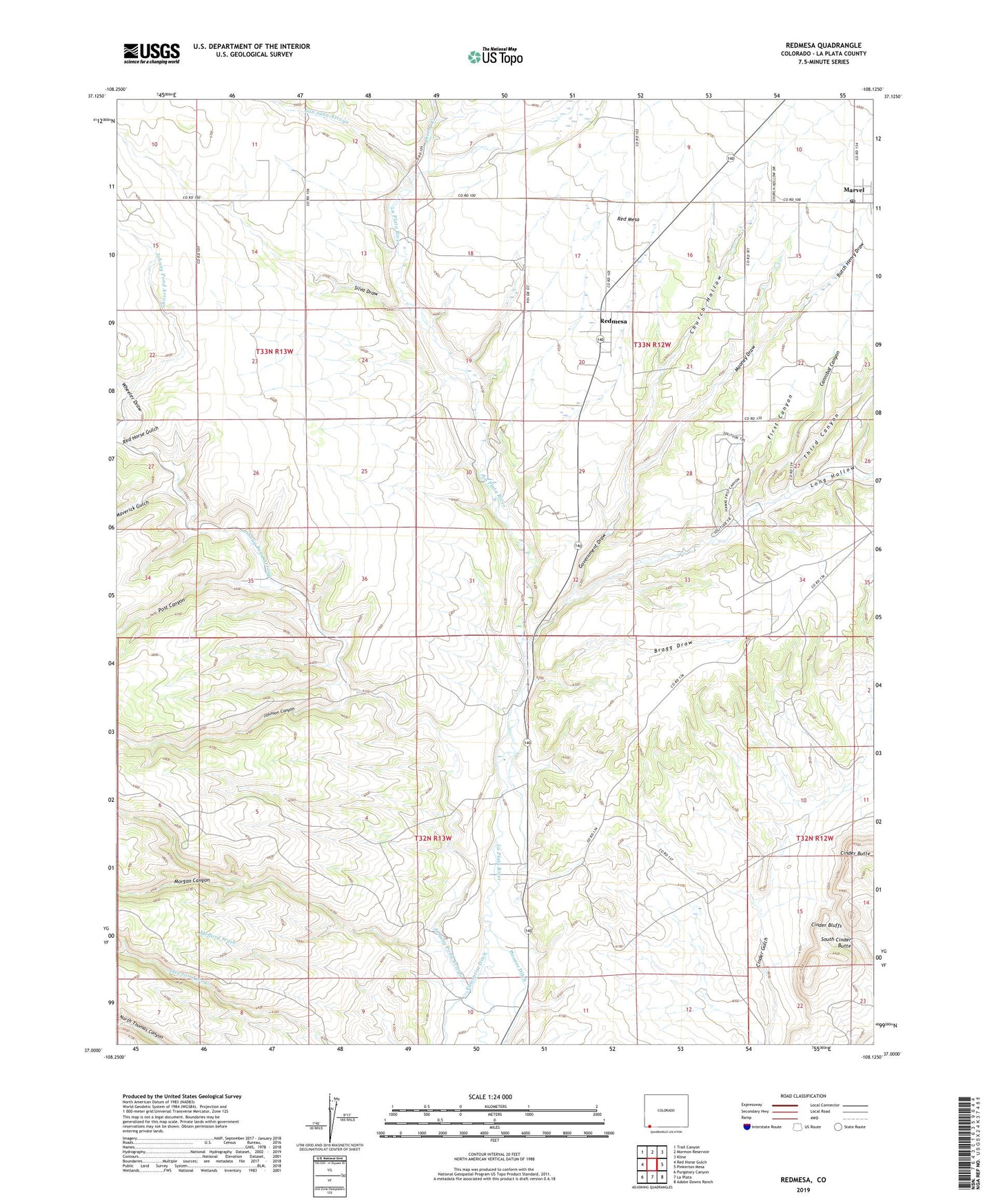
2022 topographic map quadrangle Redmesa in the state of Colorado. Scale: 1:24000. Based on the newly updated USGS 7.5' US Topo map series, this map is in the following counties: La Plata. The map contains contour data, water features, and other items you are used to seeing on USGS maps, but also has updated roads and other features. This is the next generation of topographic maps. Printed on high-quality waterproof paper with UV fade-resistant inks.
Quads adjacent to this one:
West: Red Horse Gulch
Northwest: Trail Canyon
North: Mormon Reservoir
Northeast: Kline
East: Pinkerton Mesa
Southeast: Adobe Downs Ranch
South: La Plata
Southwest: Purgatory Canyon
This map covers the same area as the classic USGS quad with code o37108a2.
Contains the following named places: Bragg Draw, Butch Henry Draw, Cannibal Canyon, Cherry Creek, Church Hollow, Cinder Bluffs, Enterprise Ditch, First Canyon, Government Draw, Johnny Pond Arroyo, Johnson Canyon, Long Hollow, Marvel, Marvel Census Designated Place, Marvel Post Office, Maverick Gulch, Mooney Draw, Morgan Canyon, Post Canyon, Red Horse Gulch, Redmesa, San Juan Arroyo, Silva Draw, South Cinder Butte, Third Canyon, Wheeler Arroyo, Wheeler Draw