MyTopo
Pyramid Peak New Mexico US Topo Map
Couldn't load pickup availability
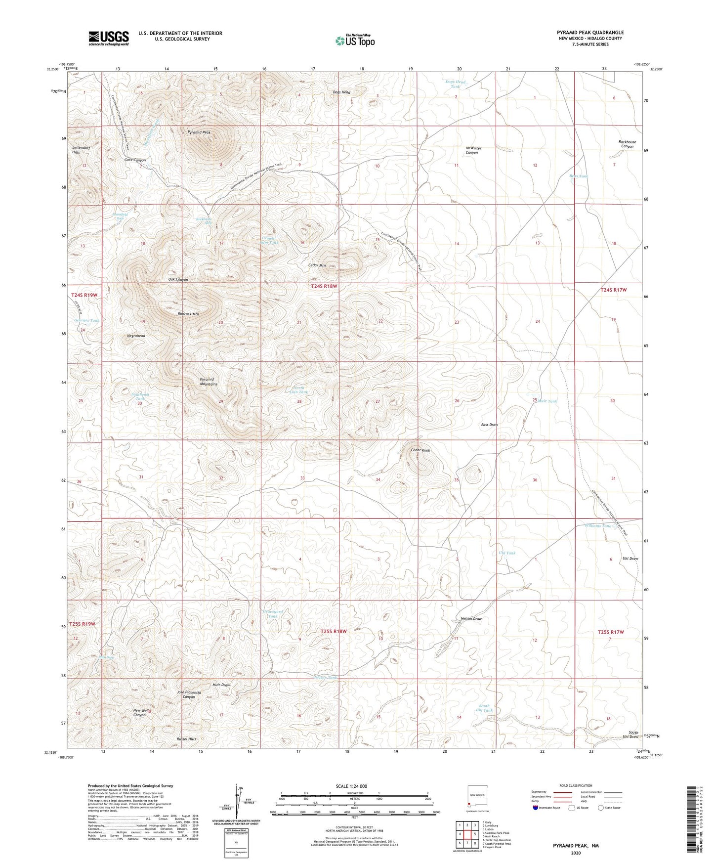
2020 topographic map quadrangle Pyramid Peak in the state of New Mexico. Scale: 1:24000. Based on the newly updated USGS 7.5' US Topo map series, this map is in the following counties: Hidalgo. The map contains contour data, water features, and other items you are used to seeing on USGS maps, but also has updated roads and other features. This is the next generation of topographic maps. Printed on high-quality waterproof paper with UV fade-resistant inks.
Quads adjacent to this one:
West: Swallow Fork Peak
Northwest: Gary
North: Lordsburg
Northeast: Lisbon
East: Muir Ranch
Southeast: Coyote Peak
South: South Pyramid Peak
Southwest: Table Top Mountain
Contains the following named places: 10326 Water Well, Allen Mine, Allen Seep, Ballard Well, Bass Draw, Bass Well, Bens Tank, Cedar Knob, Cedar Mountain, Cedar Mountain Well, Cement Dam Tank, Dogs Head, Dogs Head Tank, Fair View Lode, Georges Tank, Graham Well, Graveyard Tank, Last Chance, Last Chance Well, Leitendorf Hills, Linn Wells, Mansfield Seep, McWirter Canyon, Muir Tank, Negrohead, Negrohead Well, Nelson Draw, Nelson Tank, North Linn Tank, Pyramid Mountains, Pyramid Peak, Pyramid Well, Red Windmill, Rimrock Mountain, Rockhouse Canyon, Rockhouse Seep, Silver Tree Mine, South Uhl Tank, Southeast Tank, Uhl Tank, Uhl Well, Venice Mine, Williams Tank