MyTopo
Swallow Fork Peak New Mexico US Topo Map
Couldn't load pickup availability
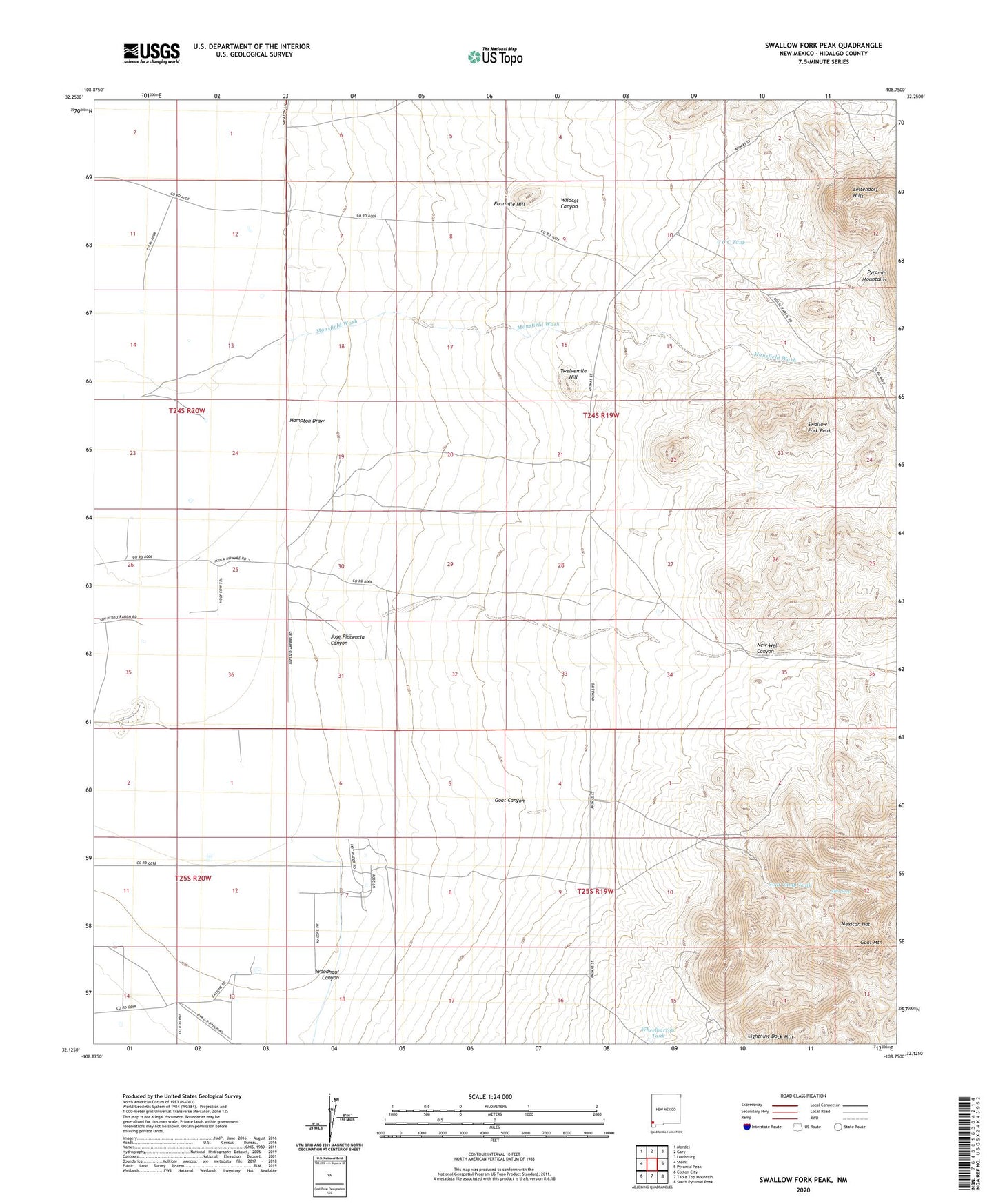
2023 topographic map quadrangle Swallow Fork Peak in the state of New Mexico. Scale: 1:24000. Based on the newly updated USGS 7.5' US Topo map series, this map is in the following counties: Hidalgo. The map contains contour data, water features, and other items you are used to seeing on USGS maps, but also has updated roads and other features. This is the next generation of topographic maps. Printed on high-quality waterproof paper with UV fade-resistant inks.
Quads adjacent to this one:
West: Steins
Northwest: Mondel
North: Gary
Northeast: Lordsburg
East: Pyramid Peak
Southeast: South Pyramid Peak
South: Table Top Mountain
Southwest: Cotton City
This map covers the same area as the classic USGS quad with code o32108b7.
Contains the following named places: 10031 Water Well, 10032 Water Well, 10056 Water Well, Able Seep, Bug House Mine, C C C Tank, Cedar Lode, Fourmile Hill, Goat Camp Tank, Goat Canyon, Goat Mountain, Hampton Draw, Hill Well, Jose Placencia Canyon, Leitendorf, Light Load Mine, Lighting Dock Area KGRA, Lightning Dock Mountain, Lucky Strike Lode, Mansfield Wash, Mexican Hat, Nation Well, New Well, New Well Canyon, Road Well, Schlesinger Ranch, Seven Twelve Ranch, Silver Bell Mine, South Well, Swallow Fork Peak, Twelvemile Hill, Well A Water Well, Wheelbarrow Tank, Wildcat Canyon, Woodhaul Canyon