MyTopo
Table Top Mountain New Mexico US Topo Map
Couldn't load pickup availability
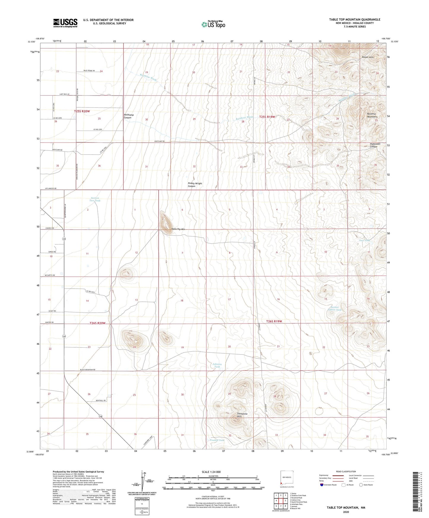
2023 topographic map quadrangle Table Top Mountain in the state of New Mexico. Scale: 1:24000. Based on the newly updated USGS 7.5' US Topo map series, this map is in the following counties: Hidalgo. The map contains contour data, water features, and other items you are used to seeing on USGS maps, but also has updated roads and other features. This is the next generation of topographic maps. Printed on high-quality waterproof paper with UV fade-resistant inks.
Quads adjacent to this one:
West: Cotton City
Northwest: Steins
North: Swallow Fork Peak
Northeast: Pyramid Peak
East: South Pyramid Peak
Southeast: Beacon Hill
South: Animas
Southwest: Antelope Pass
This map covers the same area as the classic USGS quad with code o32108a7.
Contains the following named places: 10067 Water Well, 10070 Water Well, 10072 Water Well, 10073 Water Well, 10113 Water Well, 10413 Water Well, Busy Bee Cemetery, Foothill Tank, Hightower Canyon, Holmig Well, Holtkamp Canyon, Joes Tank, Johnson Tank, Pinkey Wright Canyon, Quarter Circle W Ranch, Rainbow Wash, Section Fifteen Tank, Section Two Tank, Table Top Mountain, Threemile Hills, Wamel Ranch