MyTopo
Quay New Mexico US Topo Map
Couldn't load pickup availability
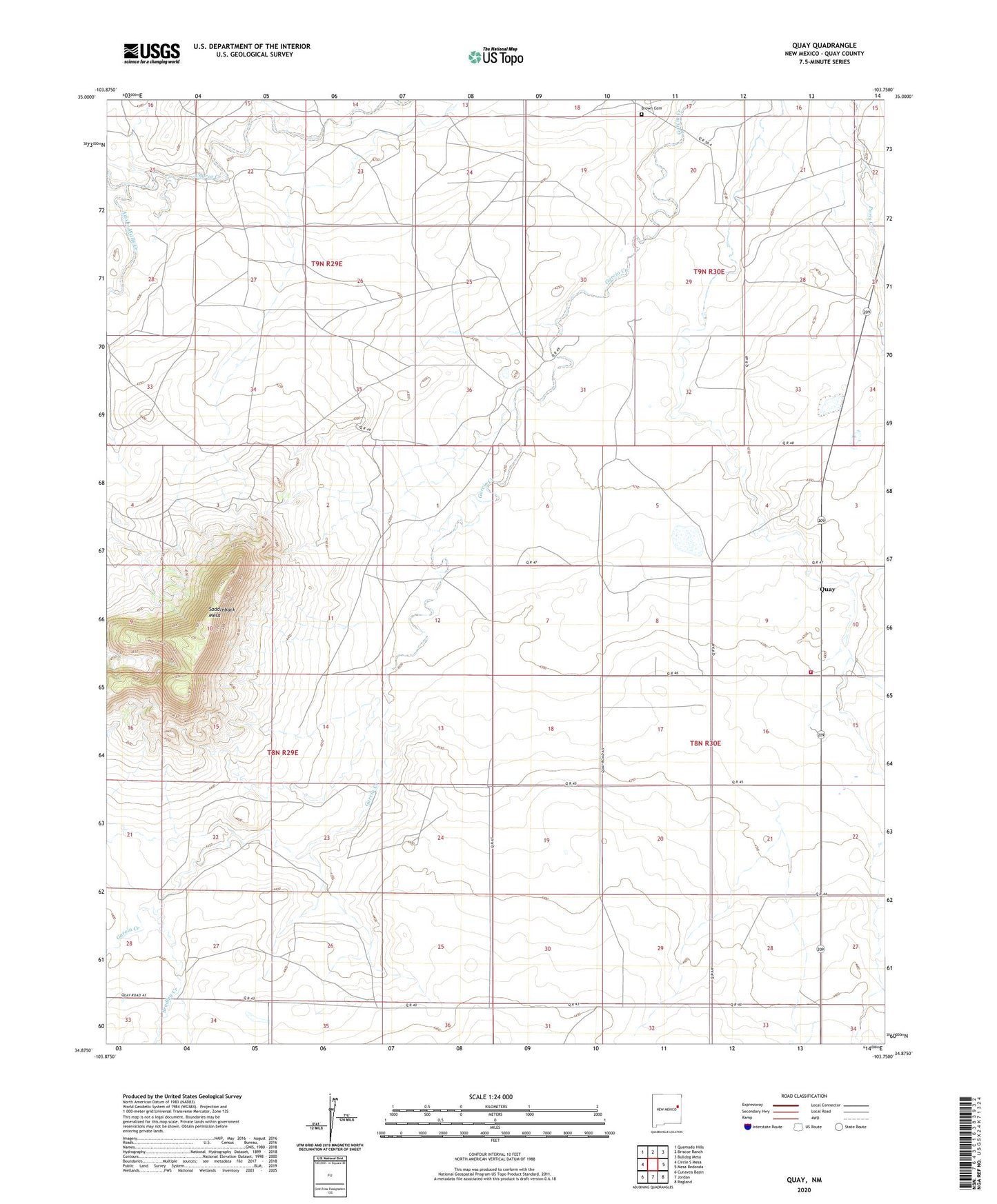
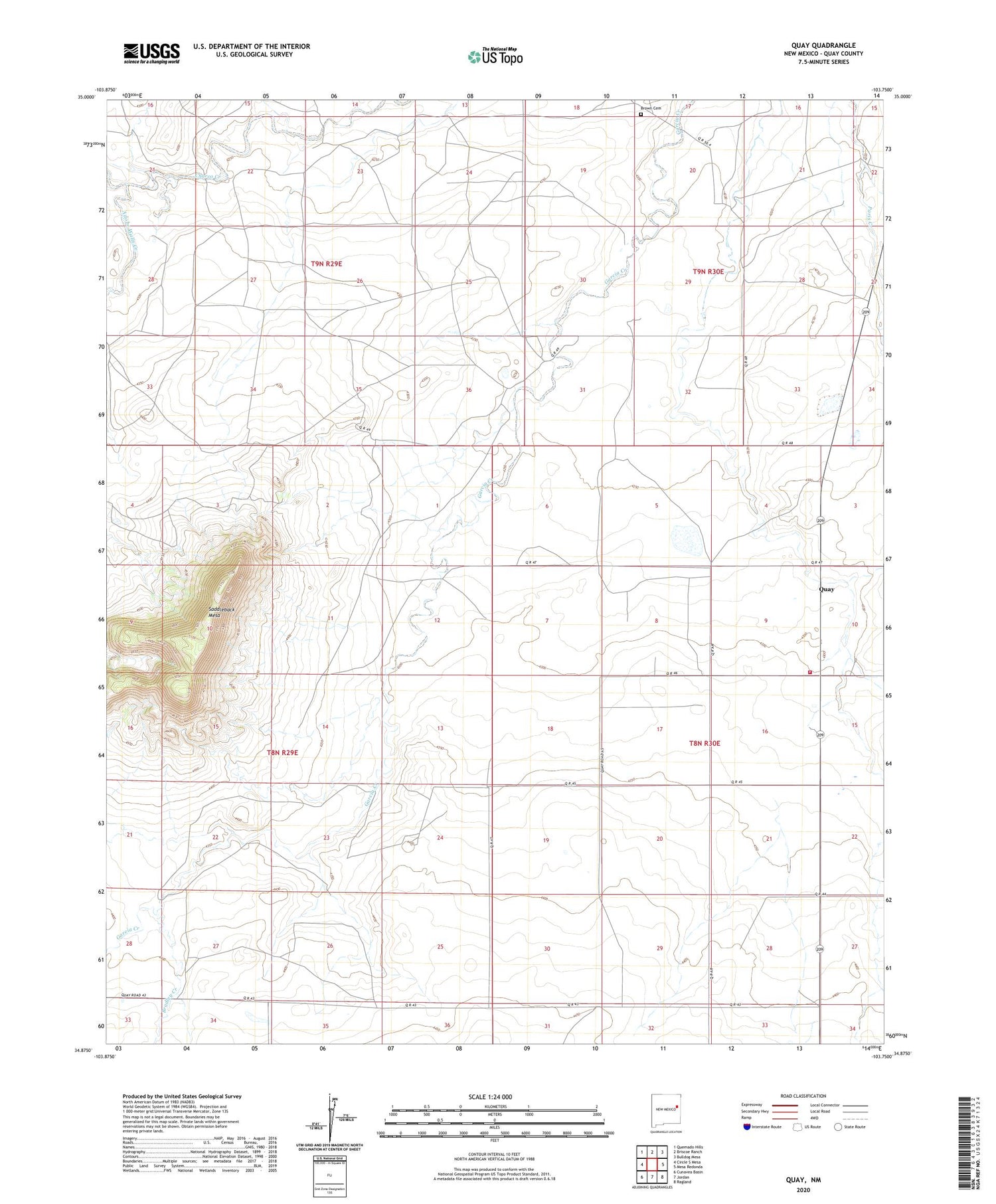
2020 topographic map quadrangle Quay in the state of New Mexico. Scale: 1:24000. Based on the newly updated USGS 7.5' US Topo map series, this map is in the following counties: Quay. The map contains contour data, water features, and other items you are used to seeing on USGS maps, but also has updated roads and other features. This is the next generation of topographic maps. Printed on high-quality waterproof paper with UV fade-resistant inks.
Quads adjacent to this one:
West: Circle S Mesa
Northwest: Quemado Hills
North: Briscoe Ranch
Northeast: Bulldog Mesa
East: Mesa Redonda
Southeast: Ragland
South: Jordan
Southwest: Cunavea Basin
Contains the following named places: Adobe Walls Creek, Baker, Bradley Creek, Brown Cemetery, Cast, Fish, Horton, Orbeson Windmill, Osteen, Quay, Quay Fire Department, Quay Post Office, Quay Weather Station, Saddleback Mesa, Wallus