MyTopo
Rainsville New Mexico US Topo Map
Couldn't load pickup availability
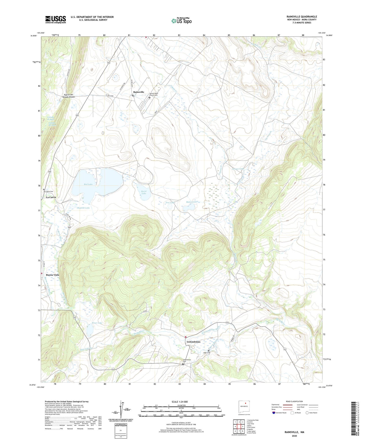
2020 topographic map quadrangle Rainsville in the state of New Mexico. Scale: 1:24000. Based on the newly updated USGS 7.5' US Topo map series, this map is in the following counties: Mora. The map contains contour data, water features, and other items you are used to seeing on USGS maps, but also has updated roads and other features. This is the next generation of topographic maps. Printed on high-quality waterproof paper with UV fade-resistant inks.
Quads adjacent to this one:
West: Mora
Northwest: Comanche Peak
North: Lucero
Northeast: Ojo Feliz
East: Fort Union
Southeast: Loma Parda
South: Lake Isabel
Southwest: Sapello
Contains the following named places: Ashe, Baker Lake, Buena Vista, Buena Vista Census Designated Place, Buena Vista Ditch, Buena Vista Post Office, Buena Vista Volunteer Fire Department, Coyote Creek, Gist, Golondrinas, Golondrinas Cemetery, Golondrinas Volunteer Fire Department, Grauer Lake, Horse Lake, Jager Cemetery, La Cueva, La Cueva Canal, La Cueva Cemetery, La Cueva Dam Number One, La Cueva Historic District, La Cueva Lake, La Cueva Post Office, La Cueva Reservoir, La Jara Creek, Marse, North Golondrinas Ditch, Puerto del Venado Alazan, Rainsville, Rainsville Post Office, Rainsville Volunteer Fire Department, Red Lake, Red Lake La Cueva Dam Number Two, Riner Lake, Rito Cebolla, Sacred Heart Church, Sacred Heart Church Cemetery, Salman Ranch, Shufeldt Lake, Sixtynine Ranch, Tree Lake, Webere, ZIP Code: 87736