MyTopo
Red Canyon New Mexico US Topo Map
Couldn't load pickup availability
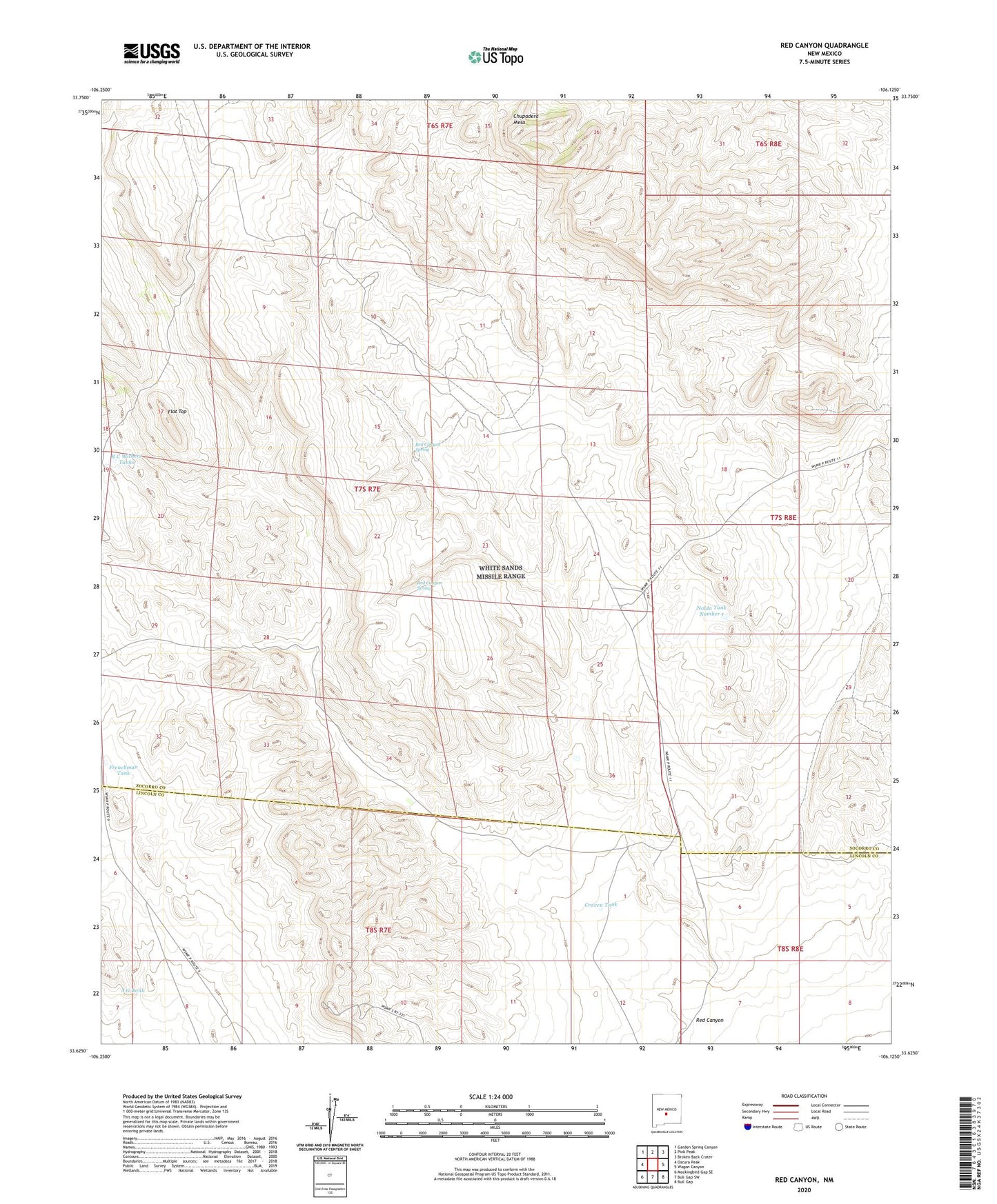
2023 topographic map quadrangle Red Canyon in the state of New Mexico. Scale: 1:24000. Based on the newly updated USGS 7.5' US Topo map series, this map is in the following counties: Socorro, Lincoln. The map contains contour data, water features, and other items you are used to seeing on USGS maps, but also has updated roads and other features. This is the next generation of topographic maps. Printed on high-quality waterproof paper with UV fade-resistant inks.
Quads adjacent to this one:
West: Oscura Peak
Northwest: Garden Spring Canyon
North: Pink Peak
Northeast: Broken Back Crater
East: Wagon Canyon
Southeast: Bull Gap
South: Bull Gap SW
Southwest: Mockingbird Gap SE
This map covers the same area as the classic USGS quad with code o33106f2.
Contains the following named places: Brown Tank, Butler Tank, Craven Tank, Flat Top, Frenchman Tank, Hill Well, J G Tank, Little Red Tank, Nolda Tank Number 1, R C Withers Tanks, Red Canyon, Red Canyon Range Camp, Red Canyon Spring, School Section Tank, Stevens Tank