MyTopo
Mockingbird Gap SE New Mexico US Topo Map
Couldn't load pickup availability
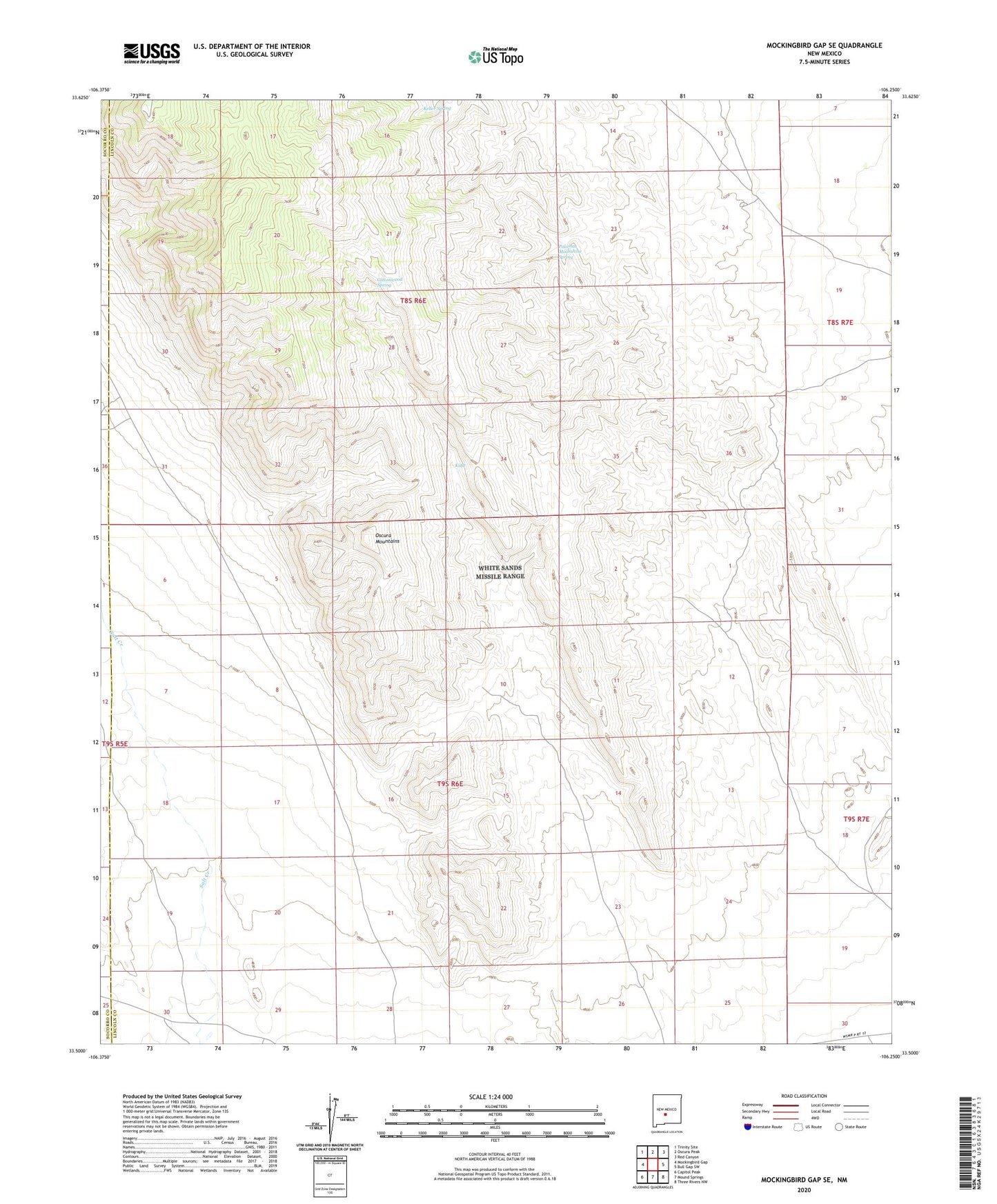
2023 topographic map quadrangle Mockingbird Gap SE in the state of New Mexico. Scale: 1:24000. Based on the newly updated USGS 7.5' US Topo map series, this map is in the following counties: Lincoln, Socorro. The map contains contour data, water features, and other items you are used to seeing on USGS maps, but also has updated roads and other features. This is the next generation of topographic maps. Printed on high-quality waterproof paper with UV fade-resistant inks.
Quads adjacent to this one:
West: Mockingbird Gap
Northwest: Trinity Site
North: Oscura Peak
Northeast: Red Canyon
East: Bull Gap SW
Southeast: Three Rivers NW
South: Mound Springs
Southwest: Capitol Peak
This map covers the same area as the classic USGS quad with code o33106e3.
Contains the following named places: Cottonwood Spring, Estey City, Keller Spring, Kidd, Old Mills Well, Palomas Moonshine Spring, Scholle Well, Woods Tank