MyTopo
Redrock New Mexico US Topo Map
Couldn't load pickup availability
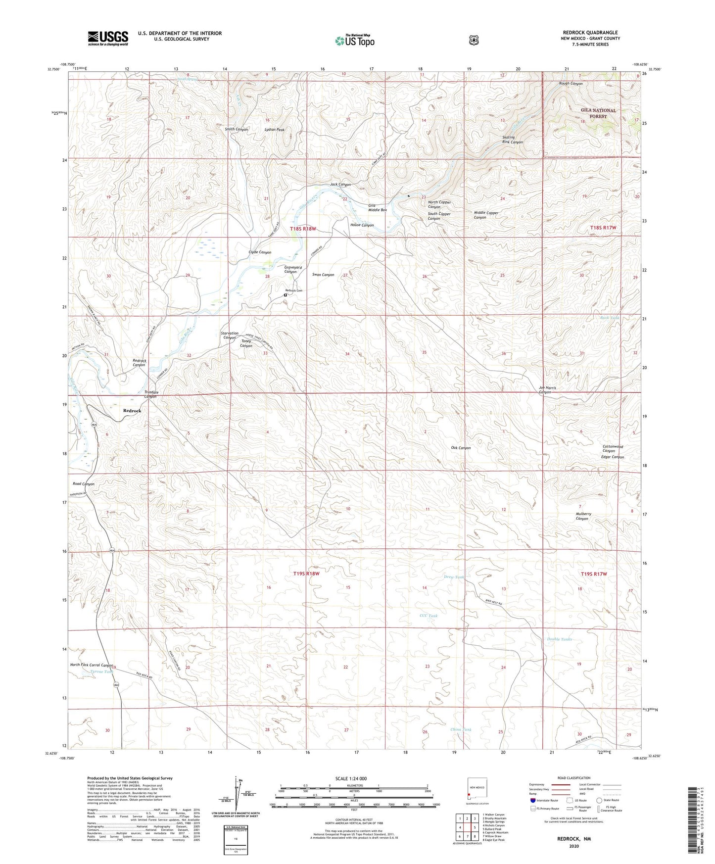
2020 topographic map quadrangle Redrock in the state of New Mexico. Scale: 1:24000. Based on the newly updated USGS 7.5' US Topo map series, this map is in the following counties: Grant. The map contains contour data, water features, and other items you are used to seeing on USGS maps, but also has updated roads and other features. This is the next generation of topographic maps. Printed on high-quality waterproof paper with UV fade-resistant inks.
Quads adjacent to this one:
West: Nichols Canyon
Northwest: Walker Canyon
North: Brushy Mountain
Northeast: Mangas Springs
East: Bullard Peak
Southeast: Eagle Eye Peak
South: Willow Draw
Southwest: Caprock Mountain
Contains the following named places: 10212 Water Well, 88055, Ash Creek, Blue Eagle Prospect, Buck Tank, CCC Tank, China Tank, Corner Tank, Cottonwood Canyon, Double Tanks, Drew Tank, Edgar Canyon, Gila Middle Box, Graveyard Canyon, Grey Eagle Mine, H Bar M Windmill, Harper Prospect, Hope Prospect, House Canyon, Jack Canyon, Jennie Mines, Joe Harris Canyon, Lydian Peak, Middle Copper Canyon, Mulberry Canyon, North Copper Canyon, Oak Canyon, Old Indian Village, Redrock, Redrock Canyon, Redrock Cemetery, Redrock Census Designated Place, Redrock Weather Station, Rough Canyon, Skating Rink Canyon, Smith Canyon, Smith Spring, South Copper Canyon, Starvation Canyon, Swan Canyon, Toney Canyon, Trusdale Canyon, Turner Windmill, Tyrone Tank