MyTopo
Brushy Mountain New Mexico US Topo Map
Couldn't load pickup availability
Also explore the Brushy Mountain Forest Service Topo of this same quad for updated USFS data
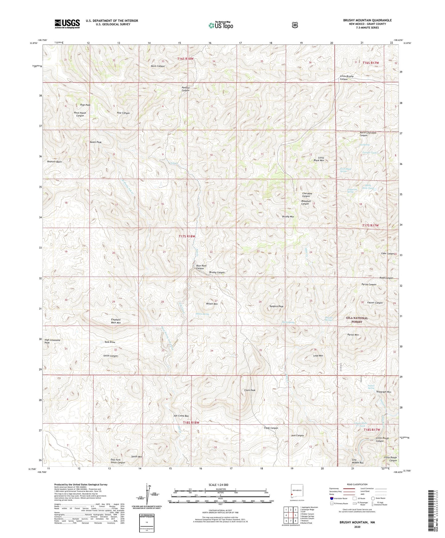
2023 topographic map quadrangle Brushy Mountain in the state of New Mexico. Scale: 1:24000. Based on the newly updated USGS 7.5' US Topo map series, this map is in the following counties: Grant. The map contains contour data, water features, and other items you are used to seeing on USGS maps, but also has updated roads and other features. This is the next generation of topographic maps. Printed on high-quality waterproof paper with UV fade-resistant inks.
Quads adjacent to this one:
West: Walker Canyon
Northwest: Applegate Mountain
North: Antelope Ridge
Northeast: Cliff
East: Mangas Springs
Southeast: Bullard Peak
South: Redrock
Southwest: Nichols Canyon
This map covers the same area as the classic USGS quad with code o32108g6.
Contains the following named places: Ash Creek Box, Ash Creek Camp, Black Eagle Mine, Blue Rock Canyon, Brushy Canyon, Brushy Mountain, Clark Peak, Clyde Canyon, Crows Nest Windmill, Davis Windmill, East Fork Smith Canyon, Elephant Back Mountain, Fairground, Foxtail Creek, Foxtail Spring, Grapevine Spring, Hatch Spring, Hells Hole Tank, High Lonesome Peak, High Peak, Lead Mountain, Little Black Mountain, Little Brushy Canyon, Little Rough Canyon, Lower Slate Creek Tank, Nolen Peak, North Cherokee Canyon, Oliver Windmill, Panther Canyon, Pearson Springs, Pot Hole Windmill, Pyrite Mountain, Redrock State Wildlife Experimental Area, Slate Creek, Slate Creek Camp, Slate Creek Canyon Deposits, Smith Mountain, South Black Spring, Tampico Peak, Telegraph Mountain, Tub Spring, Turner Tank, Tyrone Division, Walking H Windmill, West Prong Ash Creek, Wilson Mountain, Wilson Spring