MyTopo
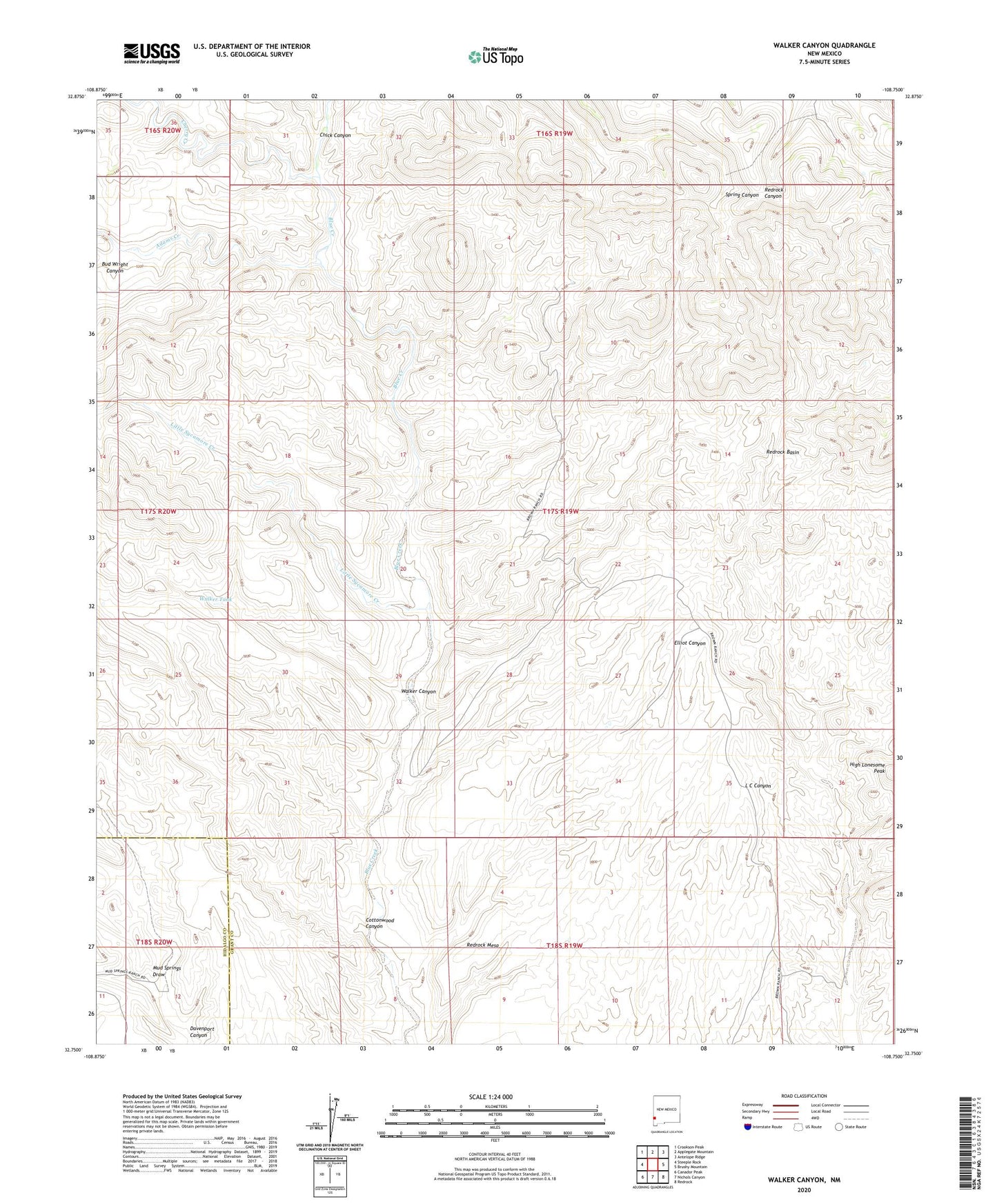
Walker Canyon New Mexico US Topo Map
Couldn't load pickup availability
2023 topographic map quadrangle Walker Canyon in the state of New Mexico. Scale: 1:24000. Based on the newly updated USGS 7.5' US Topo map series, this map is in the following counties: Grant, Hidalgo. The map contains contour data, water features, and other items you are used to seeing on USGS maps, but also has updated roads and other features. This is the next generation of topographic maps. Printed on high-quality waterproof paper with UV fade-resistant inks.
Quads adjacent to this one:
West: Steeple Rock
Northwest: Crookson Peak
North: Applegate Mountain
Northeast: Antelope Ridge
East: Brushy Mountain
Southeast: Redrock
South: Nichols Canyon
Southwest: Canador Peak
This map covers the same area as the classic USGS quad with code o32108g7.
Contains the following named places: Adams Creek, Anderson Ranch, Blakely, Blakey Ranch, Blakey Windmill, Bud Wright Canyon, Cherry Creek, Chick Canyon, Cottonwood Canyon, Dutch John Windmill, Gunn Place, Kemp Creek, Little Sycamore Creek, Martin Ranch, Matthew Place, Mouth of Cottonwood Windmill, Mud Springs Draw, Mud Springs Ranch, Redrock Basin, Redrock Mesa, Walker Canyon, Walker Tank