MyTopo
Remuda Basin New Mexico US Topo Map
Couldn't load pickup availability
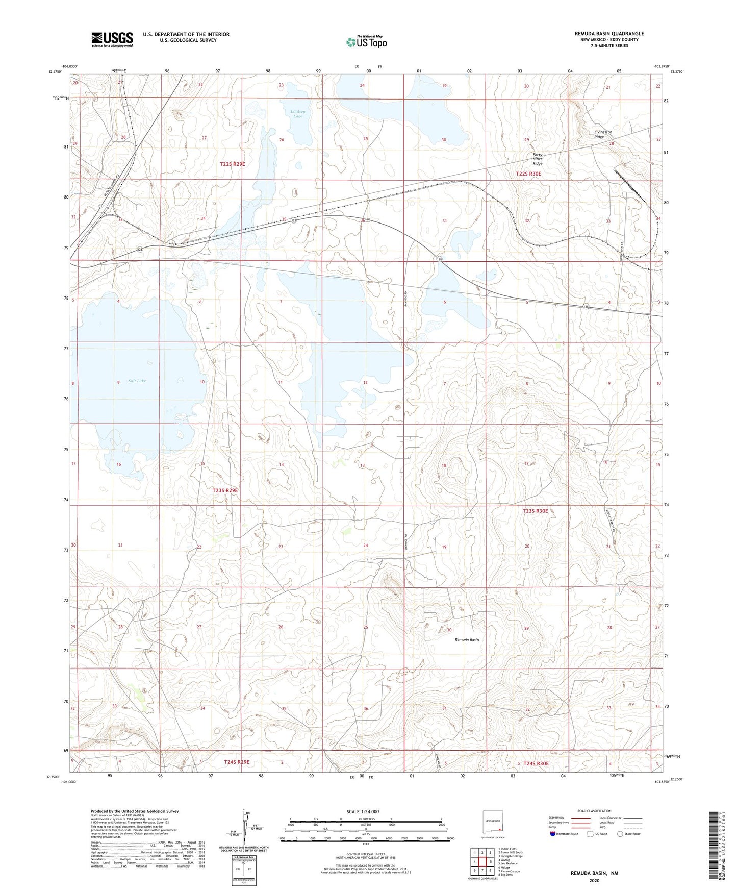
2023 topographic map quadrangle Remuda Basin in the state of New Mexico. Scale: 1:24000. Based on the newly updated USGS 7.5' US Topo map series, this map is in the following counties: Eddy. The map contains contour data, water features, and other items you are used to seeing on USGS maps, but also has updated roads and other features. This is the next generation of topographic maps. Printed on high-quality waterproof paper with UV fade-resistant inks.
Quads adjacent to this one:
West: Loving
Northwest: Indian Flats
North: Tower Hill South
Northeast: Livingston Ridge
East: Los Medanos
Southeast: Big Sinks
South: Pierce Canyon
Southwest: Malaga
This map covers the same area as the classic USGS quad with code o32103c8.
Contains the following named places: 05116 Water Well, 05123 Water Well, 06669 Water Well, 06680 Water Well, 06681 Water Well, 06682 Water Well, 07036 Water Well, 08607 Water Well, 20002 Water Well, 20003 Water Well, Duval Mine, Forty-Niner Ridge, Hodges Potash Property, Indian Well, J Bar F Well, Lindsey Lake, Nash Draw, Nash Draw Mine, Nash Well, Remuda Basin, Salt Lake, Salt Lake Mine, Tamarisk Flat, West Well