MyTopo
Big Sinks New Mexico US Topo Map
Couldn't load pickup availability
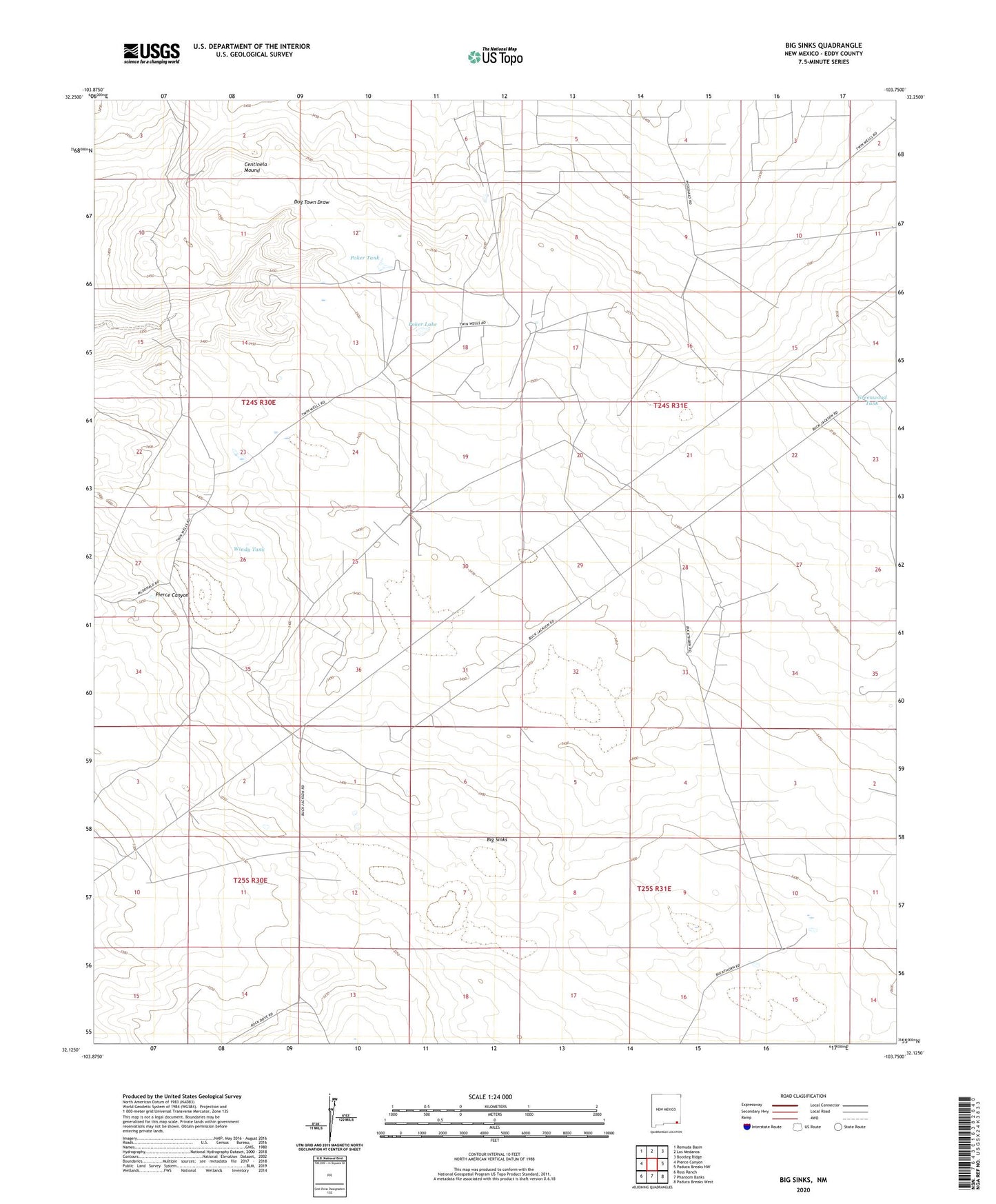
2023 topographic map quadrangle Big Sinks in the state of New Mexico. Scale: 1:24000. Based on the newly updated USGS 7.5' US Topo map series, this map is in the following counties: Eddy. The map contains contour data, water features, and other items you are used to seeing on USGS maps, but also has updated roads and other features. This is the next generation of topographic maps. Printed on high-quality waterproof paper with UV fade-resistant inks.
Quads adjacent to this one:
West: Pierce Canyon
Northwest: Remuda Basin
North: Los Medanos
Northeast: Bootleg Ridge
East: Paduca Breaks NW
Southeast: Paduca Breaks West
South: Phantom Banks
Southwest: Ross Ranch
This map covers the same area as the classic USGS quad with code o32103b7.
Contains the following named places: 06641 Water Well, 07046 Water Well, 07048 Water Well, 07049 Water Well, 07050 Water Well, 07051 Water Well, 20020 Water Well, Big Sinks, Centinela Mound, Eagles Windmill, Greenwood Tank, Hurston Tank, Jo Bar Tank, Keyhole Windmill, New Windmill, Poker Lake, Poker Tank, Twin Wells Ranch, Windy Tank, Windy Windmill