
MyTopo
Robinson Peak New Mexico US Topo Map
Couldn't load pickup availability
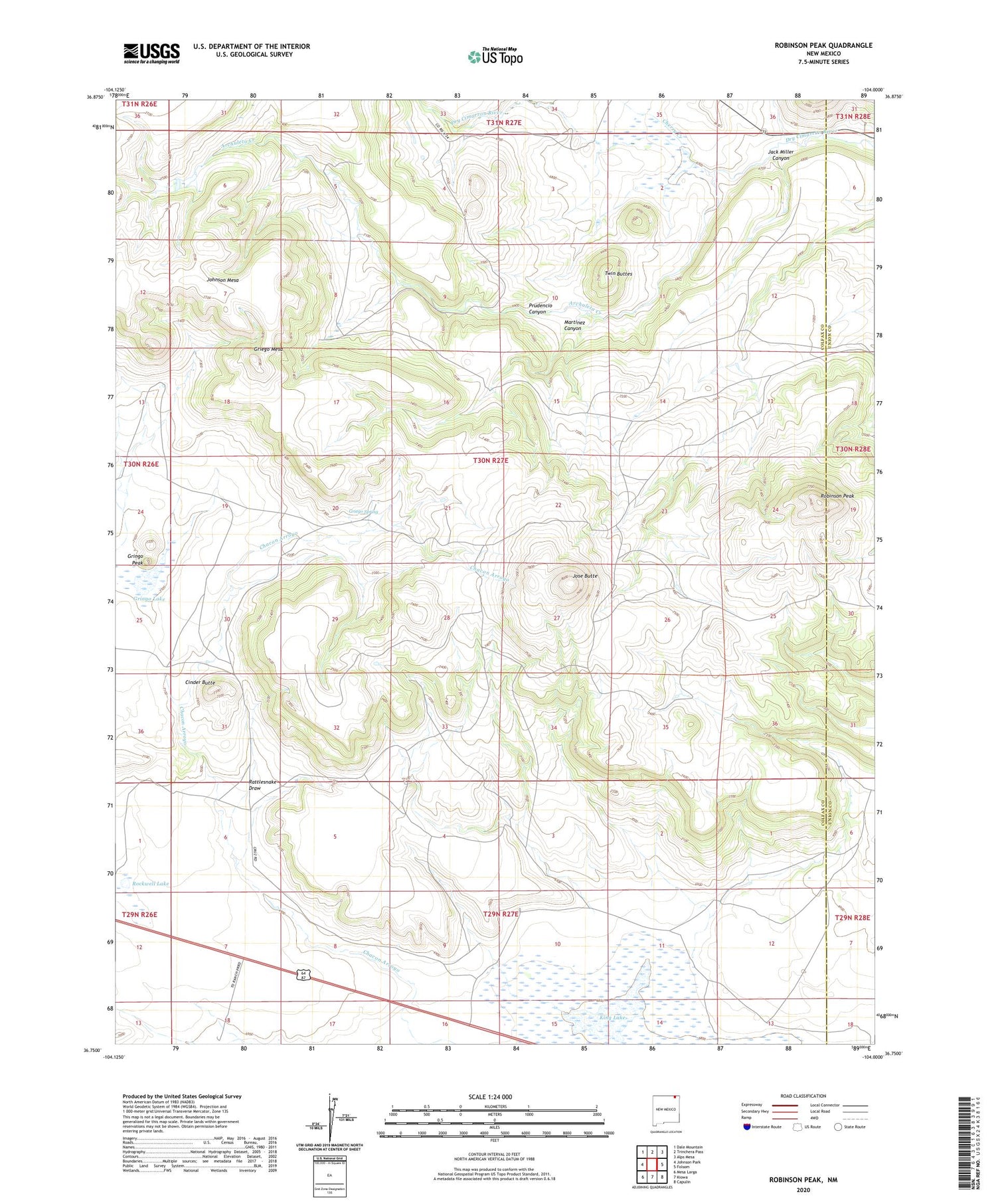
2020 topographic map quadrangle Robinson Peak in the state of New Mexico. Scale: 1:24000. Based on the newly updated USGS 7.5' US Topo map series, this map is in the following counties: Colfax, Union. The map contains contour data, water features, and other items you are used to seeing on USGS maps, but also has updated roads and other features. This is the next generation of topographic maps. Printed on high-quality waterproof paper with UV fade-resistant inks.
Quads adjacent to this one:
West: Johnson Park
Northwest: Dale Mountain
North: Trinchera Pass
Northeast: Alps Mesa
East: Folsom
Southeast: Capulin
South: Kiowa
Southwest: Mesa Larga
Contains the following named places: 10000 Water Well, 10001 Water Well, 10007 Water Well, Archuleta Creek, Cherry Creek, Cinder Butte, Cruz, Doherty, Griego Mesa, Griego Spring, Gringo Lake, Gringo Peak, Jack Miller Canyon, Jose Butte, King, King Lake, Martinez Canyon, Prudencio Canyon, Rattlesnake Draw, Robinson Peak, Rockwell Lake, Twin Buttes, Wild Horse Arroyo


