MyTopo
San Felipe Mesa New Mexico US Topo Map
Couldn't load pickup availability
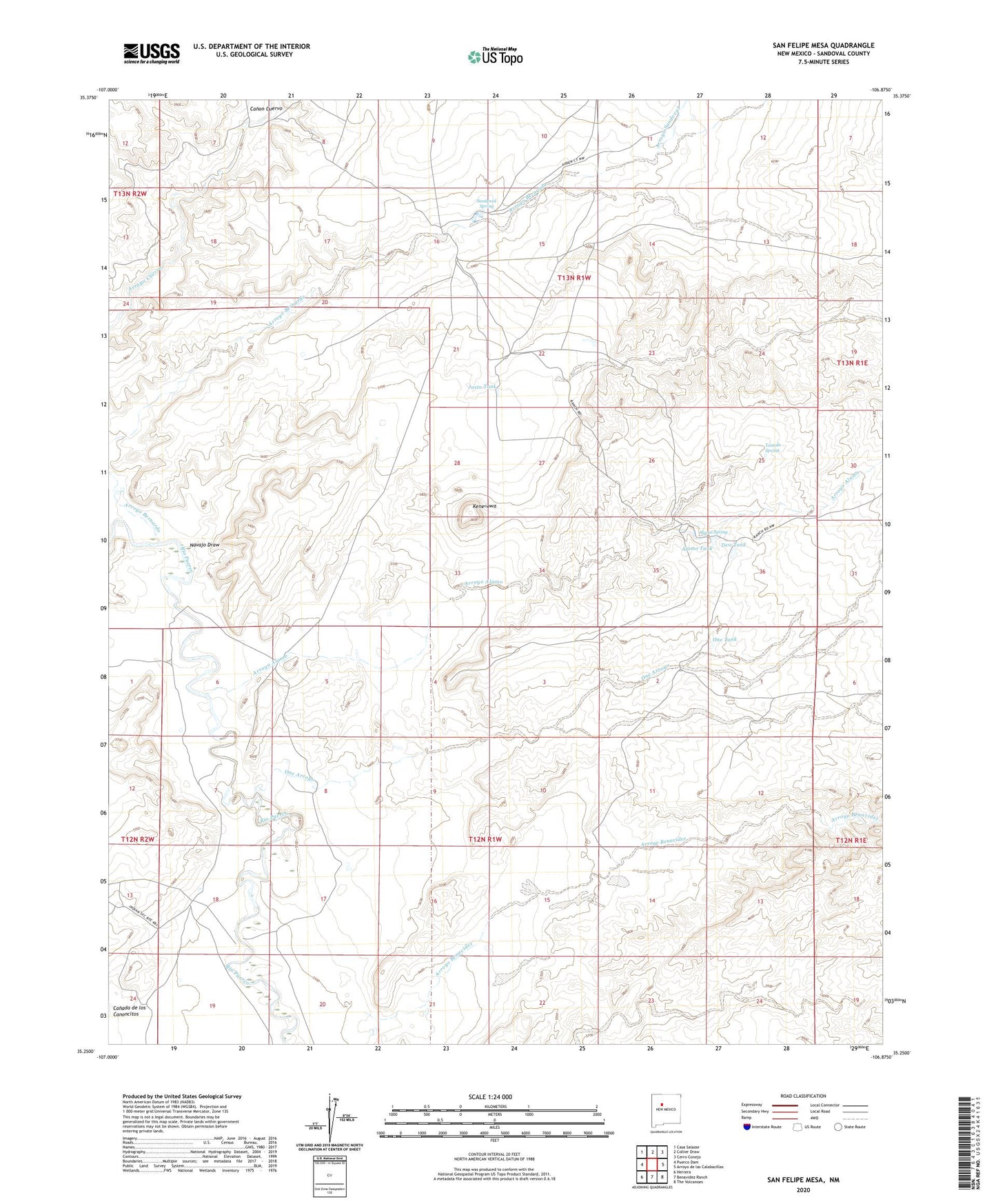
2020 topographic map quadrangle San Felipe Mesa in the state of New Mexico. Scale: 1:24000. Based on the newly updated USGS 7.5' US Topo map series, this map is in the following counties: Sandoval. The map contains contour data, water features, and other items you are used to seeing on USGS maps, but also has updated roads and other features. This is the next generation of topographic maps. Printed on high-quality waterproof paper with UV fade-resistant inks.
Quads adjacent to this one:
West: Puerco Dam
Northwest: Casa Salazar
North: Collier Draw
Northeast: Cerro Conejo
East: Arroyo de las Calabacillas
Southeast: The Volcanoes
South: Benavidez Ranch
Southwest: Herrera
Contains the following named places: Alamo Ranch, Alamo Spring, Alamo Tank, Arroyo Alamo, Arroyo Bernardo, Arroyo Sandoval, Benavidez Windmill, Bernabe M Montano, Canada de los Canoncitos, Collier Ranch, Justo Tank, Kene'ewa, Navajo Draw, Navajo Windmill, Ojito Ranch, One Arroyo, One Tank, San Francisco, Sandoval Ranch, Sandoval Spring, Sky Village, Tortola Spring, Two Tank