MyTopo
Puerco Dam New Mexico US Topo Map
Couldn't load pickup availability
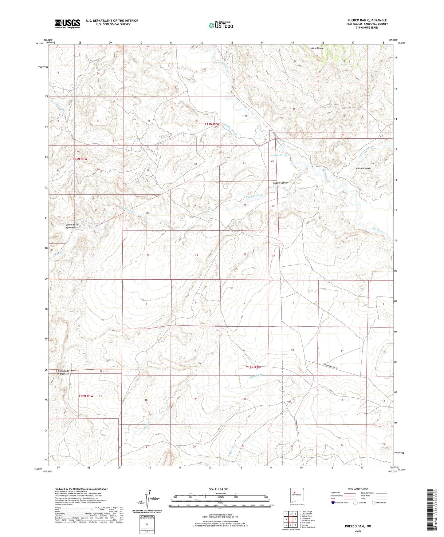
2023 topographic map quadrangle Puerco Dam in the state of New Mexico. Scale: 1:24000. Based on the newly updated USGS 7.5' US Topo map series, this map is in the following counties: Sandoval. The map contains contour data, water features, and other items you are used to seeing on USGS maps, but also has updated roads and other features. This is the next generation of topographic maps. Printed on high-quality waterproof paper with UV fade-resistant inks.
Quads adjacent to this one:
West: La Gotera
Northwest: Cerro Tinaja
North: Casa Salazar
Northeast: Collier Draw
East: San Felipe Mesa
Southeast: Benavidez Ranch
South: Herrera
Southwest: Arch Mesa
This map covers the same area as the classic USGS quad with code o35107c1.
Contains the following named places: Arroyo Cuervo, Arroyo Nine, Arroyo Six, Canada Nervio, Canon Cuervo, Canon de la Agua Blanca, Cuervo Crossing, Las Lagunitas Ranch, Puerco Dam, Salado Canyon, Salado Creek