MyTopo
Canada New Mexico US Topo Map
Couldn't load pickup availability
Also explore the Canada Forest Service Topo of this same quad for updated USFS data
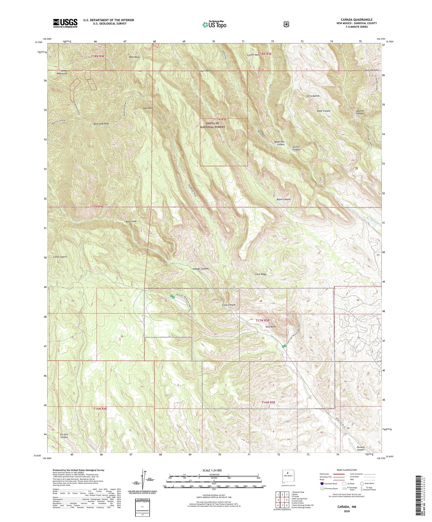
2023 topographic map quadrangle Canada in the state of New Mexico. Scale: 1:24000. Based on the newly updated USGS 7.5' US Topo map series, this map is in the following counties: Sandoval. The map contains contour data, water features, and other items you are used to seeing on USGS maps, but also has updated roads and other features. This is the next generation of topographic maps. Printed on high-quality waterproof paper with UV fade-resistant inks.
Quads adjacent to this one:
West: Bear Springs Peak
Northwest: Redondo Peak
North: Bland
Northeast: Frijoles
East: Cochiti Dam
Southeast: Santo Domingo Pueblo
South: Santo Domingo Pueblo SW
Southwest: Loma Creston
This map covers the same area as the classic USGS quad with code o35106f4.
Contains the following named places: A B Group, Albemarle, Albemarle Group, Albemarle Post Office, Bear Jump, Bearhead Peak, Benson Claim, Canada, Canada Cabin, Canada Camada, Canada de Cochiti Grant, Cerro Balitas, Cerro Picacho, Colle Canyon, Cone Ridge, Copper Prospect, Corena Lode, Corner Lode, Ellen L Mine, Gold Range Group, Group B Claims, Horn Mesa, Kasha-Katuwe Tent Rocks National Monument, La Jara Canyon, Medio Dia Canyon, Midnight Lode, Monte Carlo Lode, No Name Lode, Oaks Mesa, Otto Pit, Pumice Group Mine, Pumice Mine, Pumice Mines, Puzzle Claim, Rancho Canada, Rising Sun Lode, Saint Peters Dome Trail, Santa Barbabra Group, Smuggler Lode, Sun, T.S. Kline Lode, Tent Rocks, Toby Group, Union, Victor Number Two, West Mesa