MyTopo
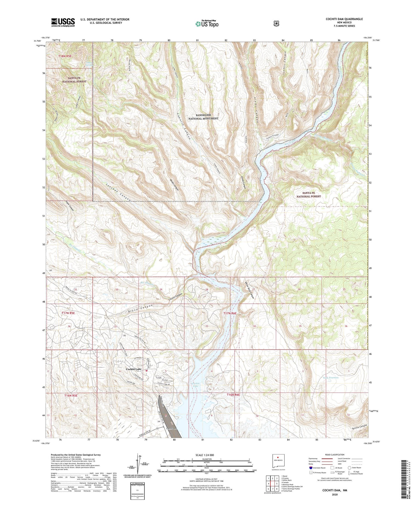
Cochiti Dam New Mexico US Topo Map
Couldn't load pickup availability
Also explore the Cochiti Dam Forest Service Topo of this same quad for updated USFS data
2023 topographic map quadrangle Cochiti Dam in the state of New Mexico. Scale: 1:24000. Based on the newly updated USGS 7.5' US Topo map series, this map is in the following counties: Sandoval. The map contains contour data, water features, and other items you are used to seeing on USGS maps, but also has updated roads and other features. This is the next generation of topographic maps. Printed on high-quality waterproof paper with UV fade-resistant inks.
Quads adjacent to this one:
West: Canada
Northwest: Bland
North: Frijoles
Northeast: White Rock
East: Montoso Peak
Southeast: Tetilla Peak
South: Santo Domingo Pueblo
Southwest: Santo Domingo Pueblo SW
This map covers the same area as the classic USGS quad with code o35106f3.
Contains the following named places: Alamo Canyon, Arroyo Eighteen, Arroyo Montoso, Atkinson Company Quarry, Bland Canyon, Canada Capulin Trail, Capulin Canyon, Capulin Canyon Trail, Cochiti Canyon, Cochiti Frijoles Trail, Cochiti Lake, Cochiti Lake Census Designated Place, Cochiti Lake Golf Course, Cochiti Lake Volunteer Fire Department, Cochiti Recreation Area, Cochiti Recretaion Area, Dome Wilderness, Eagle Canyon, Hondo Canyon, Lummis Canyon, Medio Canyon, Pueblo De Cochiti Grant, Rio Chiquito, San Miguel Ruin, Sanchez Canyon, Tank Fourteen, Tetilla Canyon, Tetilla Peak Recreation Area, Turkey Springs, White Rock Canyon, ZIP Codes: 87041, 87083