MyTopo
Seboyeta New Mexico US Topo Map
Couldn't load pickup availability
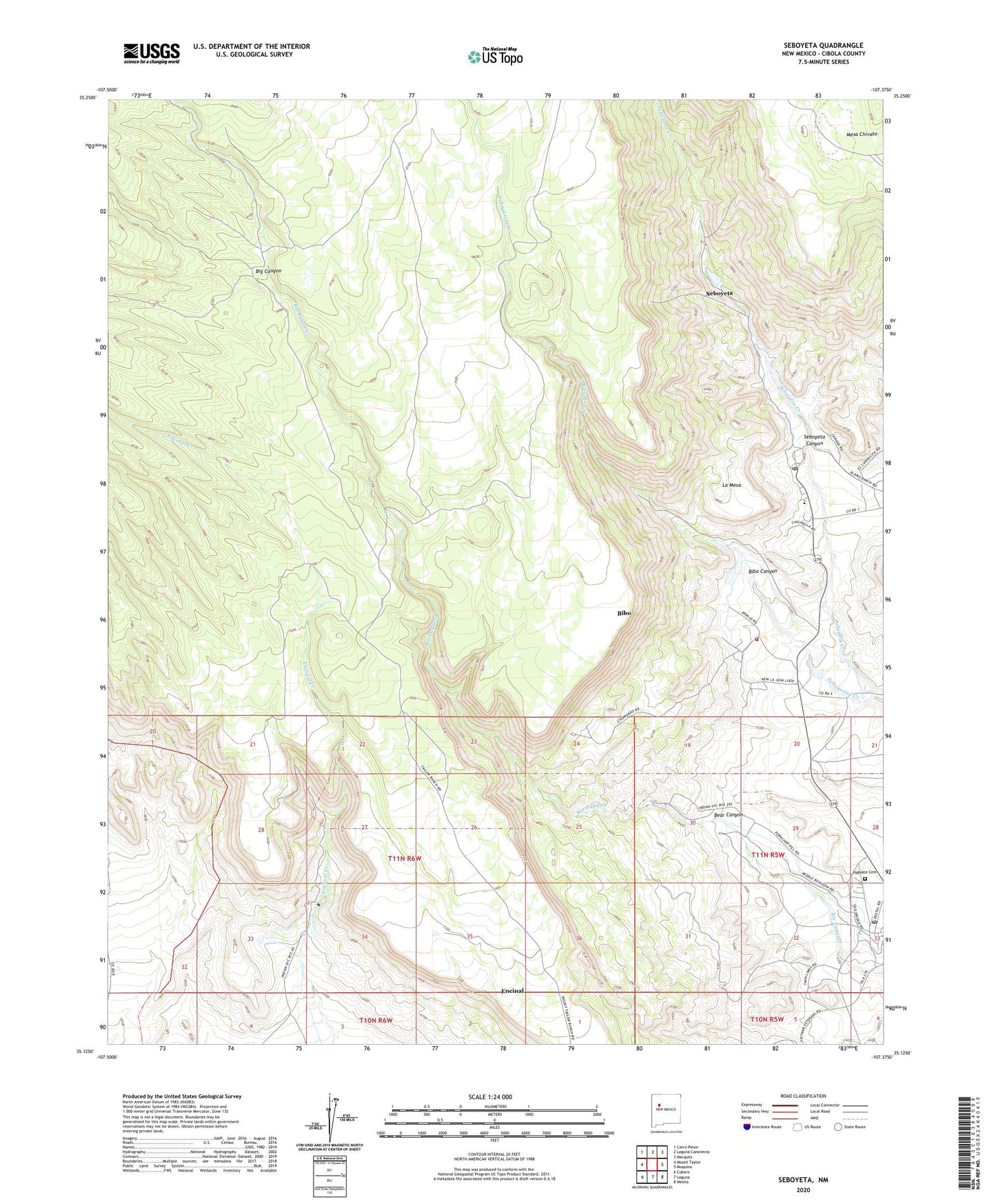
2020 topographic map quadrangle Seboyeta in the state of New Mexico. Scale: 1:24000. Based on the newly updated USGS 7.5' US Topo map series, this map is in the following counties: Cibola. The map contains contour data, water features, and other items you are used to seeing on USGS maps, but also has updated roads and other features. This is the next generation of topographic maps. Printed on high-quality waterproof paper with UV fade-resistant inks.
Quads adjacent to this one:
West: Mount Taylor
Northwest: Cerro Pelon
North: Laguna Canoneros
Northeast: Marquez
East: Moquino
Southeast: Mesita
South: Laguna
Southwest: Cubero
Contains the following named places: Bear Canyon, Bibo, Bibo Canyon, Bibo Cemetery, Bibo Census Designated Place, Bibo Irrigation Dam, Bibo Post Office, Cebolleta Fire Department, Cebolletita, Encinal 1 Water Well, La Mesa, Paguate, Paguate Cemetery, Paguate Census Designated Place, Paguate Post Office, Paguate Purchase Grant, PW - 2 Mine, Rancho Chupadero, Seboyeta, Seboyeta Canyon, Seboyeta Cemetery, Seboyeta Census Designated Place, Seboyeta Creek, Seboyeta Elementary School, Seboyeta Post Office, Seboyetita Creek, ZIP Code: 87014