MyTopo
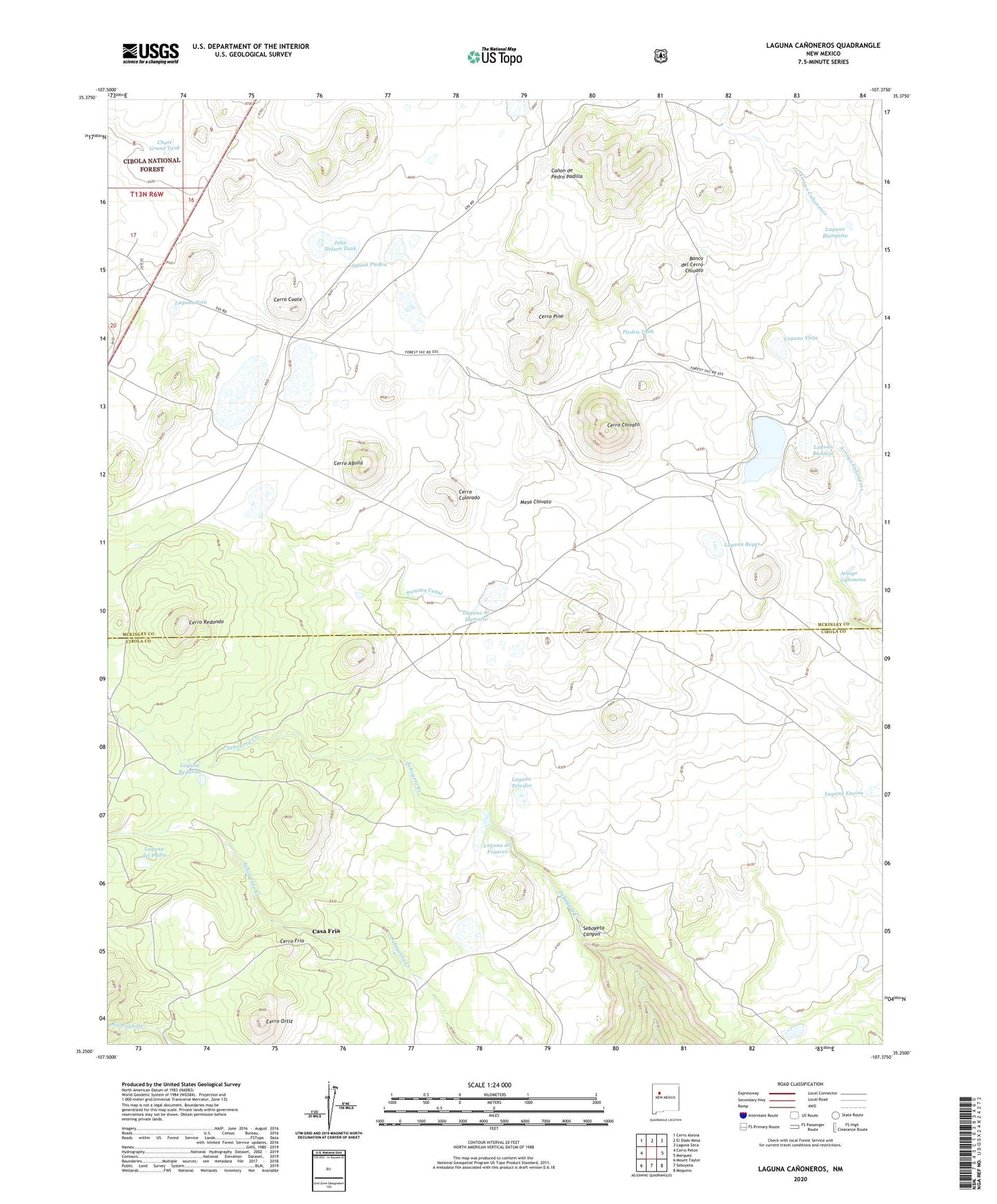
Laguna Canoneros New Mexico US Topo Map
Couldn't load pickup availability
Also explore the Laguna Canoneros Forest Service Topo of this same quad for updated USFS data
2023 topographic map quadrangle Laguna Canoneros in the state of New Mexico. Scale: 1:24000. Based on the newly updated USGS 7.5' US Topo map series, this map is in the following counties: Cibola, McKinley. The map contains contour data, water features, and other items you are used to seeing on USGS maps, but also has updated roads and other features. This is the next generation of topographic maps. Printed on high-quality waterproof paper with UV fade-resistant inks.
Quads adjacent to this one:
West: Cerro Pelon
Northwest: Cerro Alesna
North: El Dado Mesa
Northeast: Laguna Seca
East: Marquez
Southeast: Moquino
South: Seboyeta
Southwest: Mount Taylor
This map covers the same area as the classic USGS quad with code o35107c4.
Contains the following named places: Arroyo Canoneros, Banco del Cerro Chiuato, Canoneros Camp, Casa Fria, Casa Frio Water Well, Cebolleta Grant, Cerro Aguila, Cerro Chivato, Cerro Colorado, Cerro Cuate, Cerro Frio, Cerro Ortiz, Cerro Pino, Cerro Redondo, Chute Grand Tank, Cuates Camp, John Nelson Tank, Laguna Bandeja, Laguna Blanquita, Laguna Bonita, Laguna Canoneros, Laguna Cruz, Laguna de Damacio, Laguna de Frances, Laguna del Padre, Laguna Encina, Laguna Fria, Laguna Piedra, Laguna Redonda, Laguna Reyes, Laguna Telesfor, Laguna Vieja, Lagunas Cuatas, Los Portales Historic Site, Mesa Chivato, Panama Canal, Piedra Tank