MyTopo
Moquino New Mexico US Topo Map
Couldn't load pickup availability
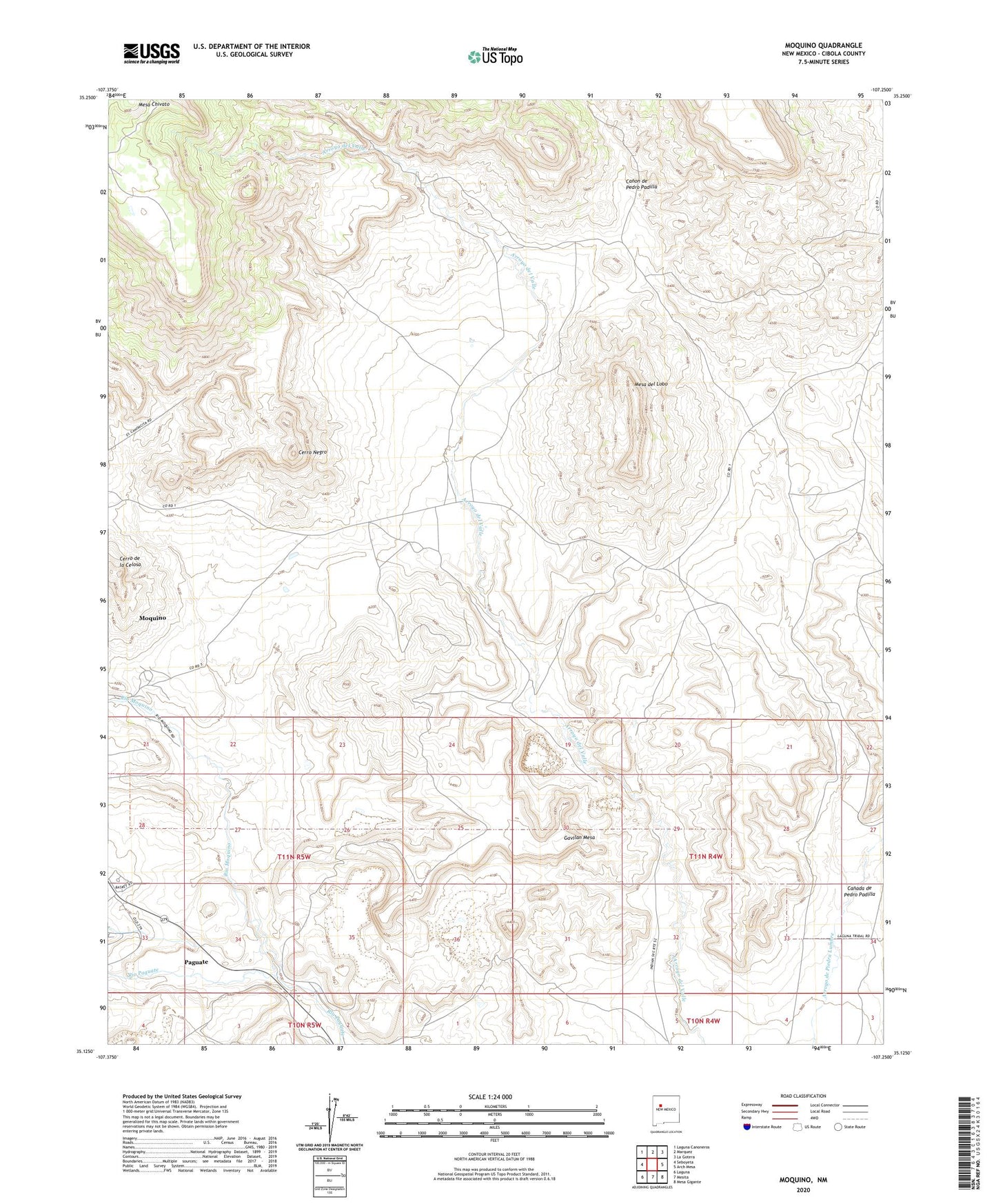
2023 topographic map quadrangle Moquino in the state of New Mexico. Scale: 1:24000. Based on the newly updated USGS 7.5' US Topo map series, this map is in the following counties: Cibola. The map contains contour data, water features, and other items you are used to seeing on USGS maps, but also has updated roads and other features. This is the next generation of topographic maps. Printed on high-quality waterproof paper with UV fade-resistant inks.
Quads adjacent to this one:
West: Seboyeta
Northwest: Laguna Canoneros
North: Marquez
Northeast: La Gotera
East: Arch Mesa
Southeast: Mesa Gigante
South: Mesita
Southwest: Laguna
This map covers the same area as the classic USGS quad with code o35107b3.
Contains the following named places: Anaconda Water Well, Arroyo Moquino, Canada de Pedro Padilla, Canon de Pedro Padilla, Cerro de la Celosa, Cerro Negro, Diablo Water Well, Gavilan Mesa, Jackpile Mine, Jackpile Number 1 Water Well, Jackpile Number 2 Water Well, JJ Number 1, L Bar Mine, L-Bar 2 Water Well, LJ 205 Water Well, Lobo Camp, Lobo Camp Water Well, Mesa del Lobo, Moquino, Moquino Census Designated Place, Number 1 Water Well, Number 10 Water Well, Number 11 Water Well, Number 12 Water Well, Number 13 Water Well, Number 14 Water Well, Number 16 Water Well, Number 2 Water Well, Number 3 Water Well, Number 4 Water Well, Number 5 Water Well, Number 6 Water Well, Number 7 Water Well, Number 8 Water Well, Number 8A Water Well, Old Water Well, Rio Moquino, Rusty Water Well, Saint Anthony Mine, Saint Anthonys Shaft Number Two, Seboyeta Project, Sohio A1 Water Well, Sohio L-Bar Tailings Dam, Sohio Uranium Mine, Well Number 9 Water Well, Wind Whip, Woodrow Mine