MyTopo
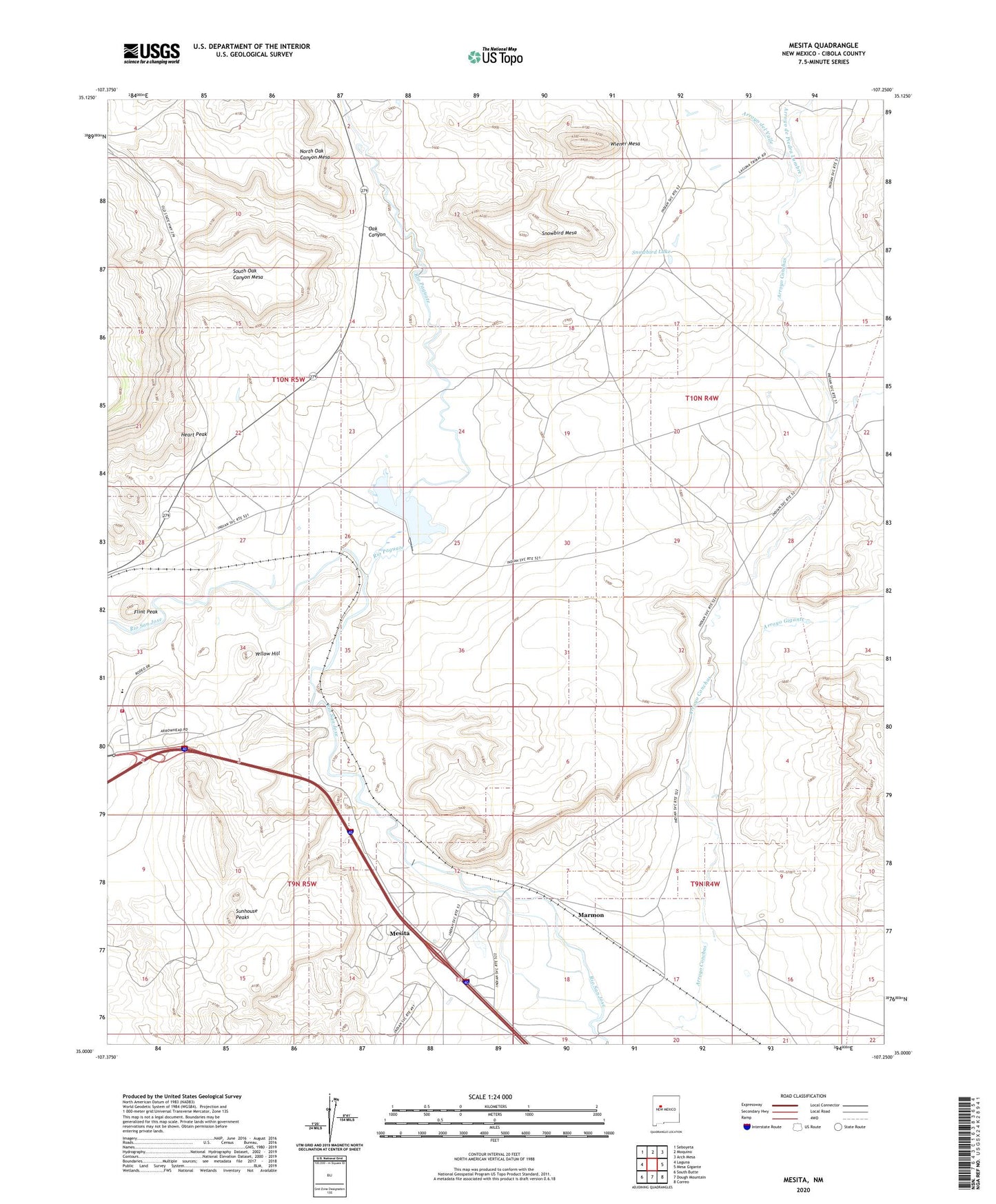
Mesita New Mexico US Topo Map
Couldn't load pickup availability
2023 topographic map quadrangle Mesita in the state of New Mexico. Scale: 1:24000. Based on the newly updated USGS 7.5' US Topo map series, this map is in the following counties: Cibola. The map contains contour data, water features, and other items you are used to seeing on USGS maps, but also has updated roads and other features. This is the next generation of topographic maps. Printed on high-quality waterproof paper with UV fade-resistant inks.
Quads adjacent to this one:
West: Laguna
Northwest: Seboyeta
North: Moquino
Northeast: Arch Mesa
East: Mesa Gigante
Southeast: Correo
South: Dough Mountain
Southwest: South Butte
This map covers the same area as the classic USGS quad with code o35107a3.
Contains the following named places: Alpine Miner Test Area, Arroyo de Piedra Lumbre, Arroyo del Valle, Arroyo Gigante, Bell Rock Arroyo, BIA-RWP16A Water Well, ECW-3 Water Well, El Rito, F-9-2 Mine, Flint Peak, H-1 Mine, Heart Peak, Laguna Pueblo, M-6, Marmon, Mesita, Mesita Cemetery, Mesita Census Designated Place, Mesita School, Mesita Water Well, Mesita Well, North Oak Canyon Mesa, Oak Canyon, Oak Creek Canyon Deposit, Paguate Reservoir, Quirk, Rio Paguate, RWP-28 Water Well, Snowbird Lake, Snowbird Mesa, South Oak Canyon Mesa, Sunhouse Peaks, Wiener Mesa, Wilcox Ranch Deposit, Yellow Hill