MyTopo
Separ NE New Mexico US Topo Map
Couldn't load pickup availability
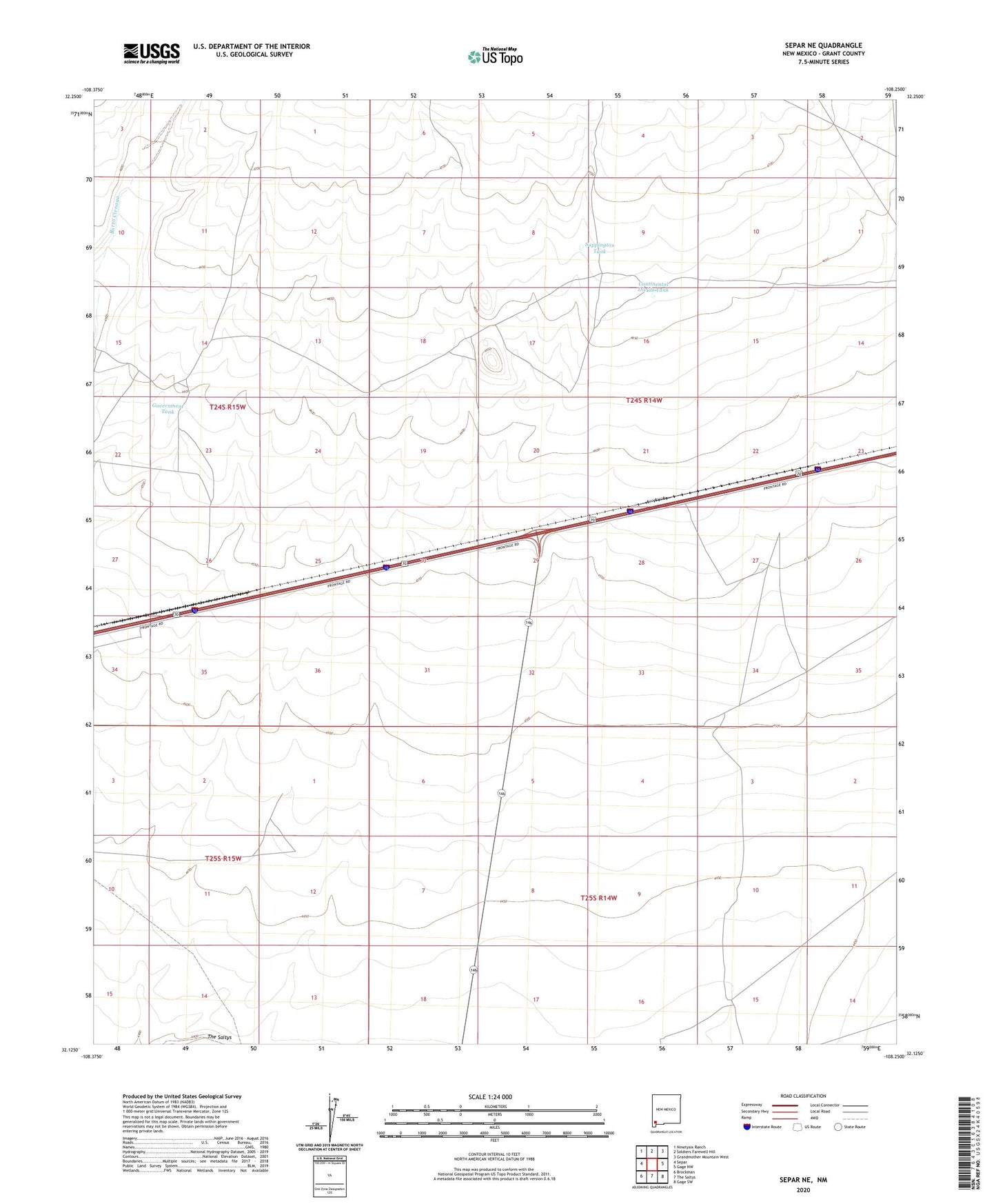
2020 topographic map quadrangle Separ NE in the state of New Mexico. Scale: 1:24000. Based on the newly updated USGS 7.5' US Topo map series, this map is in the following counties: Grant. The map contains contour data, water features, and other items you are used to seeing on USGS maps, but also has updated roads and other features. This is the next generation of topographic maps. Printed on high-quality waterproof paper with UV fade-resistant inks.
Quads adjacent to this one:
West: Separ
Northwest: Ninetysix Ranch
North: Soldiers Farewell Hill
Northeast: Grandmother Mountain West
East: Gage NW
Southeast: Gage SW
South: The Saltys
Southwest: Brockman
Contains the following named places: Basin and Range Country Historical Marker, Bonds Four Section Windmill, Continental Divide Tank, Continental Divide Well, Cookes Wagon Road Historical Marker, Government Tank, Guess Place, Highway Water Well, Middle Well, Moore Homestead, Sappington Tank, Tilts Windmill, Whitteburg Well, Yucca Plains Historical Marker