MyTopo
Rincon New Mexico US Topo Map
Couldn't load pickup availability
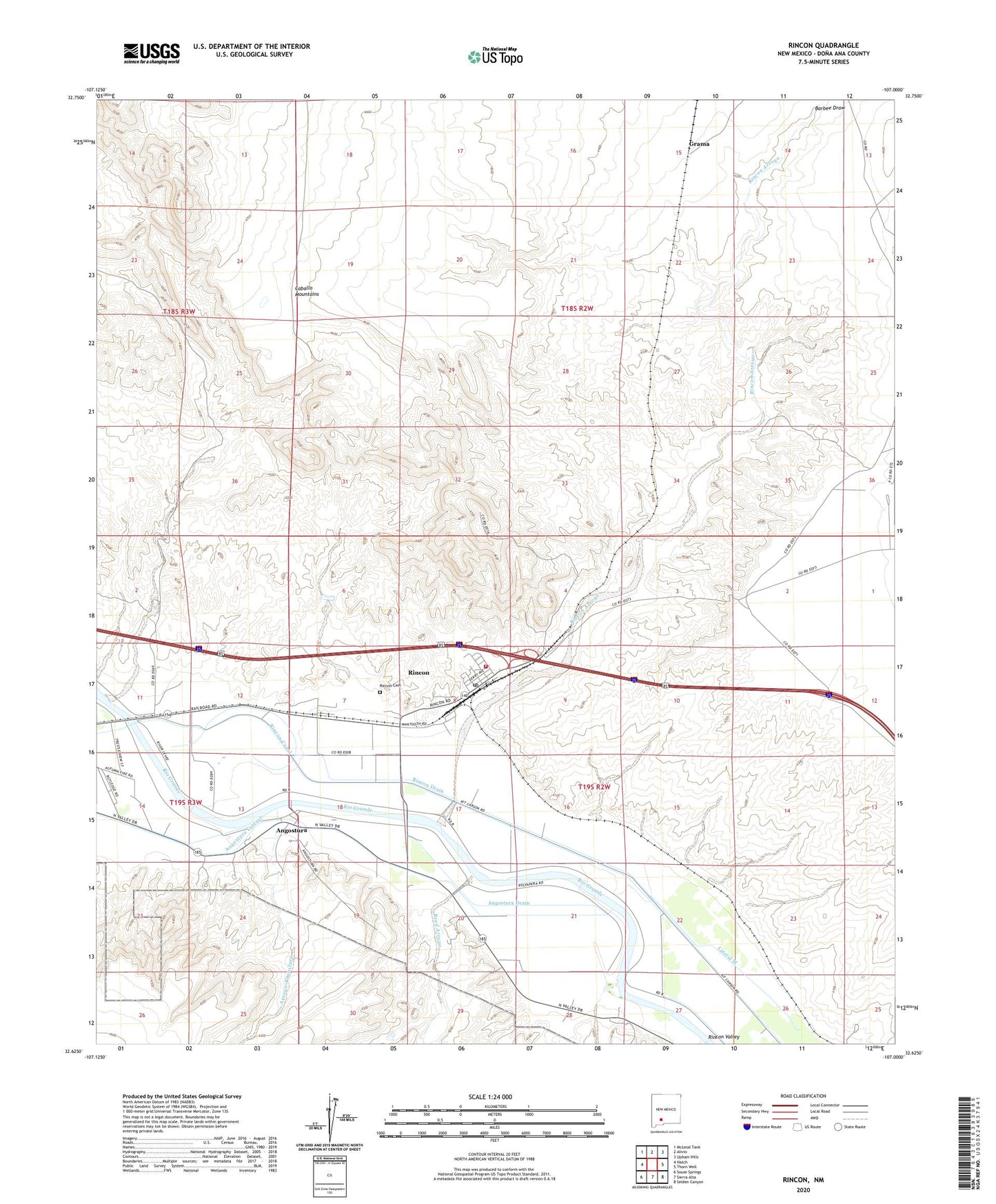
2023 topographic map quadrangle Rincon in the state of New Mexico. Scale: 1:24000. Based on the newly updated USGS 7.5' US Topo map series, this map is in the following counties: Doña Ana. The map contains contour data, water features, and other items you are used to seeing on USGS maps, but also has updated roads and other features. This is the next generation of topographic maps. Printed on high-quality waterproof paper with UV fade-resistant inks.
Quads adjacent to this one:
West: Hatch
Northwest: McLeod Tank
North: Alivio
Northeast: Upham Hills
East: Thorn Well
Southeast: Selden Canyon
South: Sierra Alta
Southwest: Souse Springs
This map covers the same area as the classic USGS quad with code o32107f1.
Contains the following named places: 10015 Water Well, 10060 Water Well, Angostura, Angostura Drain, Angostura Lateral, Arroyo Angostura, Barbee Draw, Bignell Arroyo, Cagles Historic Site, Cook Placer Claims, Grama, Hatch Division, Hatch Valley Arroyos Site Four Dam, Jornado del Muerto Historical Marker, Jornado del Muerto on the Camino Real Historical Marker, KVLC-FM (Las Cruces), KWQQ-FM (Hatch), Last Chance, Last Chance Group, Lateral M, Morgan Mine, Mormon Battalion Historical Marker, Old Rincon Cemetery, Porter Whisenhunt Arroyo Retard Dam, Reed Arroyo, Rincon, Rincon Arroyo, Rincon Canal, Rincon Cemetery, Rincon Census Designated Place, Rincon Drain, Rincon Fire Station, Rincon Lateral, Rincon Mine, Rincon Post Office, Rincon Siphon, Rincon Well, United States Bureau of Reclamation 4 Water Well, United States Bureau of Reclamation 5 Water Well, USBR 7 Water Well