MyTopo
South Butte New Mexico US Topo Map
Couldn't load pickup availability
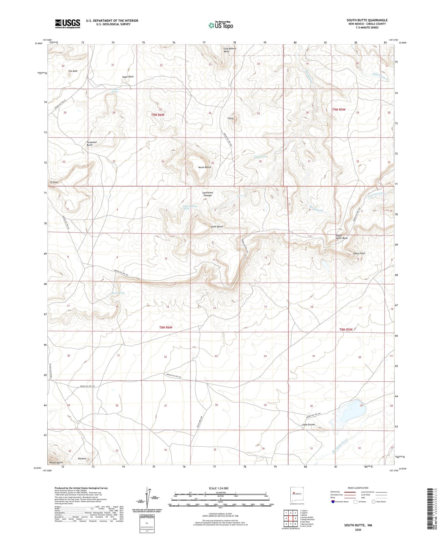
2020 topographic map quadrangle South Butte in the state of New Mexico. Scale: 1:24000. Based on the newly updated USGS 7.5' US Topo map series, this map is in the following counties: Cibola. The map contains contour data, water features, and other items you are used to seeing on USGS maps, but also has updated roads and other features. This is the next generation of topographic maps. Printed on high-quality waterproof paper with UV fade-resistant inks.
Quads adjacent to this one:
West: Acoma Pueblo
Northwest: Cubero
North: Laguna
Northeast: Mesita
East: Dough Mountain
Southeast: Cerro Verde
South: Marmon Ranch
Southwest: East Mesa
Contains the following named places: Alamo Spring, Casp-Druma, Casp-Druma Dam, Coyote Spring, Crackpot Mine, Ei-Enie, Katama, Kemp Santiago Spring, Laguna Division, Laguna Number 7 Water Well, North Butte, Paisano 23, Sharp Point, South Butte, South Creek, South Point Mesa, Southwest Passage, Sugar Rock, Timia, Turquois Spring, Turquoise Butte, Tze-Midi