MyTopo
South Spring New Mexico US Topo Map
Couldn't load pickup availability
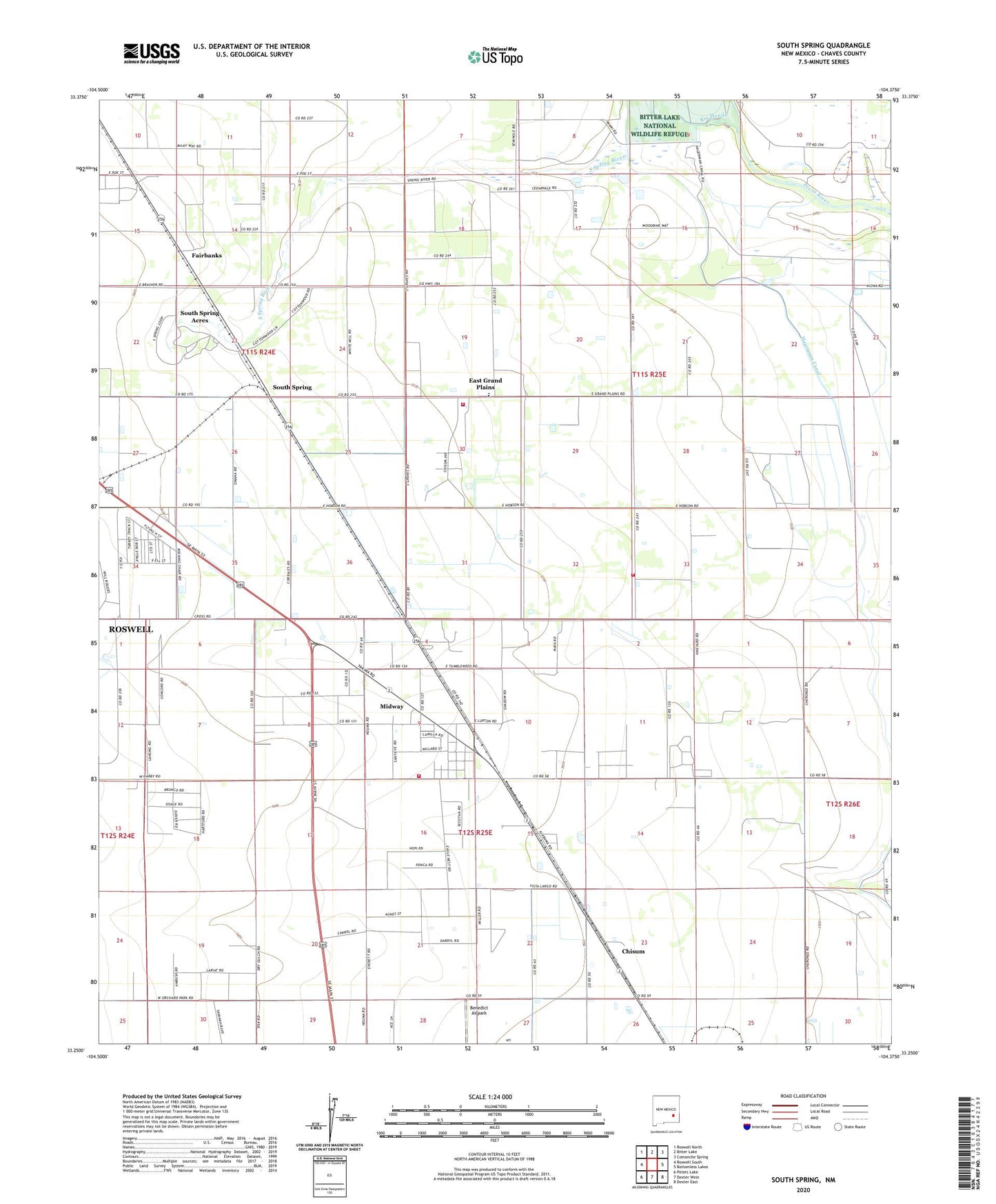
2020 topographic map quadrangle South Spring in the state of New Mexico. Scale: 1:24000. Based on the newly updated USGS 7.5' US Topo map series, this map is in the following counties: Chaves. The map contains contour data, water features, and other items you are used to seeing on USGS maps, but also has updated roads and other features. This is the next generation of topographic maps. Printed on high-quality waterproof paper with UV fade-resistant inks.
Quads adjacent to this one:
West: Roswell South
Northwest: Roswell North
North: Bitter Lake
Northeast: Comanche Spring
East: Bottomless Lakes
Southeast: Dexter East
South: Dexter West
Southwest: Peters Lake
Contains the following named places: 05159 Water Well, 06071 Water Well, 10189 Water Well, Benedict Airpark, Chaves County, Chisum, Chisum Post Office, Christ Light Ministry, East Grand Plain Elementary, East Grand Plains, East Grand Plains Volunteer Fire Department Main Station, East Grand Plains Volunteer Fire Department Station 2, Fairbanks, Hagerman Canal, Midway, Midway Census Designated Place, Midway Fire and Emergency Medical Services, Midway Post Office, Oasis Ranch, Orchard Park, Orchard Park Station, Ra-7809 Water Well, Rio Hondo, Shady Grove Church, South Spring, South Spring Acres, South Spring Ranch, South Spring River, Southspring Post Office