MyTopo
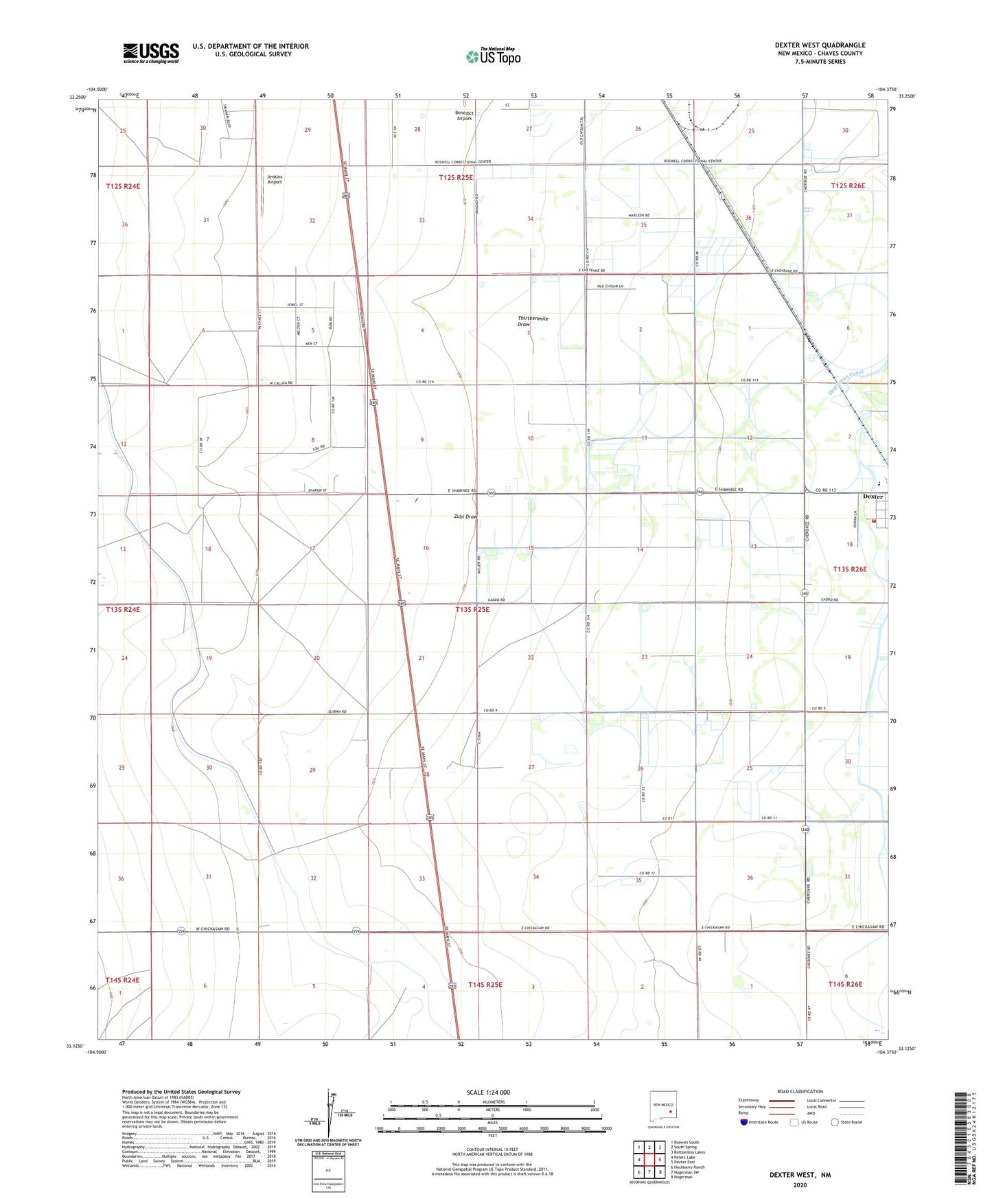
Dexter West New Mexico US Topo Map
Couldn't load pickup availability
2023 topographic map quadrangle Dexter West in the state of New Mexico. Scale: 1:24000. Based on the newly updated USGS 7.5' US Topo map series, this map is in the following counties: Chaves. The map contains contour data, water features, and other items you are used to seeing on USGS maps, but also has updated roads and other features. This is the next generation of topographic maps. Printed on high-quality waterproof paper with UV fade-resistant inks.
Quads adjacent to this one:
West: Peters Lake
Northwest: Roswell South
North: South Spring
Northeast: Bottomless Lakes
East: Dexter East
Southeast: Hagerman
South: Hagerman SW
Southwest: Hackberry Ranch
This map covers the same area as the classic USGS quad with code o33104b4.
Contains the following named places: Bogles Cotton Gin, Dexter Division, Dexter Fire and Rescue Station 2, Goodin Well, Greenfield Artesian Recorder Well, Jenkins Airport, Kerr Brothers South Ranch, Kerr Well Number 1, Kerr Well Number 2, Lowe Ranch, Moore Well, Ra-1423-S Water Well, Thirteenmile Draw, Twin Wells Stock Pens, Vinyard Well, Williams Ranch, Zubi Draw, ZIP Code: 88230