MyTopo
Peters Lake New Mexico US Topo Map
Couldn't load pickup availability
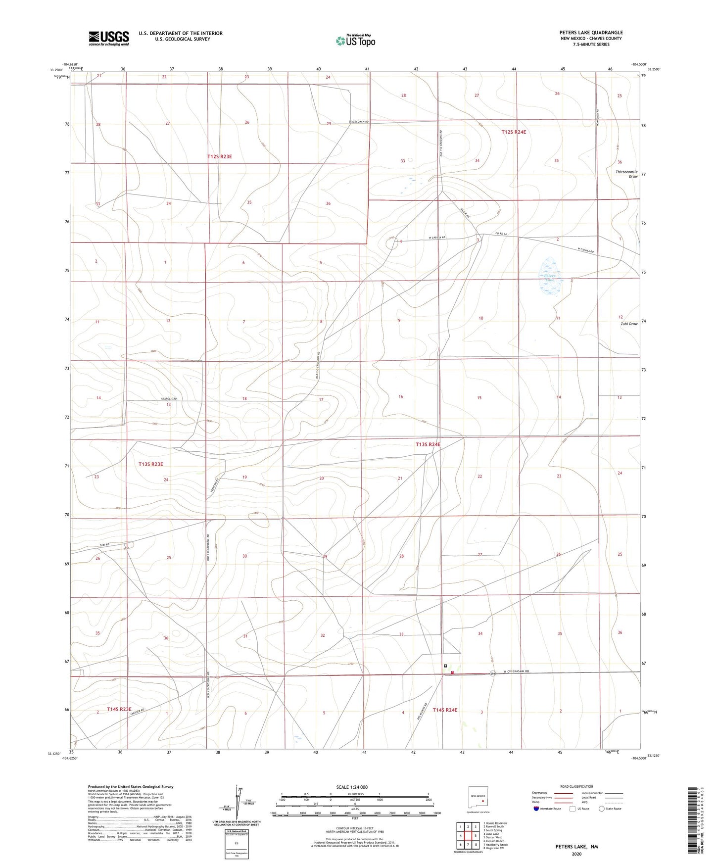
2023 topographic map quadrangle Peters Lake in the state of New Mexico. Scale: 1:24000. Based on the newly updated USGS 7.5' US Topo map series, this map is in the following counties: Chaves. The map contains contour data, water features, and other items you are used to seeing on USGS maps, but also has updated roads and other features. This is the next generation of topographic maps. Printed on high-quality waterproof paper with UV fade-resistant inks.
Quads adjacent to this one:
West: Juan Lake
Northwest: Hondo Reservoir
North: Roswell South
Northeast: South Spring
East: Dexter West
Southeast: Hagerman SW
South: Hackberry Ranch
Southwest: Kincaid Ranch
This map covers the same area as the classic USGS quad with code o33104b5.
Contains the following named places: Blackdom, Blackdom Post Office, Blackdom Well, Brown Brothers Well, District 8 Volunteer Fire Department, Greening Well, Higgins Place, Higgs Well, Jenkins Ranch, Loving Place, Number Six Well, Peters Lake, Peters Well, Pyatt Well, Ragstone Well, Roswell Correctional Center, Villa Solano School for Mentally Retarded Children, Zuber Draw Site Number One Dam, Zuber Draw Site Three Dam, Zuber Draw Site Two Dam