MyTopo
Roswell South New Mexico US Topo Map
Couldn't load pickup availability
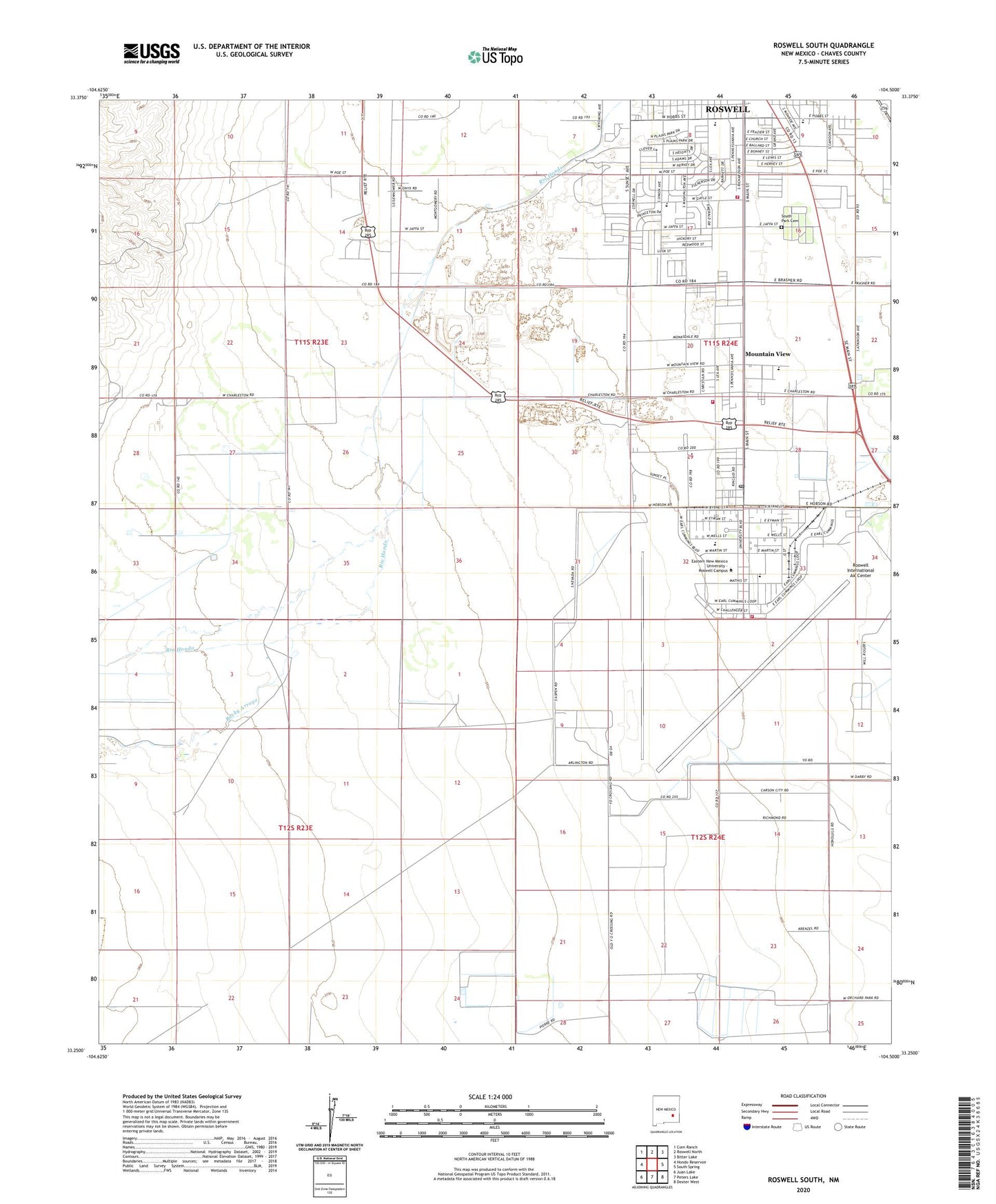
2023 topographic map quadrangle Roswell South in the state of New Mexico. Scale: 1:24000. Based on the newly updated USGS 7.5' US Topo map series, this map is in the following counties: Chaves. The map contains contour data, water features, and other items you are used to seeing on USGS maps, but also has updated roads and other features. This is the next generation of topographic maps. Printed on high-quality waterproof paper with UV fade-resistant inks.
Quads adjacent to this one:
West: Hondo Reservoir
Northwest: Corn Ranch
North: Roswell North
Northeast: Bitter Lake
East: South Spring
Southeast: Dexter West
South: Peters Lake
Southwest: Juan Lake
This map covers the same area as the classic USGS quad with code o33104c5.
Contains the following named places: Brasher Pit, Brown Brothers Ranch, Carpenter Park, Casarez Ranch, Chaves County Pit, City of Roswell, Crusher Pit, Goodin Ranch, Hondo, Kerr Ranch, Lyles Farm, Memorial Hospital, Monterey School, Mountain View, Mullinix Pit, New Mexico Rehabilitation Center, Pecos School, Rocky Arroyo, Roswell Army Air Field, Roswell Ed Serv Center, Roswell Fire Department Station 4, Roswell Fire Department Station 5, Roswell Industrial Air Center, Roswell International Air Center, Roswell Ready Mix Pit, Sacra Farm, Sierra Volunteer Fire Department Station 2, South Park Cemetery, Walker Air Force Base, Walker Post Office, Williams and Chesser Ranch