MyTopo
Tafoya Canyon New Mexico US Topo Map
Couldn't load pickup availability
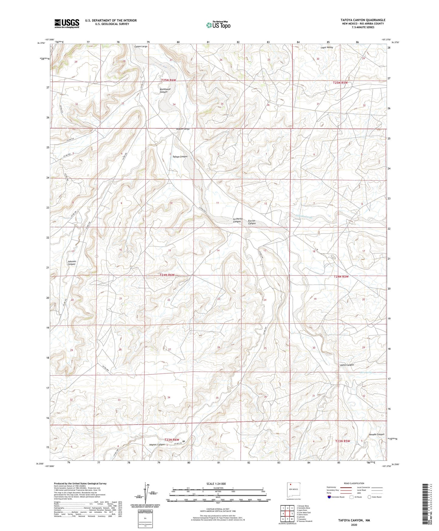
2023 topographic map quadrangle Tafoya Canyon in the state of New Mexico. Scale: 1:24000. Based on the newly updated USGS 7.5' US Topo map series, this map is in the following counties: Rio Arriba. The map contains contour data, water features, and other items you are used to seeing on USGS maps, but also has updated roads and other features. This is the next generation of topographic maps. Printed on high-quality waterproof paper with UV fade-resistant inks.
Quads adjacent to this one:
West: Crow Mesa East
Northwest: Smouse Mesa
North: Gonzales Mesa
Northeast: Lapis Point
East: Otero Store
Southeast: Tancosa Windmill
South: Counselor
Southwest: Lybrook
This map covers the same area as the classic USGS quad with code o36107c4.
Contains the following named places: Canada Larga, Canyon View Ruin, Escrito Canyon, Gallo Canyon, Haynes Canyon, Haynes Post Office, Johnson Canyon, La Parita Canyon, Lapis Valley, Lindrith Pumping Station, Mestice Ranch, Old Rock Ranch, Otero Ranch, Otero Spring, Rincon Largo, Rockhouse Canyon, Tafoya Canyon, Venado Canyon