MyTopo
Taylor Peak New Mexico US Topo Map
Couldn't load pickup availability
Also explore the Taylor Peak Forest Service Topo of this same quad for updated USFS data
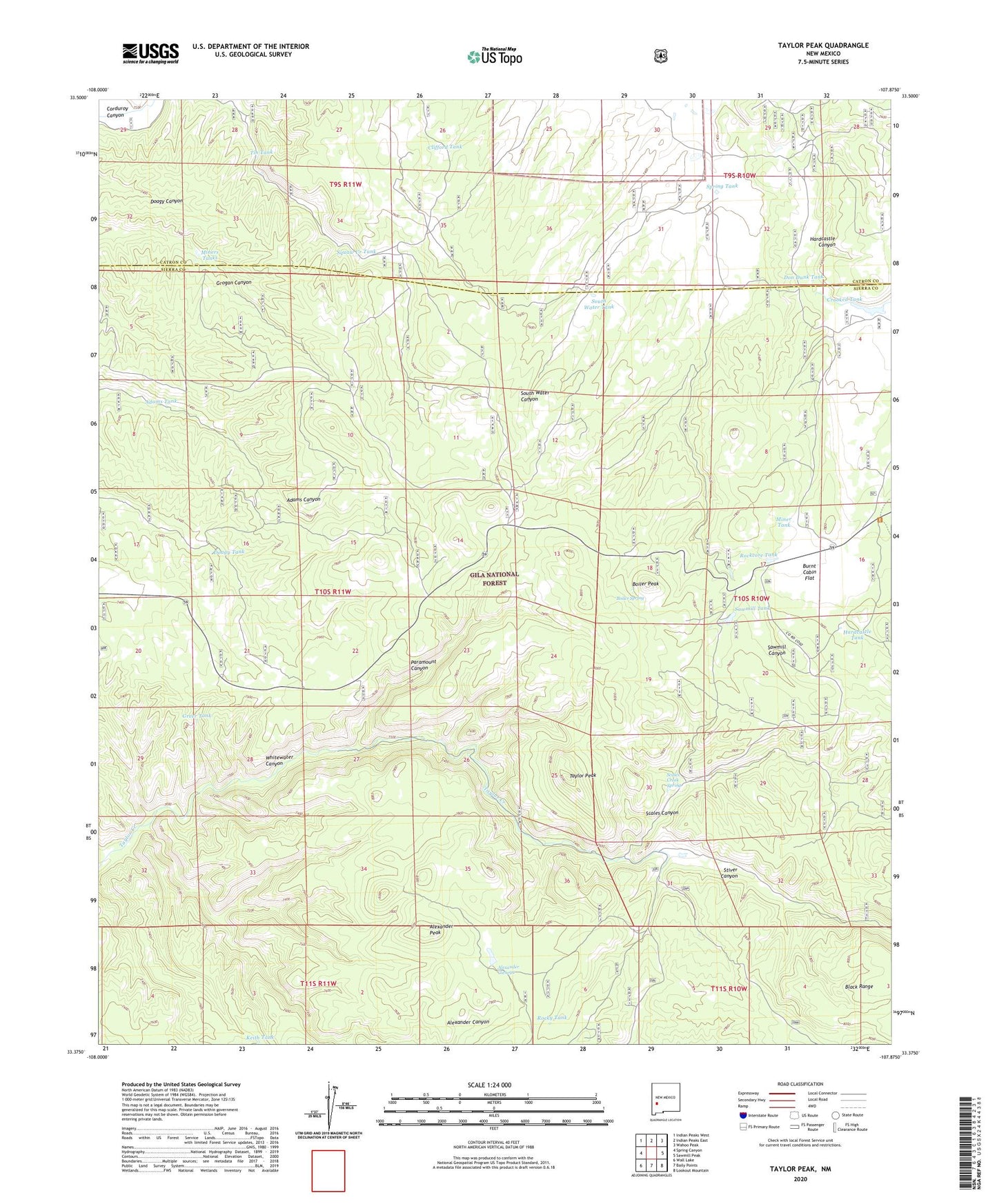
2023 topographic map quadrangle Taylor Peak in the state of New Mexico. Scale: 1:24000. Based on the newly updated USGS 7.5' US Topo map series, this map is in the following counties: Sierra, Catron. The map contains contour data, water features, and other items you are used to seeing on USGS maps, but also has updated roads and other features. This is the next generation of topographic maps. Printed on high-quality waterproof paper with UV fade-resistant inks.
Quads adjacent to this one:
West: Spring Canyon
Northwest: Indian Peaks West
North: Indian Peaks East
Northeast: Wahoo Peak
East: Sawmill Peak
Southeast: Lookout Mountain
South: Baily Points
Southwest: Wall Lake
This map covers the same area as the classic USGS quad with code o33107d8.
Contains the following named places: Adams Tank, Alexander Canyon, Alexander Cienega, Alexander Peak, Boiler Peak, Boiler Spring, Burnt Cabin Flat, Clifford Tank, Crooked Tank, Doagy Tank, Don Dunk Tank, Greer Tank, Hardcastle Canyon, Hardcastle Tank, Indian Association Placer, Inman Ranch, Inman Tin Prospect, Keith Tank, Kimberly, Lockney place, Miner Tank, Miners Tanks, Paramount Canyon, Pawnee Association Mine, Rockcore Tank, Rocky Tank, Sawmill Canyon, Sawmill Tank, Scales Canyon, Scales Creek Claim Group, Scales Creek Spring, Scales Windmill, Silver Drip Mine Area, South Water Tank, Spring Tank, Squaw Creek Tank, Stiver Canyon, Stiver Well, Taylor Peak, Tin Mines, Tin Tank, Upper South Water Tank